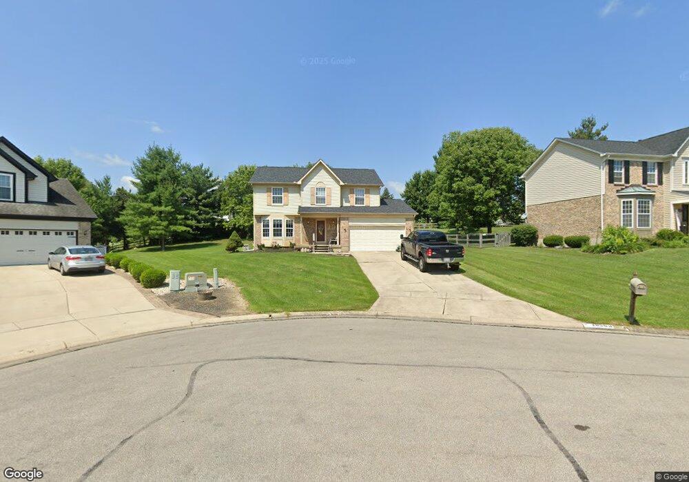
10563 Mill Farm Ct Cincinnati, OH 45231
New Burlington NeighborhoodEstimated Value: $327,000 - $363,000
4
Beds
4
Baths
1,976
Sq Ft
$175/Sq Ft
Est. Value
About This Home
This home is located at 10563 Mill Farm Ct, Cincinnati, OH 45231 and is currently estimated at $346,510, approximately $175 per square foot. 10563 Mill Farm Ct is a home located in Hamilton County with nearby schools including Mt Healthy High School, Hamilton County Mathematics and Science Academy, and Central Montessori Academy.
Ownership History
Date
Name
Owned For
Owner Type
Purchase Details
Closed on
May 4, 2007
Sold by
Congo Arthur G and Marie Congo H
Bought by
Vonbargen David B and Vonbargen Theresa R
Current Estimated Value
Home Financials for this Owner
Home Financials are based on the most recent Mortgage that was taken out on this home.
Original Mortgage
$182,535
Outstanding Balance
$111,273
Interest Rate
6.21%
Mortgage Type
FHA
Estimated Equity
$235,237
Purchase Details
Closed on
Dec 15, 1993
Sold by
The Ryland Group Inc
Bought by
Congo Arthur C and Marie Congo H
Home Financials for this Owner
Home Financials are based on the most recent Mortgage that was taken out on this home.
Original Mortgage
$117,850
Interest Rate
7.15%
Create a Home Valuation Report for This Property
The Home Valuation Report is an in-depth analysis detailing your home's value as well as a comparison with similar homes in the area
Home Values in the Area
Average Home Value in this Area
Purchase History
| Date | Buyer | Sale Price | Title Company |
|---|---|---|---|
| Vonbargen David B | $185,400 | Classic Title Agency Llc | |
| Congo Arthur C | -- | -- |
Source: Public Records
Mortgage History
| Date | Status | Borrower | Loan Amount |
|---|---|---|---|
| Open | Vonbargen David B | $182,535 | |
| Previous Owner | Congo Arthur C | $117,850 |
Source: Public Records
Tax History Compared to Growth
Tax History
| Year | Tax Paid | Tax Assessment Tax Assessment Total Assessment is a certain percentage of the fair market value that is determined by local assessors to be the total taxable value of land and additions on the property. | Land | Improvement |
|---|---|---|---|---|
| 2024 | $5,144 | $88,064 | $12,758 | $75,306 |
| 2023 | $4,890 | $88,064 | $12,758 | $75,306 |
| 2022 | $5,555 | $72,202 | $12,429 | $59,773 |
| 2021 | $5,408 | $72,202 | $12,429 | $59,773 |
| 2020 | $5,488 | $72,202 | $12,429 | $59,773 |
| 2019 | $4,634 | $56,851 | $9,786 | $47,065 |
| 2018 | $4,587 | $56,851 | $9,786 | $47,065 |
| 2017 | $4,352 | $56,851 | $9,786 | $47,065 |
| 2016 | $4,134 | $53,218 | $9,289 | $43,929 |
| 2015 | $4,166 | $53,218 | $9,289 | $43,929 |
| 2014 | $4,146 | $53,218 | $9,289 | $43,929 |
| 2013 | $4,459 | $58,478 | $10,206 | $48,272 |
Source: Public Records
Map
Nearby Homes
- 1662 Springdale Rd
- 10467 Mill Rd
- 10525 Mill Rd
- 10493 Mill Rd
- 10410 Maria Ave
- 10591 Wellingwood Ct
- 1763 Springdale Rd
- 1762 Lockbourne Dr
- 1717 Aspenhill Dr
- 1917 Springdale Rd
- 10443 Burlington Rd
- 2000 Struble Rd
- 1890 Lotushill Dr
- 10908 Tangleberry Ct
- 10804 Sprucehill Dr
- 1629 Miles Rd
- 1805 Miles Rd
- 5 Briarwood Ln
- 10359 Hawkhurst Dr
- 2 Brompton Ln
- 10569 Mill Farm Ct
- 10561 Mill Farm Ct
- 10572 Farm Hill Ct
- 10581 Mill Farm Ct
- 10576 Farm Hill Ct
- 10560 Mill Farm Ct
- 10584 Farm Hill Ct
- 10570 Farm Hill Ct
- 10568 Mill Farm Ct
- 10564 Mill Farm Ct
- 10500 Springrun Dr
- 10589 Mill Farm Ct
- 10494 Springrun Dr
- 1712 Mill Spring Ct
- 1712 Millspring Ct
- 10580 Mill Farm Ct
- 1704 Mill Spring Ct
- 10490 Springrun Dr
- 10571 Farm Hill Ct
- 1720 Mill Spring Ct