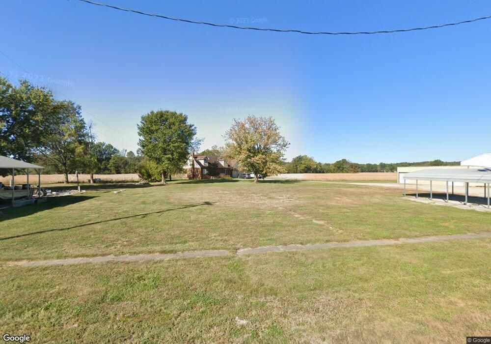
10564 N McDonald Ave Evanston, IN 47531
Estimated Value: $16,000
3
Beds
1
Bath
1,330
Sq Ft
$12/Sq Ft
Est. Value
About This Home
This home is located at 10564 N McDonald Ave, Evanston, IN 47531 and is currently estimated at $16,000, approximately $12 per square foot. 10564 N McDonald Ave is a home located in Spencer County with nearby schools including Heritage Hills High School.
Ownership History
Date
Name
Owned For
Owner Type
Purchase Details
Closed on
Jun 24, 2022
Sold by
Polster Alan W and Polster Rebecca S
Bought by
Knepper Joshua D and Knepper Dana R
Current Estimated Value
Purchase Details
Closed on
Nov 15, 2021
Sold by
Smithers Kasey and Kebortz Trenton
Bought by
Polster Alan W and Polster Rebecca S
Purchase Details
Closed on
Jun 1, 2021
Sold by
10564 Mcdonald Avenue Land Trusts
Bought by
Smithers Kasey and Kebortz Trenton
Purchase Details
Closed on
May 9, 2018
Sold by
Make Evansville Great Again Llc
Bought by
10564 Macdonald Ave Land Trust
Purchase Details
Closed on
Feb 8, 2018
Sold by
Jones Albertina D
Bought by
Make Evansville Great Again Llc
Create a Home Valuation Report for This Property
The Home Valuation Report is an in-depth analysis detailing your home's value as well as a comparison with similar homes in the area
Home Values in the Area
Average Home Value in this Area
Purchase History
| Date | Buyer | Sale Price | Title Company |
|---|---|---|---|
| Knepper Joshua D | $14,000 | None Listed On Document | |
| Polster Alan W | -- | None Available | |
| Smithers Kasey | -- | None Available | |
| 10564 Macdonald Ave Land Trust | -- | None Available | |
| Make Evansville Great Again Llc | -- | None Available |
Source: Public Records
Tax History Compared to Growth
Tax History
| Year | Tax Paid | Tax Assessment Tax Assessment Total Assessment is a certain percentage of the fair market value that is determined by local assessors to be the total taxable value of land and additions on the property. | Land | Improvement |
|---|---|---|---|---|
| 2024 | $147 | $10,300 | $10,300 | $0 |
| 2023 | $64 | $4,500 | $4,500 | $0 |
| 2022 | $89 | $8,100 | $4,500 | $3,600 |
| 2021 | $99 | $7,800 | $4,500 | $3,300 |
| 2020 | $304 | $21,000 | $4,500 | $16,500 |
| 2019 | $854 | $27,600 | $4,500 | $23,100 |
| 2018 | $333 | $27,600 | $4,500 | $23,100 |
| 2017 | $308 | $26,900 | $4,500 | $22,400 |
| 2016 | $536 | $26,900 | $4,500 | $22,400 |
| 2014 | $54 | $26,300 | $4,500 | $21,800 |
| 2013 | $54 | $26,100 | $4,600 | $21,500 |
Source: Public Records
Map
Nearby Homes
- 10546 N McDonald Ave
- 8960 N County Road 950 E
- 12674 N State Road 245
- 1336 Troy Ridge Rd
- 1338 Troy Ridge Rd
- 1430 Troy Ridge Rd
- 0 Cr 1425 E Unit 11532560
- 9585 River Rd
- 0 1100 N
- 1530 Troy Ridge Rd
- 8311 N 700 Rd E
- 0 Switzer Rd
- 9158 N County Road 600 E
- Lot 34 Balthazar Dr
- 856 S Balthazar Dr
- 153 Melchior Dr S
- 0 Jolly Ln Unit Carol Hills Lot 84
- 157 E Silver Bell Ct
- 316 Tinsel Cir
- 870 S Chimes Ct
- 10546 N McDonald Ave Unit 1
- 10580 N McDonald Ave
- 10569 N McDonald Ave
- 10598 N McDonald Ave
- 10539 N McDonald Ave
- 10619 N McDonald Ave
- 10498 N McDonald Ave
- 10650 N McDonald Ave
- 10649 N McDonald Ave
- 10666 N McDonald Ave
- 10665 N McDonald Ave
- 10680 N McDonald Ave
- 10694 N McDonald Ave
- 10683 N McDonald Ave
- 10707 N McDonald Ave
- 10725 N McDonald Ave
- 10728 N McDonald Ave
- 10792 N McDonald Ave
- 10777 N McDonald Ave
- 10237 N Stones Ln