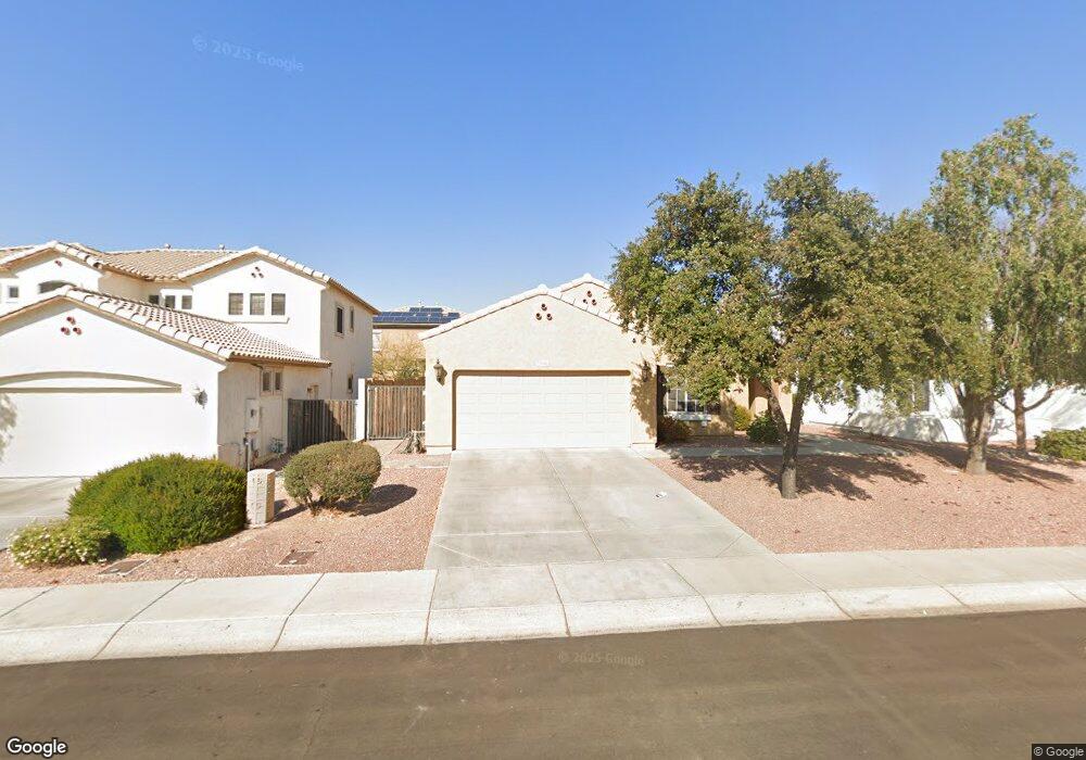
10566 W Salter Dr Peoria, AZ 85382
Estimated Value: $449,426 - $549,000
--
Bed
3
Baths
2,085
Sq Ft
$245/Sq Ft
Est. Value
About This Home
This home is located at 10566 W Salter Dr, Peoria, AZ 85382 and is currently estimated at $510,857, approximately $245 per square foot. 10566 W Salter Dr is a home located in Maricopa County with nearby schools including Parkridge Elementary School, Sunrise Mountain High School, and Candeo Peoria.
Ownership History
Date
Name
Owned For
Owner Type
Purchase Details
Closed on
Feb 22, 2024
Sold by
Foster Richard A and Foster Ladora
Bought by
Foster Family Trust and Foster
Current Estimated Value
Purchase Details
Closed on
Apr 23, 2003
Sold by
Centex Homes
Bought by
Foster Richard A and Foster Ladora
Home Financials for this Owner
Home Financials are based on the most recent Mortgage that was taken out on this home.
Original Mortgage
$194,300
Interest Rate
4.5%
Mortgage Type
New Conventional
Create a Home Valuation Report for This Property
The Home Valuation Report is an in-depth analysis detailing your home's value as well as a comparison with similar homes in the area
Home Values in the Area
Average Home Value in this Area
Purchase History
| Date | Buyer | Sale Price | Title Company |
|---|---|---|---|
| Foster Family Trust | -- | None Listed On Document | |
| Foster Richard A | $215,585 | Commerce Title Company |
Source: Public Records
Mortgage History
| Date | Status | Borrower | Loan Amount |
|---|---|---|---|
| Previous Owner | Foster Richard A | $194,300 |
Source: Public Records
Tax History Compared to Growth
Tax History
| Year | Tax Paid | Tax Assessment Tax Assessment Total Assessment is a certain percentage of the fair market value that is determined by local assessors to be the total taxable value of land and additions on the property. | Land | Improvement |
|---|---|---|---|---|
| 2025 | $1,926 | $23,912 | -- | -- |
| 2024 | $1,889 | $22,774 | -- | -- |
| 2023 | $1,889 | $37,170 | $7,430 | $29,740 |
| 2022 | $1,848 | $28,160 | $5,630 | $22,530 |
| 2021 | $1,967 | $26,100 | $5,220 | $20,880 |
| 2020 | $1,993 | $24,260 | $4,850 | $19,410 |
| 2019 | $1,933 | $23,150 | $4,630 | $18,520 |
| 2018 | $1,856 | $21,650 | $4,330 | $17,320 |
| 2017 | $1,861 | $20,360 | $4,070 | $16,290 |
| 2016 | $1,786 | $19,310 | $3,860 | $15,450 |
| 2015 | $1,718 | $18,210 | $3,640 | $14,570 |
Source: Public Records
Map
Nearby Homes
- 21379 N 105th Ave
- 10446 W Lone Cactus Dr
- 10549 W Albert Ln
- 10447 W Lone Cactus Dr
- 21479 N 104th Dr
- 10806 W Adam Ave
- 10456 W Los Gatos Dr
- 10370 W Sands Dr Unit 463
- 10894 W Alex Ave
- 10672 W Ross Ave
- 10368 W Ross Ave
- 10617 W Ross Ave
- 10528 W Potter Dr
- 10296 W Sands Dr Unit 485
- 20957 N 107th Dr
- 20769 N 106th Ln
- 10842 W Beaubien Dr
- 10328 W Carlota Ln
- 22322 N 108th Ave
- 10344 W Burnett Rd
- 10558 W Salter Dr
- 10574 W Salter Dr
- 10565 W Melinda Ln
- 10573 W Melinda Ln
- 10550 W Salter Dr
- 10557 W Melinda Ln
- 10581 W Melinda Ln
- 10569 W Salter Dr
- 10577 W Salter Dr
- 10561 W Salter Dr
- 10590 W Salter Dr
- 10542 W Salter Dr
- 10549 W Melinda Ln
- 10589 W Melinda Ln
- 10585 W Salter Dr
- 10533 W Salter Dr
- 10598 W Salter Dr
- 10541 W Melinda Ln
- 10593 W Salter Dr
- 10597 W Melinda Ln