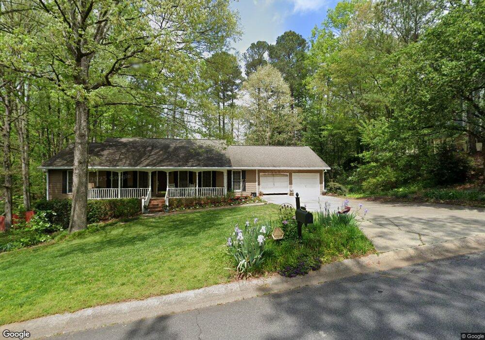
1057 Boston Ridge Unit 1 Woodstock, GA 30189
Oak Grove NeighborhoodEstimated Value: $396,000 - $401,586
3
Beds
2
Baths
1,798
Sq Ft
$222/Sq Ft
Est. Value
About This Home
This home is located at 1057 Boston Ridge Unit 1, Woodstock, GA 30189 and is currently estimated at $398,793, approximately $221 per square foot. 1057 Boston Ridge Unit 1 is a home located in Cherokee County with nearby schools including Carmel Elementary School, Woodstock Middle School, and Woodstock High School.
Ownership History
Date
Name
Owned For
Owner Type
Purchase Details
Closed on
Aug 6, 2001
Sold by
Rascoe Daniel R
Bought by
Rascoe Daniel R and Rascoe Kimberly Y
Current Estimated Value
Home Financials for this Owner
Home Financials are based on the most recent Mortgage that was taken out on this home.
Original Mortgage
$111,700
Outstanding Balance
$42,343
Interest Rate
6.76%
Mortgage Type
New Conventional
Estimated Equity
$356,450
Purchase Details
Closed on
Mar 5, 1998
Sold by
Rascoe Daniel R
Bought by
Rascoe Daniel R and Rascoe Kimberly J
Purchase Details
Closed on
Feb 6, 1997
Sold by
Lisle Jane
Bought by
Rascoe Daniel
Create a Home Valuation Report for This Property
The Home Valuation Report is an in-depth analysis detailing your home's value as well as a comparison with similar homes in the area
Home Values in the Area
Average Home Value in this Area
Purchase History
| Date | Buyer | Sale Price | Title Company |
|---|---|---|---|
| Rascoe Daniel R | -- | -- | |
| Rascoe Daniel R | -- | -- | |
| Rascoe Daniel | $110,000 | -- |
Source: Public Records
Mortgage History
| Date | Status | Borrower | Loan Amount |
|---|---|---|---|
| Open | Rascoe Daniel R | $111,700 | |
| Closed | Rascoe Daniel | $0 |
Source: Public Records
Tax History Compared to Growth
Tax History
| Year | Tax Paid | Tax Assessment Tax Assessment Total Assessment is a certain percentage of the fair market value that is determined by local assessors to be the total taxable value of land and additions on the property. | Land | Improvement |
|---|---|---|---|---|
| 2024 | $833 | $149,096 | $35,200 | $113,896 |
| 2023 | $661 | $138,456 | $35,200 | $103,256 |
| 2022 | $777 | $120,096 | $26,400 | $93,696 |
| 2021 | $2,626 | $97,936 | $18,480 | $79,456 |
| 2020 | $2,590 | $96,296 | $18,480 | $77,816 |
| 2019 | $2,381 | $87,320 | $18,480 | $68,840 |
| 2018 | $2,300 | $83,280 | $18,480 | $64,800 |
| 2017 | $2,196 | $196,200 | $18,480 | $60,000 |
| 2016 | $1,982 | $176,000 | $15,840 | $54,560 |
| 2015 | $1,908 | $168,000 | $15,840 | $51,360 |
| 2014 | $1,812 | $159,500 | $15,400 | $48,400 |
Source: Public Records
Map
Nearby Homes
- 1061 Boston Ridge
- 1055 Boston Ridge
- 1802 Yorkshire Dr
- 1063 Boston Ridge
- 1801 Yorkshire Dr
- 1804 Yorkshire Dr
- 1053 Boston Ridge
- 1901 Nantucket Dr
- 1803 Yorkshire Dr
- 1065 Boston Ridge Unit 1
- 1051 Boston Ridge
- 523 Cooper Ln
- 1806 Yorkshire Dr
- 1068 Boston Ridge Unit I
- 519 Cooper Ln
- 1903 Nantucket Dr
- 727 Cooper Ln
- 1805 Yorkshire Dr
- 517 Cooper Ln
- 521 Cooper Ln