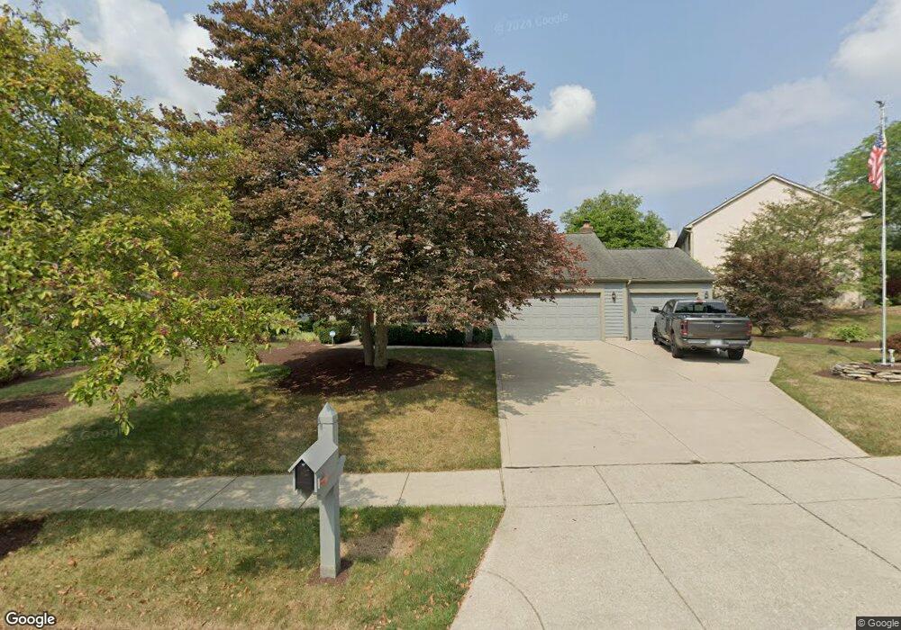
1057 Cannonade Ct Columbus, OH 43230
Estimated Value: $571,000 - $636,000
6
Beds
4
Baths
3,368
Sq Ft
$181/Sq Ft
Est. Value
About This Home
This home is located at 1057 Cannonade Ct, Columbus, OH 43230 and is currently estimated at $609,418, approximately $180 per square foot. 1057 Cannonade Ct is a home located in Franklin County with nearby schools including High Point Elementary School, Gahanna East Middle School, and Lincoln High School.
Ownership History
Date
Name
Owned For
Owner Type
Purchase Details
Closed on
Dec 21, 2018
Sold by
Buel Lynda L
Bought by
Buel Lynda L and Buel Kent J
Current Estimated Value
Purchase Details
Closed on
Dec 7, 2001
Sold by
Buel Kent J and Buel Lynda L
Bought by
Buel Lynda L
Purchase Details
Closed on
Jan 30, 1989
Bought by
Buel Kent J and Buel Lynda L
Create a Home Valuation Report for This Property
The Home Valuation Report is an in-depth analysis detailing your home's value as well as a comparison with similar homes in the area
Purchase History
| Date | Buyer | Sale Price | Title Company |
|---|---|---|---|
| Buel Lynda L | -- | None Available | |
| Buel Lynda L | -- | -- | |
| Buel Kent J | $170,200 | -- |
Source: Public Records
Tax History
| Year | Tax Paid | Tax Assessment Tax Assessment Total Assessment is a certain percentage of the fair market value that is determined by local assessors to be the total taxable value of land and additions on the property. | Land | Improvement |
|---|---|---|---|---|
| 2025 | $11,710 | $198,770 | $39,900 | $158,870 |
| 2024 | $11,710 | $198,770 | $39,900 | $158,870 |
| 2023 | $11,563 | $198,770 | $39,900 | $158,870 |
| 2022 | $10,526 | $140,950 | $21,000 | $119,950 |
| 2021 | $10,180 | $140,950 | $21,000 | $119,950 |
| 2020 | $10,095 | $140,950 | $21,000 | $119,950 |
| 2019 | $8,443 | $117,640 | $17,500 | $100,140 |
| 2018 | $7,823 | $117,640 | $17,500 | $100,140 |
| 2017 | $7,749 | $117,640 | $17,500 | $100,140 |
| 2016 | $7,258 | $100,350 | $17,330 | $83,020 |
| 2015 | $7,264 | $100,350 | $17,330 | $83,020 |
| 2014 | $7,208 | $100,350 | $17,330 | $83,020 |
| 2013 | $3,579 | $100,345 | $17,325 | $83,020 |
Source: Public Records
Map
Nearby Homes
- 1126 Sanctuary Place Unit 4
- 4220 E Johnstown Rd
- 505 Serenity Dr Unit 13
- 0 Beecher Crossing
- 636 Pincay Place
- 1160 Riva Ridge Blvd
- 4574 N Hamilton Rd
- 875 Pinnacle Pointe Place Unit 32
- 536 Calkin Ln E Unit 23
- 622 Piney Glen Dr
- 1308 Amberlea Dr W Unit 11
- 4648 E Johnstown Rd
- 370 Beecher Rd
- 846 Aylesbury Dr
- 4651 E Johnstown Rd
- 3753 Brightwell Ln
- 971 Bryn Mawr Dr
- 3665 Fish Hawk Landing
- 667 Salt Lick Ln
- 1299 Granfield Ct
- 1059 Cannonade Ct
- 1025 Arcaro Dr
- 1063 Cannonade Ct
- 1021 Arcaro Dr
- 1054 Cannonade Ct
- 1052 Cannonade Ct
- 1056 Cannonade Ct
- 1065 Cannonade Ct
- 1019 Arcaro Dr
- 1060 Cannonade Ct
- 1058 Cannonade Ct
- 1062 Cannonade Ct
- 1071 Cannonade Ct
- 1024 Arcaro Dr
- 1064 Cannonade Ct
- 1028 Arcaro Dr
- 1020 Arcaro Dr
- 1073 Cannonade Ct
- 1065 Arcaro Ct
- 1032 Arcaro Dr
Your Personal Tour Guide
Ask me questions while you tour the home.