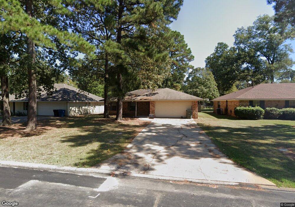
1057 Woodshire Cir Shreveport, LA 71107
Estimated Value: $172,000 - $203,000
3
Beds
2
Baths
1,534
Sq Ft
$121/Sq Ft
Est. Value
About This Home
This home is located at 1057 Woodshire Cir, Shreveport, LA 71107 and is currently estimated at $185,358, approximately $120 per square foot. 1057 Woodshire Cir is a home located in Caddo Parish with nearby schools including North Highlands Elementary School, Judson Fundamental Elementary School, and Fairfield Magnet School.
Ownership History
Date
Name
Owned For
Owner Type
Purchase Details
Closed on
Feb 14, 2014
Sold by
Ellis Christopher Lee and Thatcher Suzanne
Bought by
Tull Brian Michael and Tull Amanda Gail Wrinkle
Current Estimated Value
Home Financials for this Owner
Home Financials are based on the most recent Mortgage that was taken out on this home.
Original Mortgage
$141,836
Outstanding Balance
$108,046
Interest Rate
4.55%
Mortgage Type
Unknown
Estimated Equity
$77,312
Purchase Details
Closed on
Jan 28, 2013
Sold by
Catoe Charles Donald and Catoe Cheryl Delaine Lucas
Bought by
Ellis Christopher Lee
Home Financials for this Owner
Home Financials are based on the most recent Mortgage that was taken out on this home.
Original Mortgage
$128,571
Interest Rate
3.42%
Mortgage Type
Unknown
Create a Home Valuation Report for This Property
The Home Valuation Report is an in-depth analysis detailing your home's value as well as a comparison with similar homes in the area
Home Values in the Area
Average Home Value in this Area
Purchase History
| Date | Buyer | Sale Price | Title Company |
|---|---|---|---|
| Tull Brian Michael | $139,000 | First Commerce Title | |
| Ellis Christopher Lee | $126,000 | United Title Of Louisina Inc |
Source: Public Records
Mortgage History
| Date | Status | Borrower | Loan Amount |
|---|---|---|---|
| Open | Tull Brian Michael | $141,836 | |
| Previous Owner | Ellis Christopher Lee | $128,571 |
Source: Public Records
Tax History Compared to Growth
Tax History
| Year | Tax Paid | Tax Assessment Tax Assessment Total Assessment is a certain percentage of the fair market value that is determined by local assessors to be the total taxable value of land and additions on the property. | Land | Improvement |
|---|---|---|---|---|
| 2024 | $1,904 | $12,780 | $1,652 | $11,128 |
| 2023 | $1,798 | $11,703 | $1,573 | $10,130 |
| 2022 | $1,798 | $11,703 | $1,573 | $10,130 |
| 2021 | $1,798 | $11,703 | $1,573 | $10,130 |
| 2020 | $1,799 | $11,703 | $1,573 | $10,130 |
| 2019 | $1,763 | $11,575 | $1,573 | $10,002 |
| 2018 | $669 | $11,575 | $1,573 | $10,002 |
| 2017 | $1,759 | $11,575 | $1,573 | $10,002 |
| 2015 | $641 | $11,290 | $1,570 | $9,720 |
| 2014 | $1,771 | $11,290 | $1,570 | $9,720 |
| 2013 | -- | $11,290 | $1,570 | $9,720 |
Source: Public Records
Map
Nearby Homes
- 5036 Asaff Ave
- 955 Roanoke Dr
- 5037 N Market St
- 5244 N Market St
- 5220 Old Mooringsport Rd
- 838 Ed's Blvd
- 4823 N Market St
- 1208 Mcdaniel Dr
- 4821 N Market St
- 4803 N Market St
- 4720 Old Mooringsport Rd
- 6899 White Tail Ln
- 419 Irving Bluff Rd
- 6095 Pine Hill Rd
- 434 Irving Bluff Rd
- 4685 Kent Rd
- 4687 Kent Rd
- 5555 Old Mooringsport Rd
- 1059 Winchester Dr
- Mimosa III A Plan at Falcon Bay
- 1059 Woodshire Cir
- 1055 Woodshire Cir
- 1061 Woodshire Cir
- 1053 Woodshire Cir
- 1018 Roanoke Dr
- 1014 Roanoke Dr
- 1022 Roanoke Dr
- 1063 Woodshire Cir
- 1051 Woodshire Cir
- 1058 Woodshire Cir
- 1060 Woodshire Cir
- 1056 Woodshire Cir
- 1062 Woodshire Cir
- 1010 Roanoke Dr
- 1026 Roanoke Dr
- 1054 Woodshire Cir
- 1049 Woodshire Cir
- 1064 Woodshire Cir
- 1065 Woodshire Cir
- 1065 Woodshire Cir