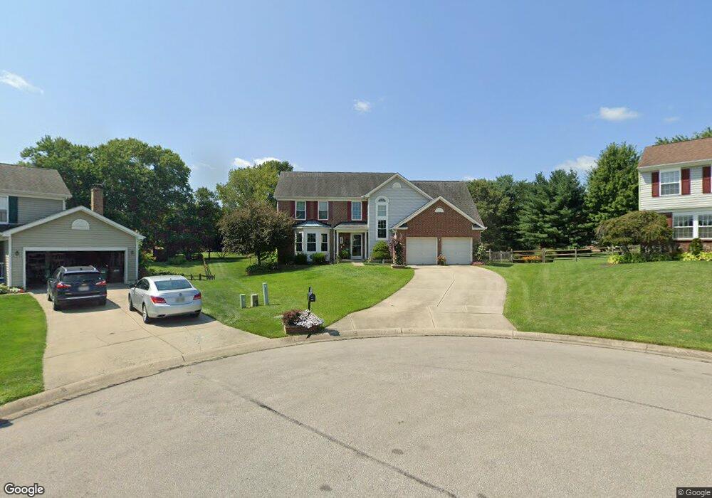
10571 Farm Hill Ct Cincinnati, OH 45231
New Burlington NeighborhoodEstimated Value: $343,000 - $369,000
3
Beds
3
Baths
2,362
Sq Ft
$151/Sq Ft
Est. Value
About This Home
This home is located at 10571 Farm Hill Ct, Cincinnati, OH 45231 and is currently estimated at $355,595, approximately $150 per square foot. 10571 Farm Hill Ct is a home located in Hamilton County with nearby schools including Mt Healthy High School, Hamilton County Mathematics and Science Academy, and Central Montessori Academy.
Ownership History
Date
Name
Owned For
Owner Type
Purchase Details
Closed on
Feb 27, 1995
Sold by
Phh Homequity Corp
Bought by
Scully David P and Perkins Lisa J
Current Estimated Value
Home Financials for this Owner
Home Financials are based on the most recent Mortgage that was taken out on this home.
Original Mortgage
$139,500
Interest Rate
8.39%
Purchase Details
Closed on
Dec 23, 1994
Sold by
Burgum William J and Burgum Irene
Bought by
Phh Homequity Corp
Create a Home Valuation Report for This Property
The Home Valuation Report is an in-depth analysis detailing your home's value as well as a comparison with similar homes in the area
Home Values in the Area
Average Home Value in this Area
Purchase History
| Date | Buyer | Sale Price | Title Company |
|---|---|---|---|
| Scully David P | -- | -- | |
| Phh Homequity Corp | -- | -- |
Source: Public Records
Mortgage History
| Date | Status | Borrower | Loan Amount |
|---|---|---|---|
| Previous Owner | Scully David P | $139,500 |
Source: Public Records
Tax History Compared to Growth
Tax History
| Year | Tax Paid | Tax Assessment Tax Assessment Total Assessment is a certain percentage of the fair market value that is determined by local assessors to be the total taxable value of land and additions on the property. | Land | Improvement |
|---|---|---|---|---|
| 2024 | $5,587 | $95,774 | $14,539 | $81,235 |
| 2023 | $5,311 | $95,774 | $14,539 | $81,235 |
| 2022 | $6,044 | $78,663 | $14,179 | $64,484 |
| 2021 | $5,884 | $78,663 | $14,179 | $64,484 |
| 2020 | $5,971 | $78,663 | $14,179 | $64,484 |
| 2019 | $5,041 | $61,940 | $11,165 | $50,775 |
| 2018 | $4,996 | $61,940 | $11,165 | $50,775 |
| 2017 | $4,740 | $61,940 | $11,165 | $50,775 |
| 2016 | $4,485 | $57,768 | $10,584 | $47,184 |
| 2015 | $4,520 | $57,768 | $10,584 | $47,184 |
| 2014 | $4,499 | $57,768 | $10,584 | $47,184 |
| 2013 | $4,839 | $63,480 | $11,631 | $51,849 |
Source: Public Records
Map
Nearby Homes
- 10410 Maria Ave
- 1662 Springdale Rd
- 10467 Mill Rd
- 10525 Mill Rd
- 10493 Mill Rd
- 1763 Springdale Rd
- 10591 Wellingwood Ct
- 1762 Lockbourne Dr
- 1717 Aspenhill Dr
- 1917 Springdale Rd
- 10443 Burlington Rd
- 2000 Struble Rd
- 1890 Lotushill Dr
- 10908 Tangleberry Ct
- 10804 Sprucehill Dr
- 1629 Miles Rd
- 10359 Hawkhurst Dr
- 1805 Miles Rd
- 10242 Chippenham Ct
- 5 Briarwood Ln
- 10570 Farm Hill Ct
- 10575 Farm Hill Ct
- 10583 Farm Hill Ct
- 10572 Farm Hill Ct
- 10436 Springrun Dr
- 10430 Springrun Dr
- 10576 Farm Hill Ct
- 10440 Springrun Dr
- 10426 Springrun Dr
- 1736 Mill Spring Ct
- 10584 Farm Hill Ct
- 10444 Springrun Dr
- 1744 Mill Spring Ct
- 1728 Mill Spring Ct
- 1736 Millspring Ct
- 10480 Springrun Dr
- 1744 Millspring Ct
- 1752 Mill Spring Ct
- 1720 Mill Spring Ct
- 10474 Springrun Dr