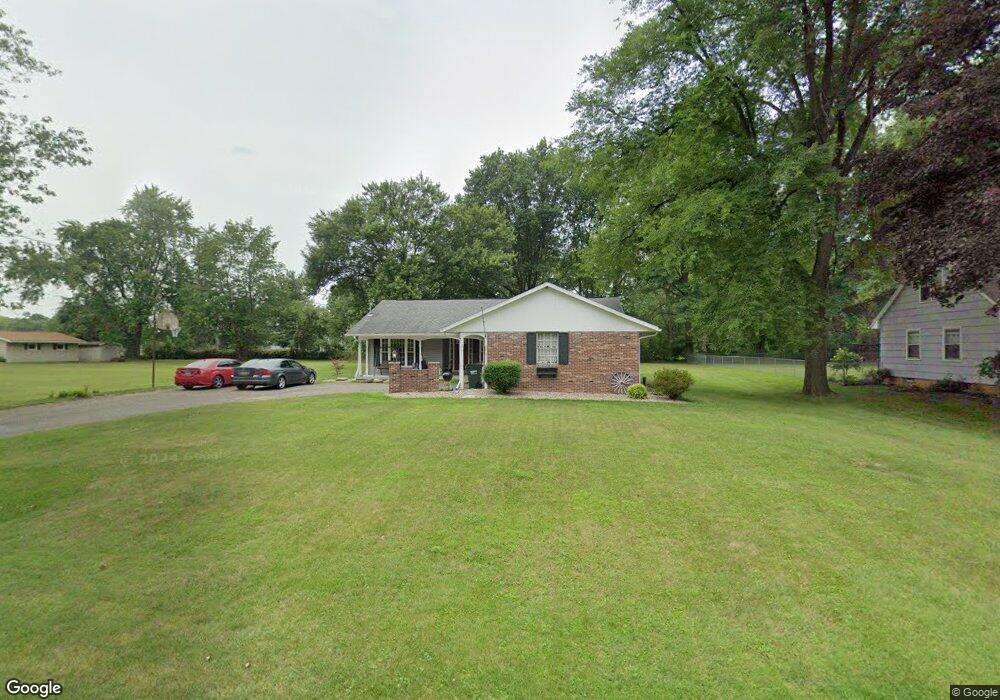
10571 Heltman Ave NE Alliance, OH 44601
Estimated Value: $211,000 - $250,000
3
Beds
2
Baths
1,376
Sq Ft
$167/Sq Ft
Est. Value
About This Home
This home is located at 10571 Heltman Ave NE, Alliance, OH 44601 and is currently estimated at $230,111, approximately $167 per square foot. 10571 Heltman Ave NE is a home located in Stark County with nearby schools including Marlington High School and Regina Coeli/St Joseph School.
Ownership History
Date
Name
Owned For
Owner Type
Purchase Details
Closed on
Sep 8, 2020
Sold by
Clark Brian D and Clark Christine M
Bought by
Wolf Skyler T and Wolf Catherine R
Current Estimated Value
Home Financials for this Owner
Home Financials are based on the most recent Mortgage that was taken out on this home.
Original Mortgage
$120,000
Outstanding Balance
$106,492
Interest Rate
2.9%
Mortgage Type
New Conventional
Estimated Equity
$123,619
Create a Home Valuation Report for This Property
The Home Valuation Report is an in-depth analysis detailing your home's value as well as a comparison with similar homes in the area
Home Values in the Area
Average Home Value in this Area
Purchase History
| Date | Buyer | Sale Price | Title Company |
|---|---|---|---|
| Wolf Skyler T | $150,000 | None Available |
Source: Public Records
Mortgage History
| Date | Status | Borrower | Loan Amount |
|---|---|---|---|
| Open | Wolf Skyler T | $120,000 |
Source: Public Records
Tax History Compared to Growth
Tax History
| Year | Tax Paid | Tax Assessment Tax Assessment Total Assessment is a certain percentage of the fair market value that is determined by local assessors to be the total taxable value of land and additions on the property. | Land | Improvement |
|---|---|---|---|---|
| 2025 | -- | $66,580 | $21,250 | $45,330 |
| 2024 | -- | $66,580 | $21,250 | $45,330 |
| 2023 | $1,812 | $51,460 | $11,310 | $40,150 |
| 2022 | $1,819 | $51,460 | $11,310 | $40,150 |
| 2021 | $1,824 | $51,460 | $11,310 | $40,150 |
| 2020 | $1,798 | $44,170 | $9,730 | $34,440 |
| 2019 | $1,400 | $44,170 | $9,730 | $34,440 |
| 2018 | $1,402 | $44,170 | $9,730 | $34,440 |
| 2017 | $1,308 | $39,690 | $9,240 | $30,450 |
| 2016 | $1,292 | $39,310 | $9,240 | $30,070 |
| 2015 | $1,230 | $39,310 | $9,240 | $30,070 |
| 2014 | $1,060 | $32,800 | $7,740 | $25,060 |
| 2013 | $527 | $32,800 | $7,740 | $25,060 |
Source: Public Records
Map
Nearby Homes
- 13334 Cindy St NE
- 0 Meadow St NE
- 13061 Beeson St NE
- 0 W Main St Unit 5090123
- 10666 Wilma Ave NE
- 11480 Aebi Ave NE
- 000 Klinger Ave
- 1430 Westwood Ave
- 432 Johnson Ave
- 2081 Marwood Cir
- 0 Klinger Ave NE
- 0 Johnson Ave NE Unit 5142926
- 11940 Freshley Ave NE
- 0 Meadowbrook Ave
- 565 W Broadway St
- 1201 Overlook Dr
- 11960 Freshley Ave NE
- 1038 Fairview Place
- 0 Homestead Ave NE
- 14422 Sturbridge Rd NE
- 10595 Heltman Ave NE
- 13363 Beeson St NE
- 10580 Heltman Ave NE
- 13331 Beeson St NE
- 10607 Heltman Ave NE
- 13321 Beeson St NE
- 10616 Heltman Ave NE
- 10645 Heltman Ave NE
- 13295 Beeson St NE
- 13445 Beeson St NE
- 10654 Heltman Ave NE
- 13285 Beeson St NE
- 10667 Heltman Ave NE
- 0 Beeson St NE Unit 3398938
- 0 Beeson St NE Unit 3467574
- 0 Beeson St NE Unit 3642527
- 0 Beeson St NE Unit 3921428
- 0 Beeson St NE Unit 4436878
- 10586 Julie St NE
- 13271 Beeson St NE