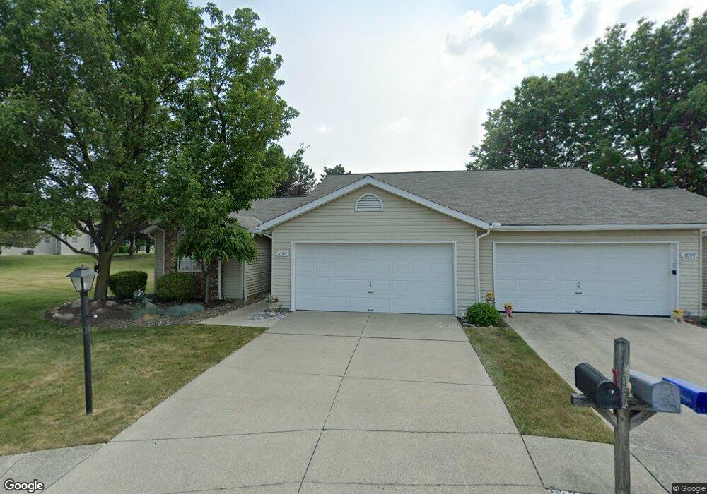
10571 Stapleton Dr Strongsville, OH 44136
Estimated Value: $255,432 - $270,000
2
Beds
2
Baths
1,306
Sq Ft
$201/Sq Ft
Est. Value
About This Home
This home is located at 10571 Stapleton Dr, Strongsville, OH 44136 and is currently estimated at $262,858, approximately $201 per square foot. 10571 Stapleton Dr is a home located in Cuyahoga County with nearby schools including Strongsville High School, Sts Joseph & John Interparochial School, and Royal Redeemer Lutheran School.
Ownership History
Date
Name
Owned For
Owner Type
Purchase Details
Closed on
Nov 3, 2011
Sold by
Krulcik Valarie and Lasko Denise
Bought by
Wasko Donna M
Current Estimated Value
Purchase Details
Closed on
Oct 23, 2006
Sold by
Knowles Theresa R
Bought by
Krulcik Valerie and Lasko Denise
Purchase Details
Closed on
Mar 21, 1990
Bought by
Knowles Stanley R
Purchase Details
Closed on
Jan 1, 1989
Bought by
Bruscino Homes Corp
Create a Home Valuation Report for This Property
The Home Valuation Report is an in-depth analysis detailing your home's value as well as a comparison with similar homes in the area
Home Values in the Area
Average Home Value in this Area
Purchase History
| Date | Buyer | Sale Price | Title Company |
|---|---|---|---|
| Wasko Donna M | $106,000 | Cleveland Home Title | |
| Krulcik Valerie | -- | None Available | |
| Knowles Stanley R | $103,300 | -- | |
| Bruscino Homes Corp | -- | -- |
Source: Public Records
Tax History Compared to Growth
Tax History
| Year | Tax Paid | Tax Assessment Tax Assessment Total Assessment is a certain percentage of the fair market value that is determined by local assessors to be the total taxable value of land and additions on the property. | Land | Improvement |
|---|---|---|---|---|
| 2024 | $3,250 | $79,030 | $14,980 | $64,050 |
| 2023 | $3,075 | $58,280 | $13,830 | $44,450 |
| 2022 | $3,079 | $58,280 | $13,830 | $44,450 |
| 2021 | $3,054 | $58,280 | $13,830 | $44,450 |
| 2020 | $2,804 | $48,970 | $11,620 | $37,350 |
| 2019 | $2,721 | $139,900 | $33,200 | $106,700 |
| 2018 | $2,365 | $48,970 | $11,620 | $37,350 |
| 2017 | $2,301 | $43,440 | $8,820 | $34,620 |
| 2016 | $2,283 | $43,440 | $8,820 | $34,620 |
| 2015 | $2,374 | $43,440 | $8,820 | $34,620 |
| 2014 | $2,374 | $44,320 | $9,000 | $35,320 |
Source: Public Records
Map
Nearby Homes
- 10560 Stapleton Dr
- 10471 Royal Oak Dr Unit 38-A
- 10266 Huntington Park Dr
- 9834 Brookline Oval
- 15485 Albion Rd
- 9945 Twelve Oaks Cir
- 10369 Council Bluff
- 9890 Webster Rd
- 10010 Chevy Chase
- 9129 Tahoe Cir
- 9286 Rainier Ct
- 15222 High Point
- 14069 Basswood Cir
- 13475 Jacqueline Ct
- 14409 Glenbrook Dr
- 9531 Nicole Cir
- 13861 Woodhawk Dr
- 14584 Baywood Ln
- 14557 Baywood Ln
- 12101 The Bluffs
- 10599 Stapleton Dr
- 10553 Stapleton Dr
- 10627 Stapleton Dr
- 10537 Stapleton Dr
- 10645 Stapleton Dr
- 15809 N Laguardia Pkwy
- 15841 N Laguardia Pkwy
- 10582 Stapleton Dr
- 10614 Stapleton Dr
- 10663 Stapleton Dr
- 15873 N Laguardia Pkwy
- 10486 Kettering Oval
- 10658 Stapleton Dr
- 10565 Scottsdale Dr
- 10587 Scottsdale Dr
- 10474 Kettering Oval
- 10521 Scottsdale Dr
- 10609 Scottsdale Dr
- 10560 Kettering Oval
- 15905 N Laguardia Pkwy