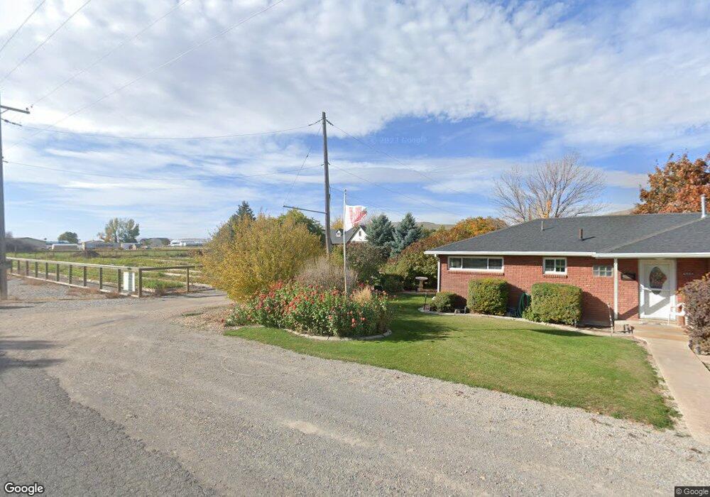
10578 S 5200 W Payson, UT 84651
Estimated Value: $1,698,000 - $2,429,000
5
Beds
4
Baths
5,043
Sq Ft
$420/Sq Ft
Est. Value
About This Home
This home is located at 10578 S 5200 W, Payson, UT 84651 and is currently estimated at $2,117,529, approximately $419 per square foot. 10578 S 5200 W is a home located in Utah County with nearby schools including Taylor Elementary School, Mt. Nebo Junior High School, and Salem Junior High School.
Ownership History
Date
Name
Owned For
Owner Type
Purchase Details
Closed on
Jul 8, 2010
Sold by
Genho Paul
Bought by
Genho Paul C and Paul C Genho Revocable Trust
Current Estimated Value
Home Financials for this Owner
Home Financials are based on the most recent Mortgage that was taken out on this home.
Original Mortgage
$130,000
Interest Rate
4.79%
Mortgage Type
New Conventional
Purchase Details
Closed on
Oct 3, 2008
Sold by
Genho Paul C
Bought by
Genho Paul C and The Paul C Genho Revocable Trust
Purchase Details
Closed on
Apr 21, 2005
Sold by
Monson Wilma M
Bought by
Genho Paul C
Create a Home Valuation Report for This Property
The Home Valuation Report is an in-depth analysis detailing your home's value as well as a comparison with similar homes in the area
Home Values in the Area
Average Home Value in this Area
Purchase History
| Date | Buyer | Sale Price | Title Company |
|---|---|---|---|
| Genho Paul C | -- | Inwest Title Services Sal | |
| Genho Paul | -- | Inwest Title Services Sal | |
| Genho Paul C | -- | None Available | |
| Genho Paul C | -- | Backman Stewart Title Servic |
Source: Public Records
Mortgage History
| Date | Status | Borrower | Loan Amount |
|---|---|---|---|
| Closed | Genho Paul | $130,000 |
Source: Public Records
Tax History Compared to Growth
Tax History
| Year | Tax Paid | Tax Assessment Tax Assessment Total Assessment is a certain percentage of the fair market value that is determined by local assessors to be the total taxable value of land and additions on the property. | Land | Improvement |
|---|---|---|---|---|
| 2025 | $5,778 | $566,980 | $743,600 | $907,400 |
| 2024 | $5,778 | $588,020 | $0 | $0 |
| 2023 | $11,413 | $1,164,661 | $0 | $0 |
| 2022 | $8,719 | $1,512,600 | $755,000 | $757,600 |
| 2021 | $7,451 | $1,058,100 | $483,800 | $574,300 |
| 2020 | $3,715 | $970,400 | $423,000 | $547,400 |
| 2019 | $3,624 | $860,100 | $312,700 | $547,400 |
| 2018 | $3,349 | $774,900 | $292,700 | $482,200 |
| 2017 | $3,428 | $286,907 | $0 | $0 |
| 2016 | $3,512 | $292,060 | $0 | $0 |
| 2015 | $3,351 | $276,732 | $0 | $0 |
| 2014 | $3,703 | $276,948 | $0 | $0 |
Source: Public Records
Map
Nearby Homes
- 10900 S 5200 W
- 5132 W 10400 S
- 841 N Dryland Cir Unit BALLAR
- 841 N Dryland Cir Unit DREXEL
- 841 N Dryland Cir Unit HILDAL
- 841 N Dryland Cir Unit WINDSR
- 841 N Dryland Cir Unit WAKEFI
- 841 N Dryland Cir Unit LUCAS
- 841 N Dryland Cir Unit AUBREY
- 841 N Dryland Cir Unit COLUMB
- 841 N Dryland Cir Unit HARMON
- 841 N Dryland Cir Unit CALDWL
- 1972 W 1150 S Unit 1027
- 2007 W 1150 S Unit 1041
- 1968 W 1150 S Unit 1028
- 1993 W 1150 S Unit 1038
- 1971 W 1150 S Unit 1034
- 1967 W 1150 S Unit 1033
- 1045 S 1700 W Unit 1533
- 1045 S 1700 W Unit 710