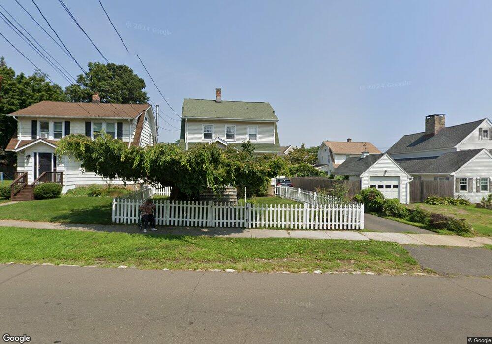
1058 North Ave Stratford, CT 06614
Estimated Value: $421,000 - $482,000
3
Beds
3
Baths
1,627
Sq Ft
$278/Sq Ft
Est. Value
About This Home
This home is located at 1058 North Ave, Stratford, CT 06614 and is currently estimated at $451,891, approximately $277 per square foot. 1058 North Ave is a home located in Fairfield County with nearby schools including Nichols Elementary School, David Wooster Middle School, and Stratford High School.
Ownership History
Date
Name
Owned For
Owner Type
Purchase Details
Closed on
Apr 8, 2005
Sold by
Baroni John and Baroni Denise
Bought by
Moshier Frank and Moshier Colleen
Current Estimated Value
Purchase Details
Closed on
Jul 31, 2001
Sold by
Burns Shawn W and Burns Denise M
Bought by
Baroni John S and Baroni Denise
Purchase Details
Closed on
May 8, 1998
Sold by
Marks Suzanne E
Bought by
Burns Shawn W and Burns Denise M
Create a Home Valuation Report for This Property
The Home Valuation Report is an in-depth analysis detailing your home's value as well as a comparison with similar homes in the area
Home Values in the Area
Average Home Value in this Area
Purchase History
| Date | Buyer | Sale Price | Title Company |
|---|---|---|---|
| Moshier Frank | $333,000 | -- | |
| Baroni John S | $174,900 | -- | |
| Burns Shawn W | $90,000 | -- |
Source: Public Records
Mortgage History
| Date | Status | Borrower | Loan Amount |
|---|---|---|---|
| Open | Burns Shawn W | $281,461 | |
| Closed | Burns Shawn W | $32,500 | |
| Closed | Burns Shawn W | $288,000 |
Source: Public Records
Tax History Compared to Growth
Tax History
| Year | Tax Paid | Tax Assessment Tax Assessment Total Assessment is a certain percentage of the fair market value that is determined by local assessors to be the total taxable value of land and additions on the property. | Land | Improvement |
|---|---|---|---|---|
| 2025 | $5,943 | $147,840 | $58,310 | $89,530 |
| 2024 | $5,943 | $147,840 | $58,310 | $89,530 |
| 2023 | $5,943 | $147,840 | $58,310 | $89,530 |
| 2022 | $5,834 | $147,840 | $58,310 | $89,530 |
| 2021 | $5,835 | $147,840 | $58,310 | $89,530 |
| 2020 | $5,860 | $147,840 | $58,310 | $89,530 |
| 2019 | $5,774 | $144,830 | $55,510 | $89,320 |
| 2018 | $5,779 | $144,830 | $55,510 | $89,320 |
| 2017 | $5,789 | $144,830 | $55,510 | $89,320 |
| 2016 | $5,647 | $144,830 | $55,510 | $89,320 |
| 2015 | $5,356 | $144,830 | $55,510 | $89,320 |
| 2014 | $5,961 | $167,300 | $68,810 | $98,490 |
Source: Public Records
Map
Nearby Homes
- 702 King St
- 114 Terrill Rd
- 55 Woodcrest Ave
- 24 Brewster St
- 195 Lobdell Dr
- 309 Freeman Ave
- 217 Huntington Rd
- 39 Parkway Dr
- 411 Windsor Ave
- 90 Mercer St
- 140 Spring St
- 169 Laughlin Rd E
- 25 Glenwood Ave
- 810 Nichols Ave
- 525 Wilcoxson Ave
- 150 San Gabriel Ave
- 40 Laughlin Rd E
- 204 California St
- 145 Wiebe Ave
- 1867 Broadbridge Ave
- 1056 North Ave
- 3209 Main St
- 3231 Main St
- 3219 Main St
- 1025 North Ave
- 1037 North Ave
- 1082 North Ave
- 3241 Main St Unit A1
- 3241 Main St Unit D
- 3241 Main St Unit B
- 3241 Main St Unit A
- 3181 Main St
- 1085 North Ave
- 1099 North Ave
- 50 Edmund St
- 1106 North Ave
- 42 Garden St
- 1105 North Ave
- 42 Garden St E
- 3178 Main St