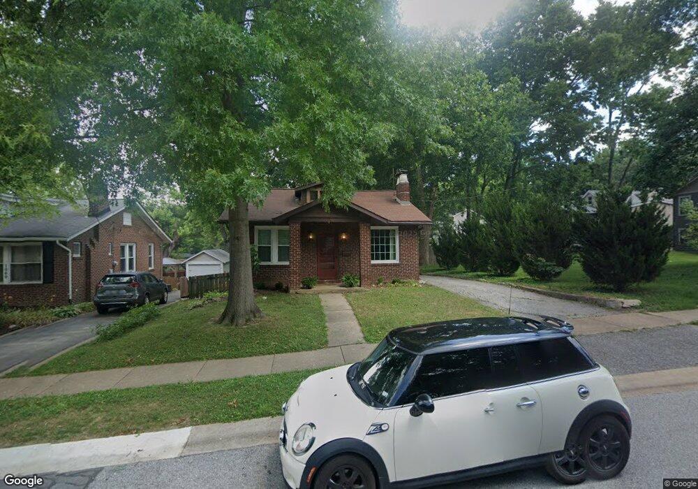
1058 Summit Ave Saint Louis, MO 63119
Estimated Value: $196,000 - $261,000
2
Beds
1
Bath
952
Sq Ft
$239/Sq Ft
Est. Value
About This Home
This home is located at 1058 Summit Ave, Saint Louis, MO 63119 and is currently estimated at $227,723, approximately $239 per square foot. 1058 Summit Ave is a home located in St. Louis County with nearby schools including Avery Elementary School, Hixson Middle School, and Webster Groves High School.
Ownership History
Date
Name
Owned For
Owner Type
Purchase Details
Closed on
Apr 14, 2023
Sold by
Woodcrest & West Llc
Bought by
Heins Dale and Heins Suzanne
Current Estimated Value
Purchase Details
Closed on
Jul 28, 2022
Sold by
Growth Developments Llc
Bought by
Woodcrest & West Llc
Purchase Details
Closed on
May 29, 2020
Sold by
Grantham Russell Alan and Estate Of Russell Alan
Bought by
Grantham Russell Alan
Purchase Details
Closed on
Oct 16, 2000
Sold by
Lawrence Smith Ronald and Lawrence Ronald L
Bought by
Grantham Russell
Home Financials for this Owner
Home Financials are based on the most recent Mortgage that was taken out on this home.
Original Mortgage
$85,000
Interest Rate
7.89%
Create a Home Valuation Report for This Property
The Home Valuation Report is an in-depth analysis detailing your home's value as well as a comparison with similar homes in the area
Home Values in the Area
Average Home Value in this Area
Purchase History
| Date | Buyer | Sale Price | Title Company |
|---|---|---|---|
| Heins Dale | -- | None Listed On Document | |
| Woodcrest & West Llc | -- | None Listed On Document | |
| Growth Developments Llc | -- | None Listed On Document | |
| Grantham Russell Alan | $110,000 | None Available | |
| Grantham Russell | $125,000 | -- | |
| Grantham Russell | $125,000 | -- |
Source: Public Records
Mortgage History
| Date | Status | Borrower | Loan Amount |
|---|---|---|---|
| Previous Owner | Grantham Russell | $85,000 |
Source: Public Records
Tax History
| Year | Tax Paid | Tax Assessment Tax Assessment Total Assessment is a certain percentage of the fair market value that is determined by local assessors to be the total taxable value of land and additions on the property. | Land | Improvement |
|---|---|---|---|---|
| 2025 | $3,306 | $44,040 | $37,010 | $7,030 |
| 2024 | $3,306 | $47,230 | $26,920 | $20,310 |
| 2023 | $3,290 | $47,230 | $26,920 | $20,310 |
| 2022 | $2,847 | $37,880 | $26,920 | $10,960 |
| 2021 | $2,838 | $37,880 | $26,920 | $10,960 |
| 2020 | $2,816 | $35,010 | $26,920 | $8,090 |
| 2019 | $2,796 | $35,010 | $26,920 | $8,090 |
| 2018 | $2,874 | $31,980 | $18,850 | $13,130 |
| 2017 | $2,855 | $31,980 | $18,850 | $13,130 |
| 2016 | $2,777 | $29,810 | $16,150 | $13,660 |
Source: Public Records
Map
Nearby Homes
- 835 N Forest Ave
- 727 Marshall Ave
- 633 N Forest Ave
- 643 Marshall Ave
- 650 Clark Ave
- 544 Summit Ave
- 619 N Bompart Ave
- 2649 Melvin Ave
- 503 Atalanta Ave
- 517 Clark Ave
- 1048 Kuhlman Ln
- 2639 Louis Ave
- 1052 Kuhlman Ln
- 404 Clark Ave
- 1088 Key West Ave
- 643 Elmwood Ave
- 2503 Louis Ave
- 2905 Brazeau Ave
- 3718 Oxford Blvd
- 3218 Walter Ave
- 1060 Summit Ave
- 808 N Forest Ave
- 1062 Summit Ave
- 1046 Summit Ave
- 809 Eunice Ave
- 810 N Forest Ave
- 813 Eunice Ave
- 750 N Forest Ave
- 755 Eunice Ave
- 812 N Forest Ave
- 817 Eunice Ave
- 1102 Summit Ave
- 751 Eunice Ave
- 746 N Forest Ave
- 745 Eunice Ave
- 821 Eunice Ave
- 755 N Forest Ave
- 824 N Forest Ave
- 1014 Summit Ave
- 1110 Summit Ave
Your Personal Tour Guide
Ask me questions while you tour the home.