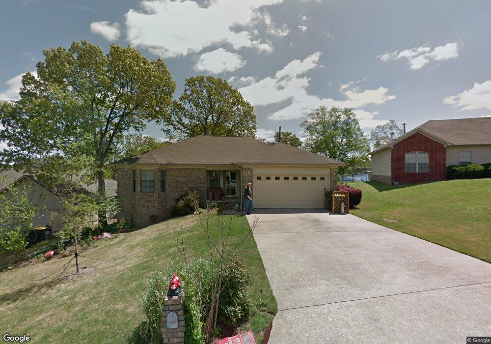
10587 Stoneridge Ct Sherwood, AR 72120
Estimated Value: $229,000 - $262,000
--
Bed
2
Baths
2,530
Sq Ft
$96/Sq Ft
Est. Value
About This Home
This home is located at 10587 Stoneridge Ct, Sherwood, AR 72120 and is currently estimated at $243,081, approximately $96 per square foot. 10587 Stoneridge Ct is a home located in Pulaski County with nearby schools including Sylvan Hills Elementary School, Sylvan Hills Middle School, and Sylvan Hills High School.
Ownership History
Date
Name
Owned For
Owner Type
Purchase Details
Closed on
Aug 29, 2003
Sold by
Yarbrough Hugh and Yarbrough Katie
Bought by
Richardson William J and Richardson Janet C
Current Estimated Value
Purchase Details
Closed on
Nov 21, 1997
Sold by
Farr Stephen M and Farr Julie Amanda
Bought by
Yarbrough William H and Yarbrough Katie A
Home Financials for this Owner
Home Financials are based on the most recent Mortgage that was taken out on this home.
Original Mortgage
$91,900
Interest Rate
7.31%
Mortgage Type
FHA
Create a Home Valuation Report for This Property
The Home Valuation Report is an in-depth analysis detailing your home's value as well as a comparison with similar homes in the area
Home Values in the Area
Average Home Value in this Area
Purchase History
| Date | Buyer | Sale Price | Title Company |
|---|---|---|---|
| Richardson William J | $129,000 | American Abstract & Title Co | |
| Yarbrough William H | $92,000 | -- |
Source: Public Records
Mortgage History
| Date | Status | Borrower | Loan Amount |
|---|---|---|---|
| Previous Owner | Yarbrough William H | $91,900 |
Source: Public Records
Tax History Compared to Growth
Tax History
| Year | Tax Paid | Tax Assessment Tax Assessment Total Assessment is a certain percentage of the fair market value that is determined by local assessors to be the total taxable value of land and additions on the property. | Land | Improvement |
|---|---|---|---|---|
| 2025 | $1,178 | $46,437 | $7,600 | $38,837 |
| 2024 | $1,178 | $38,725 | $7,600 | $31,125 |
| 2023 | $1,178 | $38,725 | $7,600 | $31,125 |
| 2022 | $1,371 | $38,725 | $7,600 | $31,125 |
| 2021 | $1,330 | $31,120 | $5,500 | $25,620 |
| 2020 | $947 | $31,120 | $5,500 | $25,620 |
| 2019 | $947 | $31,120 | $5,500 | $25,620 |
| 2018 | $621 | $31,120 | $5,500 | $25,620 |
| 2017 | $956 | $31,120 | $5,500 | $25,620 |
| 2016 | $956 | $30,480 | $5,600 | $24,880 |
| 2015 | $1,074 | $21,133 | $5,600 | $15,533 |
| 2014 | $1,074 | $21,133 | $5,600 | $15,533 |
Source: Public Records
Map
Nearby Homes
- Lot 30 Hidden Creek Dr
- 10732 Rocky Creek Dr
- 10724 Rocky Creek Dr
- 1909 Windridge Ct
- 2520 Austin Oaks Dr
- 10114 Hidden Cir
- 519 Hillcrest Rd
- 9833 Oak Heights Dr
- 4 Property Package
- 597 Valley Oak Dr
- 564 Valley Oak Dr
- 109 Pamela Ln
- 2117 Ingleside Dr
- 222 Gragson Ave
- 9909 Oakdale Rd
- 616 E Woodruff Ave
- 2032 Miramonte Dr
- 25 Acres Denton Rd
- Lot 4 Johnson Dr
- 00 Johnson Dr
- 10583 Stoneridge Ct
- 10591 Stoneridge Ct
- 10595 Stoneridge Ct
- 10581 Stoneridge Ct
- 10594 Stoneridge Ct
- 10590 Stoneridge Ct
- 0 Stoneridge Ct
- 10600 Stoneridge Ct
- 10599 Stoneridge Ct
- 10586 Stoneridge Ct
- 10580 Stoneridge Ct
- 10604 Stoneridge Ct
- 10582 Stoneridge Ct
- 10619 Rockbrook Dr
- 10611 Rockbrook Dr
- 10627 Rockbrook Dr
- 0 Rockbrook Dr Unit 16004253
- 0 Rockbrook Dr Unit 17016081
- 0 Rockbrook Dr Unit 18001021
- 10607 Stoneridge Ct