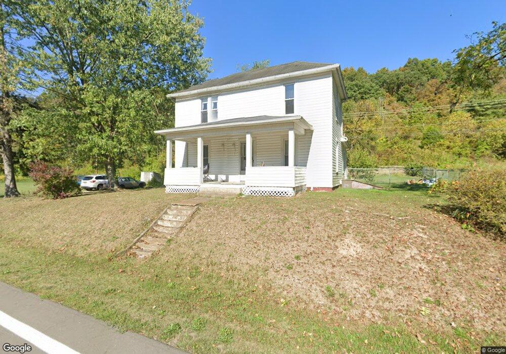
10588 State Route 550 Athens, OH 45701
Estimated Value: $116,000 - $249,000
2
Beds
1
Bath
1,197
Sq Ft
$152/Sq Ft
Est. Value
About This Home
This home is located at 10588 State Route 550, Athens, OH 45701 and is currently estimated at $182,500, approximately $152 per square foot. 10588 State Route 550 is a home located in Athens County with nearby schools including The Plains Elementary School, Athens Middle School, and Athens High School.
Ownership History
Date
Name
Owned For
Owner Type
Purchase Details
Closed on
Jul 12, 2019
Sold by
Johnson Melanie and Samblanet Marek
Bought by
Weber Megan Jean
Current Estimated Value
Home Financials for this Owner
Home Financials are based on the most recent Mortgage that was taken out on this home.
Original Mortgage
$155,555
Outstanding Balance
$136,280
Interest Rate
3.82%
Mortgage Type
New Conventional
Estimated Equity
$46,220
Purchase Details
Closed on
Sep 24, 2018
Sold by
Courtney Robert A and Courtney Judith A
Bought by
Johnson Melanie and Samblanet Marek
Purchase Details
Closed on
May 7, 2018
Sold by
Courtney Robert A and Courtney Judith A
Bought by
Courtney Robert A and Courtney Judith A
Create a Home Valuation Report for This Property
The Home Valuation Report is an in-depth analysis detailing your home's value as well as a comparison with similar homes in the area
Home Values in the Area
Average Home Value in this Area
Purchase History
| Date | Buyer | Sale Price | Title Company |
|---|---|---|---|
| Weber Megan Jean | $154,000 | Van Horn Title Agency Inc | |
| Johnson Melanie | $135,000 | Secure Title Services | |
| Courtney Robert A | -- | None Available | |
| Courtney Robert A | -- | None Available |
Source: Public Records
Mortgage History
| Date | Status | Borrower | Loan Amount |
|---|---|---|---|
| Open | Weber Megan Jean | $155,555 |
Source: Public Records
Tax History Compared to Growth
Tax History
| Year | Tax Paid | Tax Assessment Tax Assessment Total Assessment is a certain percentage of the fair market value that is determined by local assessors to be the total taxable value of land and additions on the property. | Land | Improvement |
|---|---|---|---|---|
| 2024 | $549 | $9,120 | $6,480 | $2,640 |
| 2023 | $507 | $9,120 | $6,480 | $2,640 |
| 2022 | $501 | $8,530 | $5,890 | $2,640 |
| 2021 | $486 | $8,530 | $5,890 | $2,640 |
| 2020 | $433 | $8,530 | $5,890 | $2,640 |
| 2019 | $373 | $6,510 | $4,050 | $2,460 |
| 2018 | $1,625 | $28,680 | $10,350 | $18,330 |
| 2017 | $2,721 | $28,680 | $10,350 | $18,330 |
| 2016 | $1,458 | $26,420 | $9,410 | $17,010 |
| 2015 | $2,566 | $26,420 | $9,410 | $17,010 |
| 2014 | $2,566 | $26,420 | $9,410 | $17,010 |
| 2013 | $2,457 | $25,950 | $9,410 | $16,540 |
Source: Public Records
Map
Nearby Homes
- 0 Salt Creek Rd
- 11711 Peach Ridge Rd
- 11845 N Peach Ridge
- 0 Strouds Run Unit 2433166
- 0 Columbus Rd
- 11933 Ohio 550
- 11933 State Route 550
- 30 Joneswood Dr
- 36 Johnson Rd
- 35 Johnson Rd
- 1 Northwood Dr
- 57 Ohio Ave
- 5 Oak St
- 4-20 Beech Rd
- 0 Carol Ln Unit 2433046
- 0 S Plains Rd
- 7 W 2nd St
- 59 Mill St
- 27 North St
- 90 Main St
- 10597 State Route 550
- 10591 State Route 550
- 10562 State Route 550
- 10616 State Route 550
- 12429 Center St
- 10547 State Route 550
- 10646 State Route 550
- 10547 Ohio 550
- 10650 State Route 550
- 10699 State Route 550
- 10662 State Route 550
- 12424 Center St
- 10521 State Route 550
- 12376 Center St
- 10727 State Route 550
- 10497 State Route 550
- 10731 State Route 550
- 10491 State Route 550
- 12367 Holdcroft Ln
- 12367 Holdcroft Ln