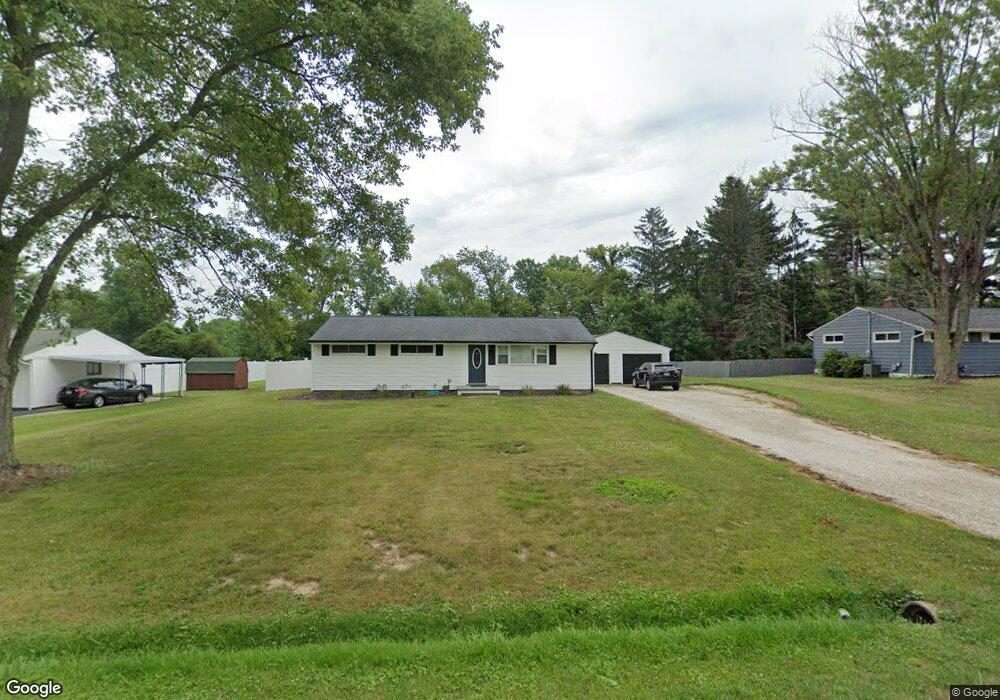
10588 Wilma Ave NE Alliance, OH 44601
Estimated Value: $192,000 - $237,000
3
Beds
1
Bath
1,170
Sq Ft
$177/Sq Ft
Est. Value
About This Home
This home is located at 10588 Wilma Ave NE, Alliance, OH 44601 and is currently estimated at $207,228, approximately $177 per square foot. 10588 Wilma Ave NE is a home located in Stark County with nearby schools including Marlington High School and Regina Coeli/St Joseph School.
Ownership History
Date
Name
Owned For
Owner Type
Purchase Details
Closed on
Jun 28, 2019
Sold by
Troyer Lance L and Troyer Christa D
Bought by
Harper Joshua B
Current Estimated Value
Home Financials for this Owner
Home Financials are based on the most recent Mortgage that was taken out on this home.
Original Mortgage
$145,053
Outstanding Balance
$127,546
Interest Rate
4%
Mortgage Type
VA
Estimated Equity
$79,682
Purchase Details
Closed on
Sep 20, 2018
Sold by
Troyer Lance L
Bought by
Troyer Lance L and Troyer Christa D
Purchase Details
Closed on
Jun 27, 2018
Sold by
Troyer Lance L and Troyer Christa D
Bought by
Buckeye State Credit Union
Purchase Details
Closed on
Aug 17, 2009
Sold by
Estate Of Marie K Chunko
Bought by
Chunko Joseph W
Create a Home Valuation Report for This Property
The Home Valuation Report is an in-depth analysis detailing your home's value as well as a comparison with similar homes in the area
Home Values in the Area
Average Home Value in this Area
Purchase History
| Date | Buyer | Sale Price | Title Company |
|---|---|---|---|
| Harper Joshua B | $142,000 | None Available | |
| Troyer Lance L | -- | None Available | |
| Buckeye State Credit Union | $32,565 | None Available | |
| Chunko Joseph W | -- | None Available |
Source: Public Records
Mortgage History
| Date | Status | Borrower | Loan Amount |
|---|---|---|---|
| Open | Harper Joshua B | $145,053 |
Source: Public Records
Tax History Compared to Growth
Tax History
| Year | Tax Paid | Tax Assessment Tax Assessment Total Assessment is a certain percentage of the fair market value that is determined by local assessors to be the total taxable value of land and additions on the property. | Land | Improvement |
|---|---|---|---|---|
| 2025 | -- | $62,940 | $21,880 | $41,060 |
| 2024 | -- | $62,940 | $21,880 | $41,060 |
| 2023 | $1,747 | $49,600 | $11,620 | $37,980 |
| 2022 | $1,753 | $49,600 | $11,620 | $37,980 |
| 2021 | $1,758 | $49,600 | $11,620 | $37,980 |
| 2020 | $1,710 | $42,980 | $10,010 | $32,970 |
| 2019 | $1,509 | $37,280 | $10,010 | $27,270 |
| 2018 | $1,511 | $37,280 | $10,010 | $27,270 |
| 2017 | $1,442 | $33,290 | $9,520 | $23,770 |
| 2016 | $1,189 | $27,440 | $9,520 | $17,920 |
| 2015 | $1,136 | $27,440 | $9,520 | $17,920 |
| 2014 | $1,038 | $22,900 | $7,950 | $14,950 |
| 2013 | $516 | $22,900 | $7,950 | $14,950 |
Source: Public Records
Map
Nearby Homes
- 10666 Wilma Ave NE
- 13334 Cindy St NE
- 0 Meadow St NE
- 0 W Main St Unit 5090123
- 11480 Aebi Ave NE
- 11960 Freshley Ave NE
- 1430 Westwood Ave
- 12355 Edison St NE
- 2081 Marwood Cir
- 13109 Edison St NE
- 2377 Ansley St Unit 2377
- 000 Klinger Ave
- 12252 Snode St NE
- 432 Johnson Ave
- 0 Klinger Ave NE
- 12415 Snode St NE
- 0 Reeder Ave NE
- 1201 Overlook Dr
- 14422 Sturbridge Rd NE
- 0 Johnson Ave NE Unit 5142926
- 10606 Wilma Ave NE
- 10572 Wilma Ave NE
- 10626 Wilma Ave NE
- 10544 Wilma Ave NE
- 10585 Wilma Ave NE
- 10567 Wilma Ave NE
- 10605 Wilma Ave NE
- 10644 Wilma Ave NE
- 10522 Wilma Ave NE
- 10625 Wilma Ave NE
- 12544 Agnes St NE
- 10645 Wilma Ave NE
- 10588 Barcus Ave NE
- 12534 Agnes St NE
- 10570 Barcus Ave NE
- 10626 Barcus Ave NE
- 10665 Wilma Ave NE
- 10684 Wilma Ave NE
- 10644 Barcus Ave NE
- 10530 Barcus Ave NE