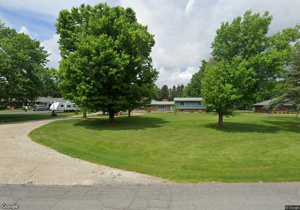
10589 Homestead Ln Plymouth, MI 48170
Estimated Value: $414,000 - $627,000
3
Beds
2
Baths
1,620
Sq Ft
$326/Sq Ft
Est. Value
About This Home
This home is located at 10589 Homestead Ln, Plymouth, MI 48170 and is currently estimated at $527,465, approximately $325 per square foot. 10589 Homestead Ln is a home located in Washtenaw County with nearby schools including Canton High School, Bird Elementary School, and West Middle School.
Ownership History
Date
Name
Owned For
Owner Type
Purchase Details
Closed on
Dec 22, 1997
Sold by
Moote Ralph E
Bought by
Kujat Ronald J and Horne Shelley T
Current Estimated Value
Home Financials for this Owner
Home Financials are based on the most recent Mortgage that was taken out on this home.
Original Mortgage
$155,200
Outstanding Balance
$28,642
Interest Rate
8.25%
Mortgage Type
New Conventional
Estimated Equity
$498,823
Create a Home Valuation Report for This Property
The Home Valuation Report is an in-depth analysis detailing your home's value as well as a comparison with similar homes in the area
Home Values in the Area
Average Home Value in this Area
Purchase History
| Date | Buyer | Sale Price | Title Company |
|---|---|---|---|
| Kujat Ronald J | $194,000 | -- |
Source: Public Records
Mortgage History
| Date | Status | Borrower | Loan Amount |
|---|---|---|---|
| Open | Kujat Ronald J | $155,200 |
Source: Public Records
Tax History Compared to Growth
Tax History
| Year | Tax Paid | Tax Assessment Tax Assessment Total Assessment is a certain percentage of the fair market value that is determined by local assessors to be the total taxable value of land and additions on the property. | Land | Improvement |
|---|---|---|---|---|
| 2025 | $3,383 | $205,900 | $0 | $0 |
| 2024 | $3,383 | $190,950 | $0 | $0 |
| 2023 | $3,225 | $139,350 | $0 | $0 |
| 2022 | $351 | $131,900 | $0 | $0 |
| 2021 | $3,324 | $136,800 | $0 | $0 |
| 2020 | $3,288 | $127,650 | $0 | $0 |
| 2019 | $3,226 | $126,650 | $126,650 | $0 |
| 2018 | $3,099 | $123,600 | $0 | $0 |
| 2017 | $2,935 | $126,050 | $0 | $0 |
| 2016 | $2,486 | $115,795 | $0 | $0 |
| 2015 | -- | $115,449 | $0 | $0 |
| 2014 | -- | $111,842 | $0 | $0 |
| 2013 | -- | $111,842 | $0 | $0 |
Source: Public Records
Map
Nearby Homes
- 10631 Homestead Ln
- 00 N Territorial Rd
- 0000 N Territorial Rd
- 6411 Lapham Ct
- 6908 Abi Ln
- 50536 Cottonwood Ct
- 50499 Cottonwood Ct Unit 26
- 50511 Beechwood Ct Unit 1112
- 50492 Beechwood Ct
- 50520 Elmwood Ct
- 50501 Elmwood Ct Unit 11
- 11641 Chandler Dr
- 6755 Brook Trout Ct
- 0 E Ann Arbor Trail Unit 20251048195
- 14180 F Dr
- 49582 Main Dr
- 9343 5 Mile Rd
- 9109 N Territorial Rd
- 9875 Ann Arbor Trail
- 46755 Five Mile Rd
- 10611 Homestead Ln
- 10571 Homestead Ln
- 10551 Homestead Ln
- 10572 Homestead Ln
- 10614 Homestead Ln
- 10590 Homestead Ln
- 10634 Homestead Ln
- 10651 Homestead Ln
- 6465 Napier Rd
- 10533 Homestead Ln
- 10534 Homestead Ln
- 10656 Homestead Ln
- 10509 Homestead Ln
- 10552 Homestead Ln
- 6415 Napier Rd
- 6435 Napier Rd Unit Bldg-Unit
- 6435 Napier Rd
- 10505 N Territorial Rd
- 6375 Napier Rd
- 10510 Homestead Ln