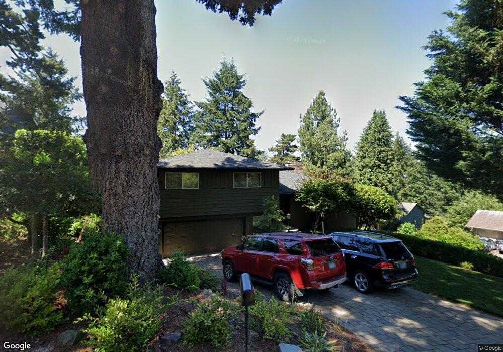
1059 Devon Ln Lake Oswego, OR 97034
Hallinan NeighborhoodEstimated Value: $965,000 - $1,169,000
4
Beds
3
Baths
2,188
Sq Ft
$472/Sq Ft
Est. Value
About This Home
This home is located at 1059 Devon Ln, Lake Oswego, OR 97034 and is currently estimated at $1,032,976, approximately $472 per square foot. 1059 Devon Ln is a home located in Clackamas County with nearby schools including Hallinan Elementary School, Lakeridge Middle School, and Lakeridge High School.
Ownership History
Date
Name
Owned For
Owner Type
Purchase Details
Closed on
Jun 27, 1996
Sold by
Collins Oliver R
Bought by
Buck Daniel R and Buck Victoria C
Current Estimated Value
Home Financials for this Owner
Home Financials are based on the most recent Mortgage that was taken out on this home.
Original Mortgage
$243,000
Outstanding Balance
$13,846
Interest Rate
8%
Estimated Equity
$1,019,130
Create a Home Valuation Report for This Property
The Home Valuation Report is an in-depth analysis detailing your home's value as well as a comparison with similar homes in the area
Home Values in the Area
Average Home Value in this Area
Purchase History
| Date | Buyer | Sale Price | Title Company |
|---|---|---|---|
| Buck Daniel R | $270,000 | Chicago Title Insurance Co |
Source: Public Records
Mortgage History
| Date | Status | Borrower | Loan Amount |
|---|---|---|---|
| Open | Buck Daniel R | $243,000 |
Source: Public Records
Tax History
| Year | Tax Paid | Tax Assessment Tax Assessment Total Assessment is a certain percentage of the fair market value that is determined by local assessors to be the total taxable value of land and additions on the property. | Land | Improvement |
|---|---|---|---|---|
| 2025 | $10,079 | $525,990 | -- | -- |
| 2024 | $9,810 | $510,670 | -- | -- |
| 2023 | $9,810 | $495,797 | $0 | $0 |
| 2022 | $9,240 | $481,357 | $0 | $0 |
| 2021 | $8,533 | $467,337 | $0 | $0 |
| 2020 | $8,319 | $453,726 | $0 | $0 |
| 2019 | $8,114 | $440,511 | $0 | $0 |
| 2018 | $7,716 | $427,681 | $0 | $0 |
| 2017 | $7,445 | $415,224 | $0 | $0 |
| 2016 | $6,777 | $403,130 | $0 | $0 |
Source: Public Records
Map
Nearby Homes
- 1060 Upper Devon Ln
- 17700 Upper Cherry Ln
- 1115 Larch St
- 1225 Spruce St
- 1247 Spruce St
- 1206 Cedar St
- 1674 Fircrest Dr
- 860 Skyland Dr
- 1720 Kilkenny Dr
- 1760 Kilkenny Dr
- 1710 S Shore Blvd
- 16081 Pearcy St
- 1227 Ash St
- 719 SW Maple St
- 1708 Conifer Dr
- 600 Maple St
- 990 Lund St
- 1036 Bullock St
- 1527 Lake Front Rd
- 668 Mcvey Ave Unit 12
- 1121 Devon Ln
- 999 Oxford Dr
- 1041 Oxford (Leased) Dr
- 1031 Oxford Dr
- 1080 Upper Devon Ln
- 1041 Oxford Dr
- 1131 Devon Ln
- 1100 Upper Devon Ln
- 1131 Oxford Dr Unit 72HR
- 1131 Oxford Dr
- 1040 Upper Devon Ln
- 979 Devon Ln
- 1110 Upper Devon Ln
- 1170 Oxford Dr
- 1191 Oxford Dr
- 1646 Devon Ln
- 1010 Upper Devon Ln
- 1130 Upper Devon Ln
- 939 Devon Ln
- 1180 Oxford Dr
Your Personal Tour Guide
Ask me questions while you tour the home.