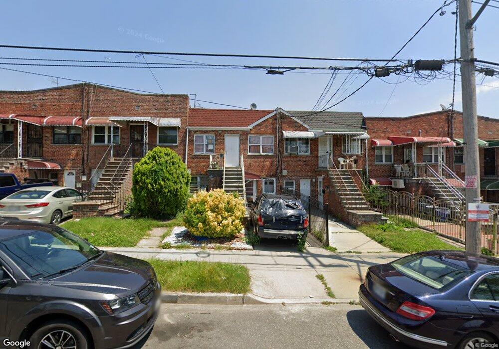
1059 E 221st St Bronx, NY 10469
Williamsbridge NeighborhoodEstimated Value: $588,895 - $695,000
Studio
--
Bath
1,560
Sq Ft
$414/Sq Ft
Est. Value
About This Home
This home is located at 1059 E 221st St, Bronx, NY 10469 and is currently estimated at $645,474, approximately $413 per square foot. 1059 E 221st St is a home located in Bronx County with nearby schools including P.S. 78 Anne Hutchinson, J.H.S. 144 Michelangelo, and New Covenant Christian School.
Ownership History
Date
Name
Owned For
Owner Type
Purchase Details
Closed on
Jul 16, 2007
Sold by
Gosine Daynanand and Ramroop Subhas
Bought by
Rios Felix
Current Estimated Value
Home Financials for this Owner
Home Financials are based on the most recent Mortgage that was taken out on this home.
Original Mortgage
$380,000
Outstanding Balance
$240,351
Interest Rate
6.73%
Mortgage Type
Purchase Money Mortgage
Estimated Equity
$405,123
Purchase Details
Closed on
Jan 26, 2007
Sold by
Estate Of Sandra Ellis
Bought by
Gosine Daynanand and Ramroop Subhas
Create a Home Valuation Report for This Property
The Home Valuation Report is an in-depth analysis detailing your home's value as well as a comparison with similar homes in the area
Home Values in the Area
Average Home Value in this Area
Purchase History
| Date | Buyer | Sale Price | Title Company |
|---|---|---|---|
| Rios Felix | $475,000 | -- | |
| Gosine Daynanand | $335,000 | -- |
Source: Public Records
Mortgage History
| Date | Status | Borrower | Loan Amount |
|---|---|---|---|
| Open | Rios Felix | $380,000 |
Source: Public Records
Tax History
| Year | Tax Paid | Tax Assessment Tax Assessment Total Assessment is a certain percentage of the fair market value that is determined by local assessors to be the total taxable value of land and additions on the property. | Land | Improvement |
|---|---|---|---|---|
| 2025 | $6,195 | $32,695 | $6,652 | $26,043 |
| 2024 | $6,195 | $30,845 | $6,534 | $24,311 |
| 2023 | $6,084 | $29,959 | $6,233 | $23,726 |
| 2022 | $5,643 | $31,740 | $7,740 | $24,000 |
| 2021 | $5,948 | $30,060 | $7,740 | $22,320 |
| 2020 | $5,767 | $29,940 | $7,740 | $22,200 |
| 2019 | $5,377 | $28,380 | $7,740 | $20,640 |
| 2018 | $5,089 | $24,966 | $7,650 | $17,316 |
| 2017 | $4,801 | $23,554 | $6,767 | $16,787 |
| 2016 | $4,709 | $23,554 | $7,099 | $16,455 |
| 2015 | $2,680 | $22,705 | $8,262 | $14,443 |
| 2014 | $2,680 | $21,420 | $8,580 | $12,840 |
Source: Public Records
Map
Nearby Homes
- 3863 Laconia Ave
- 1057 E 221st St
- 3941 Laconia Ave
- 1011 E 221st St
- 1038 E 224th St
- 1037 E 219th St
- 1149 E 219th St
- 1143 E 224th St
- - E 221st Street & Paulding Ave
- 1023 E 224th St
- 1159 E 224th St
- 1427 Needham Ave
- 1167 E 224th St
- 1817 Schieffelin Ave
- 962 E 221st St
- 959 E 220th St
- 1059 E 225th St
- 1012 E 225th St
- 945 E 222nd St
- 946 E 221st St
- 1061 E 221st St
- 1063 E 221st St
- 1055 E 221st St
- 1053 E 221st St
- 1065 E 221st St
- 3861 Laconia Ave
- 1051 E 221st St Unit E
- 1051 E 221st St
- 1051 E 221st St
- 1067 E 221st St
- 1058 E 222nd St
- 1056 E 222nd St
- 1049 E 221st St
- 1054 E 222nd St
- 1056 E 222 St
- 3865 Laconia Ave
- 1052 E 222nd St
- 1050 E 222nd St
- 3867 Laconia Ave
- 1048 E 222nd St
Your Personal Tour Guide
Ask me questions while you tour the home.