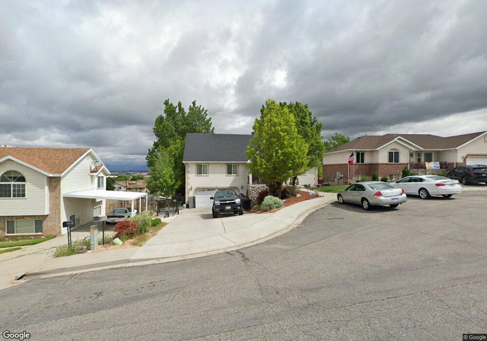
1059 E 300 N Spanish Fork, UT 84660
Estimated Value: $556,000 - $609,000
6
Beds
3
Baths
3,295
Sq Ft
$178/Sq Ft
Est. Value
About This Home
This home is located at 1059 E 300 N, Spanish Fork, UT 84660 and is currently estimated at $585,496, approximately $177 per square foot. 1059 E 300 N is a home located in Utah County with nearby schools including Larsen Elementary School, Spanish Fork Jr High School, and Spanish Fork High School.
Ownership History
Date
Name
Owned For
Owner Type
Purchase Details
Closed on
Sep 1, 2022
Sold by
Leavitt Adrein R
Bought by
Holbrook Misty and Kempton Chase
Current Estimated Value
Home Financials for this Owner
Home Financials are based on the most recent Mortgage that was taken out on this home.
Original Mortgage
$487,382
Outstanding Balance
$464,649
Interest Rate
4.99%
Mortgage Type
FHA
Estimated Equity
$120,847
Purchase Details
Closed on
Oct 14, 2009
Sold by
Ward Kellye
Bought by
Leavitt Adrein R
Home Financials for this Owner
Home Financials are based on the most recent Mortgage that was taken out on this home.
Original Mortgage
$252,800
Interest Rate
5.02%
Mortgage Type
VA
Purchase Details
Closed on
Nov 7, 2001
Sold by
Finch Jeffrey S and Finch Deborah F
Bought by
Carlsen Marilyn
Home Financials for this Owner
Home Financials are based on the most recent Mortgage that was taken out on this home.
Original Mortgage
$182,047
Interest Rate
6.73%
Create a Home Valuation Report for This Property
The Home Valuation Report is an in-depth analysis detailing your home's value as well as a comparison with similar homes in the area
Home Values in the Area
Average Home Value in this Area
Purchase History
| Date | Buyer | Sale Price | Title Company |
|---|---|---|---|
| Holbrook Misty | -- | -- | |
| Leavitt Adrein R | -- | First American Union Park | |
| Carlsen Marilyn | -- | Pro Title & Escrow Inc |
Source: Public Records
Mortgage History
| Date | Status | Borrower | Loan Amount |
|---|---|---|---|
| Open | Holbrook Misty | $487,382 | |
| Previous Owner | Leavitt Adrein R | $252,800 | |
| Previous Owner | Carlsen Marilyn | $182,047 |
Source: Public Records
Tax History
| Year | Tax Paid | Tax Assessment Tax Assessment Total Assessment is a certain percentage of the fair market value that is determined by local assessors to be the total taxable value of land and additions on the property. | Land | Improvement |
|---|---|---|---|---|
| 2025 | $2,513 | $291,775 | -- | -- |
| 2024 | $2,591 | $259,050 | $0 | $0 |
| 2023 | $2,591 | $267,410 | $0 | $0 |
| 2022 | $2,546 | $257,620 | $0 | $0 |
| 2021 | $190 | $381,600 | $88,800 | $292,800 |
| 2020 | $1,848 | $337,800 | $74,000 | $263,800 |
| 2019 | $1,848 | $306,000 | $74,000 | $232,000 |
| 2018 | $1,722 | $275,700 | $74,000 | $201,700 |
| 2017 | $1,608 | $138,325 | $0 | $0 |
| 2016 | $1,358 | $115,335 | $0 | $0 |
| 2015 | $1,219 | $102,245 | $0 | $0 |
| 2014 | $1,229 | $103,455 | $0 | $0 |
Source: Public Records
Map
Nearby Homes
- 314 N 1070 E
- 284 N 1000 E
- 998 E 260 N Unit 16
- 992 E 260 N Unit 15
- 306 N 1070 E
- 306 N 1070 E Unit 17
- 274 N 1070 E Unit 14
- 299 N 1070 E Unit 8
- 212 N 1070 E Unit 9
- 224 N 1070 E Unit 10
- 453 N 1210 E
- 1025 E 360 N Unit 5
- 1022 E 360 N Unit 27
- 991 E 360 N Unit 8
- 136 N 1120 E
- 2672 E 360 N Unit MRVL09
- 1074 E 660 N
- 1238 E 680 N
- 1005 E 260 N Unit 20
- 1261 E 680 N
Your Personal Tour Guide
Ask me questions while you tour the home.