Estimated Value: $536,578 - $678,000
4
Beds
2
Baths
1,962
Sq Ft
$324/Sq Ft
Est. Value
About This Home
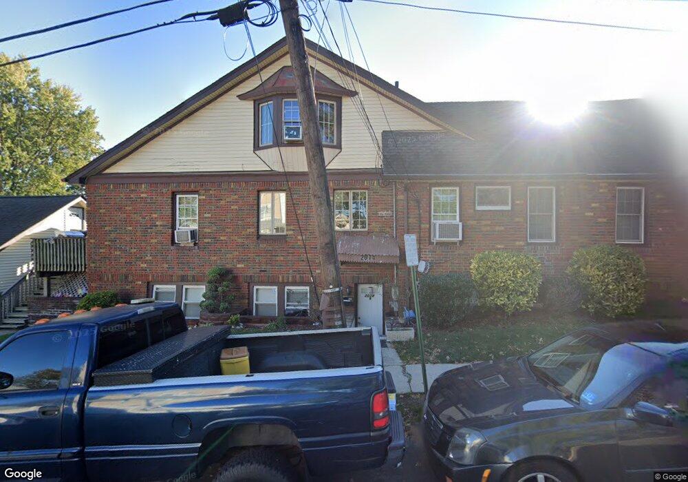
This home is located at 1059 Pine Ave Unit 1, Union, NJ 07083 and is currently estimated at $635,895, approximately $324 per square foot. 1059 Pine Ave Unit 1 is a home located in Union County with nearby schools including Connecticut Farms Elementary School, Union High School, and St Michael Parish School.
Ownership History
Date
Name
Owned For
Owner Type
Purchase Details
Closed on
Nov 30, 2023
Sold by
Smulski Cezary A and Smulski Bozena A
Bought by
Pozzo Galo Ernesto and Pozzo Rocio E
Current Estimated Value
Home Financials for this Owner
Home Financials are based on the most recent Mortgage that was taken out on this home.
Original Mortgage
$510,000
Outstanding Balance
$501,743
Interest Rate
7.63%
Mortgage Type
New Conventional
Estimated Equity
$134,152
Purchase Details
Closed on
Sep 11, 1997
Sold by
Smulski Cezary A and Rajchel Bozena A
Bought by
Smulski Cezary A and Rajchel Bozena A
Purchase Details
Closed on
Jan 30, 1997
Sold by
Alvarez Joseph and Alvarez Rosaura
Bought by
Smulski Cezary A and Rajchel Bozena A
Home Financials for this Owner
Home Financials are based on the most recent Mortgage that was taken out on this home.
Original Mortgage
$161,000
Interest Rate
7.6%
Create a Home Valuation Report for This Property
The Home Valuation Report is an in-depth analysis detailing your home's value as well as a comparison with similar homes in the area
Home Values in the Area
Average Home Value in this Area
Purchase History
| Date | Buyer | Sale Price | Title Company |
|---|---|---|---|
| Pozzo Galo Ernesto | $600,000 | Equity National Title | |
| Pozzo Galo Ernesto | $600,000 | Equity National Title | |
| Smulski Cezary A | -- | -- | |
| Smulski Cezary A | $181,000 | -- |
Source: Public Records
Mortgage History
| Date | Status | Borrower | Loan Amount |
|---|---|---|---|
| Open | Pozzo Galo Ernesto | $510,000 | |
| Previous Owner | Smulski Cezary A | $161,000 |
Source: Public Records
Tax History
| Year | Tax Paid | Tax Assessment Tax Assessment Total Assessment is a certain percentage of the fair market value that is determined by local assessors to be the total taxable value of land and additions on the property. | Land | Improvement |
|---|---|---|---|---|
| 2025 | $12,695 | $56,800 | $17,500 | $39,300 |
| 2024 | $12,308 | $56,800 | $17,500 | $39,300 |
| 2023 | $12,308 | $56,800 | $17,500 | $39,300 |
| 2022 | $11,880 | $56,800 | $17,500 | $39,300 |
| 2021 | $11,592 | $56,800 | $17,500 | $39,300 |
| 2020 | $11,361 | $56,800 | $17,500 | $39,300 |
| 2019 | $11,208 | $56,800 | $17,500 | $39,300 |
| 2018 | $11,018 | $56,800 | $17,500 | $39,300 |
| 2017 | $10,854 | $56,800 | $17,500 | $39,300 |
| 2016 | $10,590 | $56,800 | $17,500 | $39,300 |
| 2015 | $10,414 | $56,800 | $17,500 | $39,300 |
| 2014 | $10,181 | $56,800 | $17,500 | $39,300 |
Source: Public Records
Map
Nearby Homes
- 1115 Falls Terrace
- 1010 Falls Terrace
- 1244 Grandview Ave
- 1265 Shetland Dr
- 2011 Kay Ave
- 2144 Tyler St
- 1011 Adams Ave
- 1263 Coolidge Ave
- 987 Floyd Terrace
- 937 Roosevelt Ave
- 891 Pennsylvania Ave
- 931 Madison Ave
- 1239 Victor Ave
- 118 Orchard Terrace
- 2210 Stecher Ave
- 1395 Isabella Ave
- 2273 Balmoral Ave
- 210 Globe Ave
- 1841 Cider Mill Rd
- 4 Sadie Cir Unit 4103
Your Personal Tour Guide
Ask me questions while you tour the home.