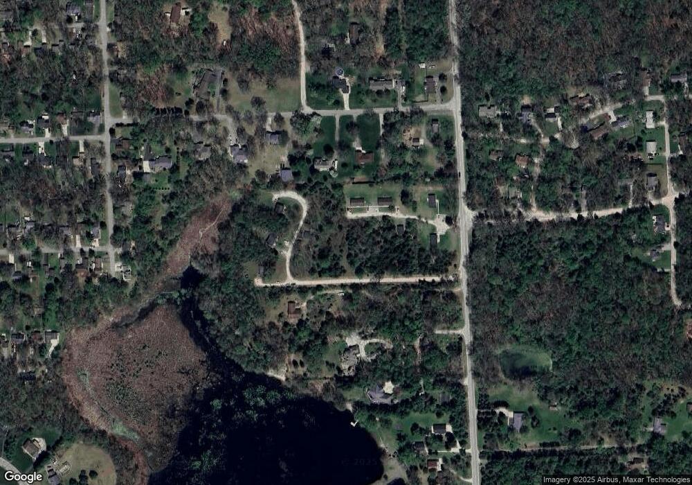
10592 Whitewood Rd Pinckney, MI 48169
Estimated Value: $1,124,749
4
Beds
1
Bath
10,896
Sq Ft
$103/Sq Ft
Est. Value
About This Home
This home is located at 10592 Whitewood Rd, Pinckney, MI 48169 and is currently estimated at $1,124,749, approximately $103 per square foot. 10592 Whitewood Rd is a home located in Livingston County with nearby schools including Country Elementary School, Navigator School, and Pathfinder School.
Ownership History
Date
Name
Owned For
Owner Type
Purchase Details
Closed on
Jul 20, 2016
Sold by
Whitewood Duplex Llc
Bought by
Lamitch Llc
Current Estimated Value
Purchase Details
Closed on
Jun 21, 2010
Sold by
West Patrick T and West Ma Mei
Bought by
Whitewood Duplex Llc
Purchase Details
Closed on
May 5, 1983
Sold by
Laurin Carl H and Laurin Loretta M
Bought by
West Patrick T and West Ma Mei
Create a Home Valuation Report for This Property
The Home Valuation Report is an in-depth analysis detailing your home's value as well as a comparison with similar homes in the area
Home Values in the Area
Average Home Value in this Area
Purchase History
| Date | Buyer | Sale Price | Title Company |
|---|---|---|---|
| Lamitch Llc | $650,000 | Liberty Title | |
| Whitewood Duplex Llc | -- | -- | |
| West Patrick T | $33,000 | -- | |
| West Patrick T | $33,000 | -- | |
| West Patrick T | $33,000 | -- | |
| West Patrick T | $33,000 | -- | |
| West Patrick T | $33,000 | -- | |
| West Patrick T | $33,000 | -- | |
| West Patrick T | $33,000 | -- |
Source: Public Records
Tax History Compared to Growth
Tax History
| Year | Tax Paid | Tax Assessment Tax Assessment Total Assessment is a certain percentage of the fair market value that is determined by local assessors to be the total taxable value of land and additions on the property. | Land | Improvement |
|---|---|---|---|---|
| 2025 | $16,265 | $616,970 | $0 | $0 |
| 2024 | $3,300 | $600,050 | $0 | $0 |
| 2023 | $3,148 | $487,790 | $0 | $0 |
| 2022 | $11,733 | $394,340 | $0 | $0 |
| 2021 | $14,275 | $394,340 | $0 | $0 |
| 2020 | $14,123 | $383,090 | $0 | $0 |
| 2019 | $13,898 | $372,240 | $0 | $0 |
| 2018 | $13,646 | $333,260 | $0 | $0 |
| 2017 | $15,100 | $333,260 | $0 | $0 |
| 2016 | $11,926 | $295,730 | $0 | $0 |
| 2014 | $10,444 | $264,580 | $0 | $0 |
| 2012 | $10,444 | $252,970 | $0 | $0 |
Source: Public Records
Map
Nearby Homes
- 10499 Michael Blvd
- 3380 McCluskey
- 9970 Whispering Woods Dr
- 10350 Half Moon Dr
- 9993 Tioga Trail Unit 154
- 3590 Habitat Trail Unit 25
- 2540 Lister Dr
- 3558 Windwheel Point Dr
- 11410 Tall Shadows Ct
- 9771 Tioga Trail Unit 171
- 3450 Hooker Rd
- 4106 Shoreview Ln
- 11770 Woodview
- 0 Western Ln
- 2939 Indian Trail
- 4405 Shoreview Ln
- Lot 1 Dunlavy Ln
- 11527 Mcgregor Rd
- 11670 Louis Ln
- 11589 Lombardy Ct
- 10592 Whitewood Rd Unit 14
- 000 Colonial
- 0000 Colonial Dr
- 10544 Whitewood Rd
- 0000 Crystal Springs Ln
- 3232 Madison
- 3241 Colonial Dr
- 3108 Crystal Unit 7
- 3244 Madison
- 0 Monticello Rd Unit 4923285
- 3217 Madison
- 3080 Crystal Unit 6
- 3125 Crystal
- 3245 Madison
- 10500 Whitewood Rd
- 3295 Colonial Dr
- 3052 Crystal Unit 5
- 10628 Monticello Rd
- 3311 Colonial Dr
- 3311 Colonial Dr
