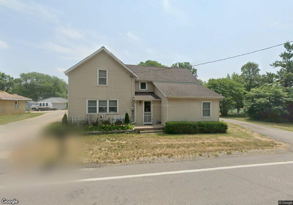
10596 Springfield Rd Tremont, IL 61568
Estimated Value: $162,826 - $243,000
5
Beds
2
Baths
3,106
Sq Ft
$63/Sq Ft
Est. Value
About This Home
This home is located at 10596 Springfield Rd, Tremont, IL 61568 and is currently estimated at $196,707, approximately $63 per square foot. 10596 Springfield Rd is a home located in Tazewell County with nearby schools including Tremont Elementary School, Tremont Middle School, and Tremont High School.
Ownership History
Date
Name
Owned For
Owner Type
Purchase Details
Closed on
Aug 31, 2012
Sold by
Oliver Tammy Jolene
Bought by
Goeken Stanley A and Goeken Connie E
Current Estimated Value
Purchase Details
Closed on
Aug 26, 2011
Sold by
Simms Inga and Lelm Inga
Bought by
Goeken Stanley A and Goeken Connie E
Home Financials for this Owner
Home Financials are based on the most recent Mortgage that was taken out on this home.
Original Mortgage
$104,030
Interest Rate
4.58%
Mortgage Type
FHA
Purchase Details
Closed on
Jul 7, 2005
Sold by
Bowers Eric M
Bought by
Simms Inga K
Home Financials for this Owner
Home Financials are based on the most recent Mortgage that was taken out on this home.
Original Mortgage
$130,432
Interest Rate
5.75%
Mortgage Type
New Conventional
Create a Home Valuation Report for This Property
The Home Valuation Report is an in-depth analysis detailing your home's value as well as a comparison with similar homes in the area
Purchase History
| Date | Buyer | Sale Price | Title Company |
|---|---|---|---|
| Goeken Stanley A | -- | None Available | |
| Goeken Stanley A | $133,000 | None Available | |
| Simms Inga K | $130,000 | -- |
Source: Public Records
Mortgage History
| Date | Status | Borrower | Loan Amount |
|---|---|---|---|
| Previous Owner | Goeken Stanley A | $104,030 | |
| Previous Owner | Simms Inga K | $130,432 |
Source: Public Records
Tax History
| Year | Tax Paid | Tax Assessment Tax Assessment Total Assessment is a certain percentage of the fair market value that is determined by local assessors to be the total taxable value of land and additions on the property. | Land | Improvement |
|---|---|---|---|---|
| 2024 | $2,762 | $47,950 | $4,180 | $43,770 |
| 2023 | $2,762 | $43,560 | $3,800 | $39,760 |
| 2022 | $2,578 | $39,570 | $3,450 | $36,120 |
| 2021 | $2,479 | $38,050 | $3,320 | $34,730 |
| 2020 | $2,498 | $38,050 | $3,320 | $34,730 |
| 2019 | $2,499 | $38,050 | $3,320 | $34,730 |
| 2018 | $2,468 | $38,050 | $3,320 | $34,730 |
| 2017 | $2,423 | $37,680 | $3,290 | $34,390 |
| 2016 | $2,388 | $37,680 | $3,290 | $34,390 |
| 2015 | $2,329 | $0 | $0 | $0 |
| 2013 | $2,299 | $37,310 | $3,260 | $34,050 |
Source: Public Records
Map
Nearby Homes
- 12656 Schleder Rd
- 4507 Greenlawn Ct
- 700 S Hancock St
- 7266 Granada Dr
- 604 Ivy Ln
- 10109 Arrow Rd
- 1960 Mayflower Dr
- 10105 Hickory Rd
- 313 W South St
- 1920 - 1922 Mayflower Dr
- 1960-1962 Mayflower Dr
- 201 Royal Point Ct
- 105 Royal Point Ct
- 106 Royal Point Ct
- 107 Lost Creek Ct
- 116 Lost Creek Ct
- 417 N Toepfer St
- 122 S Chestnut St
- 316 N Locust St
- 0 Furrow Rd
- 10626 Springfield Rd
- 10588 Springfield Rd
- 10581 Springfield Rd
- 10603 Springfield Rd
- 20540 Peach St
- 10736 Dillon Rd
- 10676 Springfield Rd
- 20615 Peach St
- 10626 Apple St
- 10699 Springfield Rd
- 10664 Apple St
- 10664 Apple St
- 10741 Dillon Rd
- 10689 Apple St
- 10600 Apple St
- 20521 Townline Rd
- 10977 Springfield Rd
- 20639 Peach St
- 20577 Townline Rd
- 10694 Apple St
Your Personal Tour Guide
Ask me questions while you tour the home.