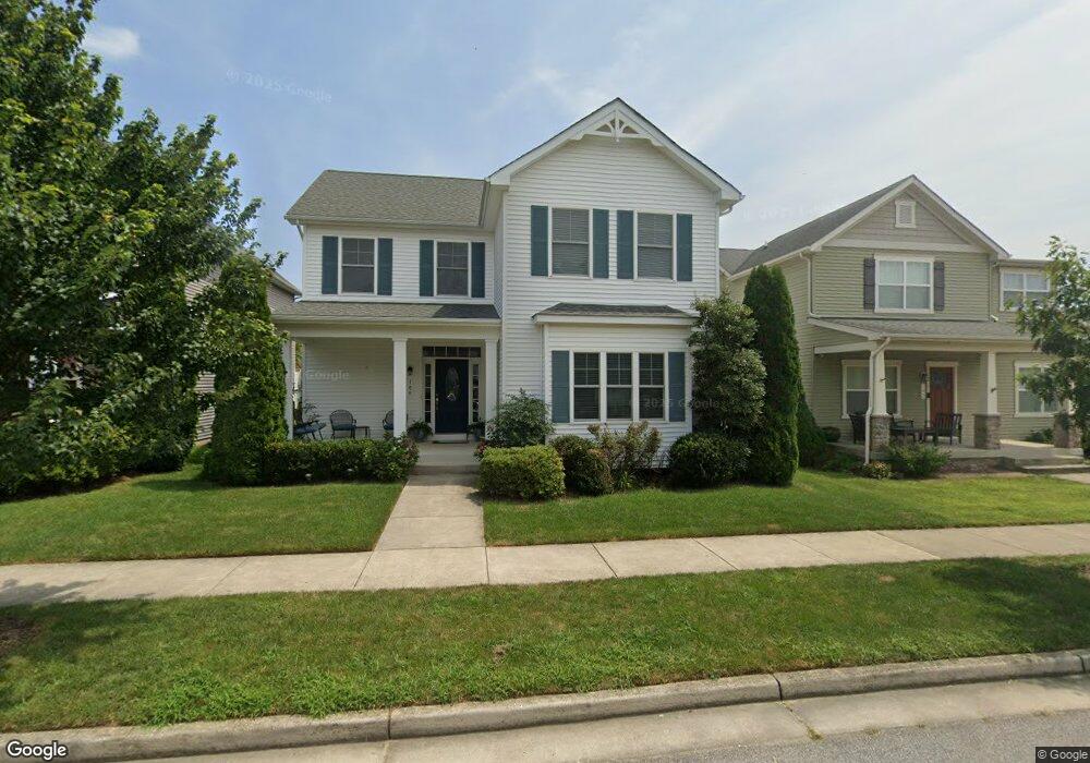
106 Allison Jane Dr Stevensville, MD 21666
Estimated Value: $552,833 - $628,000
Studio
1
Bath
2,257
Sq Ft
$264/Sq Ft
Est. Value
About This Home
This home is located at 106 Allison Jane Dr, Stevensville, MD 21666 and is currently estimated at $595,458, approximately $263 per square foot. 106 Allison Jane Dr is a home located in Queen Anne's County with nearby schools including Kent Island Elementary School, Bayside Elementary School, and Matapeake Middle School.
Ownership History
Date
Name
Owned For
Owner Type
Purchase Details
Closed on
Nov 15, 2013
Sold by
Reliable Development Company Llc
Bought by
Strawley James T and Strawley Jana M
Current Estimated Value
Home Financials for this Owner
Home Financials are based on the most recent Mortgage that was taken out on this home.
Original Mortgage
$382,860
Outstanding Balance
$284,837
Interest Rate
4.17%
Mortgage Type
New Conventional
Estimated Equity
$310,621
Create a Home Valuation Report for This Property
The Home Valuation Report is an in-depth analysis detailing your home's value as well as a comparison with similar homes in the area
Home Values in the Area
Average Home Value in this Area
Purchase History
| Date | Buyer | Sale Price | Title Company |
|---|---|---|---|
| Strawley James T | $403,011 | Uniteds Title & Escrow Inc |
Source: Public Records
Mortgage History
| Date | Status | Borrower | Loan Amount |
|---|---|---|---|
| Open | Strawley James T | $382,860 |
Source: Public Records
Tax History
| Year | Tax Paid | Tax Assessment Tax Assessment Total Assessment is a certain percentage of the fair market value that is determined by local assessors to be the total taxable value of land and additions on the property. | Land | Improvement |
|---|---|---|---|---|
| 2025 | $4,150 | $466,033 | $0 | $0 |
| 2024 | $3,939 | $431,267 | $0 | $0 |
| 2023 | $3,735 | $396,500 | $165,000 | $231,500 |
| 2022 | $3,735 | $396,500 | $165,000 | $231,500 |
| 2021 | $4,064 | $396,500 | $165,000 | $231,500 |
| 2020 | $4,064 | $423,700 | $180,000 | $243,700 |
| 2019 | $3,946 | $411,433 | $0 | $0 |
| 2018 | $3,798 | $399,167 | $0 | $0 |
| 2017 | $3,624 | $386,900 | $0 | $0 |
| 2016 | -- | $366,400 | $0 | $0 |
| 2015 | $587 | $345,900 | $0 | $0 |
| 2014 | $587 | $325,400 | $0 | $0 |
Source: Public Records
Map
Nearby Homes
- 434 Conor Dr
- 128 John Patrick Dr
- 131 John Patrick Dr
- 108 John Patrick Dr
- 111 Keenan Way
- 822 Moorings Cir Unit 17
- 784 Moorings Cir
- 107 Liam Thomas Ln
- 238 Liam Thomas Ln
- 119 Liam Thomas Ln
- 917 Moorings Cir Unit 131
- 116 Anthony Ln
- 1004 Marion Quimby Dr
- 252 Mikes Way
- 222 Moorings Cir Unit 126
- 1205 Marion Quimby Dr
- 1305 Marion Quimby Dr
- 222 Topside Dr
- 644 Moorings Cir
- 440 Moorings Cir
- 102 Allison Jane Dr
- 110 Allison Jane Dr
- 116 Allison Jane Dr
- 107 Anna Carol Dr
- 103 Anna Carol Dr
- 124 Allison Jane Dr
- 0 John Patrick Dr Unit 1007547184
- 0 John Patrick Dr Unit 1004467769
- 0 John Patrick Dr Unit 1007262376
- 0 John Patrick Dr Unit 1007249964
- 0 John Patrick Dr Unit 1007233664
- 0 John Patrick Dr Unit 1007210874
- 0 John Patrick Dr Unit 1007174024
- 0 John Patrick Dr Unit 1007137140
- 0 John Patrick Dr Unit 1007121462
- 0 John Patrick Dr Unit 1007084240
- 0 John Patrick Dr Unit 1007054762
- 0 John Patrick Dr Unit 1007040826
- 0 John Patrick Dr Unit 1006992320
- 0 John Patrick Dr Unit 1006975304
Your Personal Tour Guide
Ask me questions while you tour the home.