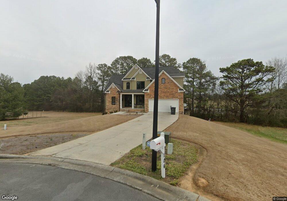
106 Bob White Dr Calhoun, GA 30701
Estimated Value: $406,349 - $468,000
3
Beds
3
Baths
2,715
Sq Ft
$162/Sq Ft
Est. Value
About This Home
This home is located at 106 Bob White Dr, Calhoun, GA 30701 and is currently estimated at $440,337, approximately $162 per square foot. 106 Bob White Dr is a home located in Gordon County with nearby schools including Calhoun Primary School, Calhoun Elementary School, and Calhoun Middle School.
Ownership History
Date
Name
Owned For
Owner Type
Purchase Details
Closed on
Sep 5, 2008
Sold by
Not Provided
Bought by
Morrison Kevin and Morrison Amy
Current Estimated Value
Home Financials for this Owner
Home Financials are based on the most recent Mortgage that was taken out on this home.
Original Mortgage
$201,400
Outstanding Balance
$133,767
Interest Rate
6.49%
Mortgage Type
New Conventional
Estimated Equity
$306,570
Purchase Details
Closed on
Jan 2, 2008
Sold by
Washington Mutual Bank
Bought by
Stokes Jason
Purchase Details
Closed on
Dec 27, 2002
Sold by
G Bonner Construction Co Inc
Bought by
Stokes Jason and Stokes Brandy
Purchase Details
Closed on
Nov 6, 2001
Sold by
Tecron Inc
Bought by
G Bonner Construction Co Inc
Create a Home Valuation Report for This Property
The Home Valuation Report is an in-depth analysis detailing your home's value as well as a comparison with similar homes in the area
Home Values in the Area
Average Home Value in this Area
Purchase History
| Date | Buyer | Sale Price | Title Company |
|---|---|---|---|
| Morrison Kevin | $212,000 | -- | |
| Stokes Jason | $251,881 | -- | |
| Stokes Jason | $289,900 | -- | |
| G Bonner Construction Co Inc | $42,500 | -- |
Source: Public Records
Mortgage History
| Date | Status | Borrower | Loan Amount |
|---|---|---|---|
| Open | Morrison Kevin | $201,400 |
Source: Public Records
Tax History Compared to Growth
Tax History
| Year | Tax Paid | Tax Assessment Tax Assessment Total Assessment is a certain percentage of the fair market value that is determined by local assessors to be the total taxable value of land and additions on the property. | Land | Improvement |
|---|---|---|---|---|
| 2024 | $4,313 | $154,040 | $10,360 | $143,680 |
| 2023 | $4,045 | $144,520 | $10,360 | $134,160 |
| 2022 | $1,269 | $135,400 | $10,360 | $125,040 |
| 2021 | $3,406 | $115,040 | $10,360 | $104,680 |
| 2020 | $3,468 | $116,200 | $10,360 | $105,840 |
| 2019 | $3,463 | $116,200 | $10,360 | $105,840 |
| 2018 | $1,024 | $108,320 | $10,360 | $97,960 |
| 2017 | $995 | $103,240 | $10,360 | $92,880 |
| 2016 | $998 | $103,240 | $10,360 | $92,880 |
| 2015 | $992 | $101,440 | $10,360 | $91,080 |
| 2014 | $955 | $99,018 | $10,360 | $88,658 |
Source: Public Records
Map
Nearby Homes
- 104 Bobwhite Dr
- 107 Bobwhite Dr
- 105 Bobwhite Dr
- 202 Montclair Dr
- 229 Hillcrest Dr
- 114 Vinings Way SE
- 107 Savoy Place SE
- 212 Sherwood Dr
- 220 Lenox Rd SE
- 198 Hillcrest Dr
- 136 Boston Rd
- 209 Willowbrook Dr SE
- 112 Willowbrook Dr SE
- 511 Boulevard Heights
- 421 Boulevard Heights
- 121 Hunt Dr
- The Pearson Plan at Creekview
- The Coleman Plan at Creekview
- The Benson II Plan at Creekview
- 102 Bob White Dr
- 103 Quail Cir
- 100 Clubhouse Dr
- 0 Bobwhite Dr
- 100 Bobwhite Dr
- 104 Quail Run Dr
- 101 Quail Run Dr
- 100 Bob White Cir
- 101 Quail Cir
- 100 Bob White Dr
- 0 Quail Cir Unit 8420944
- 0 Quail Cir Unit 8365088
- 0 Quail Cir
- 105 Quail Run Dr
- 104 Quail Cir
- 102 Quail Cir
- 102 Bob White Cir
- 127 Meadowbrook Rd
- 127 Meadowbrook Rd
- 108 Quail Run Dr