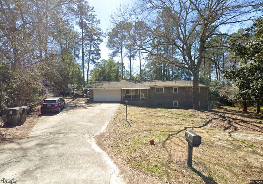
106 Brett Ave Warner Robins, GA 31088
Estimated Value: $175,000 - $223,000
5
Beds
3
Baths
2,268
Sq Ft
$88/Sq Ft
Est. Value
About This Home
This home is located at 106 Brett Ave, Warner Robins, GA 31088 and is currently estimated at $199,291, approximately $87 per square foot. 106 Brett Ave is a home located in Houston County with nearby schools including Miller Elementary School, Warner Robins Middle School, and Warner Robins High School.
Ownership History
Date
Name
Owned For
Owner Type
Purchase Details
Closed on
May 20, 2019
Sold by
Gibbs Charles E and Gibbs Linda
Bought by
Whitfield Arthur C and Whitfield Keyanna P
Current Estimated Value
Home Financials for this Owner
Home Financials are based on the most recent Mortgage that was taken out on this home.
Original Mortgage
$117,826
Outstanding Balance
$103,382
Interest Rate
4.1%
Mortgage Type
FHA
Estimated Equity
$95,909
Purchase Details
Closed on
Feb 26, 2003
Sold by
Patterson Lee D
Bought by
Gibbs Charles E and Gibbs Linda G
Create a Home Valuation Report for This Property
The Home Valuation Report is an in-depth analysis detailing your home's value as well as a comparison with similar homes in the area
Home Values in the Area
Average Home Value in this Area
Purchase History
| Date | Buyer | Sale Price | Title Company |
|---|---|---|---|
| Whitfield Arthur C | $120,000 | None Available | |
| Gibbs Charles E | $102,900 | -- |
Source: Public Records
Mortgage History
| Date | Status | Borrower | Loan Amount |
|---|---|---|---|
| Open | Whitfield Arthur C | $117,826 |
Source: Public Records
Tax History Compared to Growth
Tax History
| Year | Tax Paid | Tax Assessment Tax Assessment Total Assessment is a certain percentage of the fair market value that is determined by local assessors to be the total taxable value of land and additions on the property. | Land | Improvement |
|---|---|---|---|---|
| 2024 | $1,974 | $60,320 | $6,000 | $54,320 |
| 2023 | $1,653 | $50,120 | $6,000 | $44,120 |
| 2022 | $1,066 | $46,360 | $6,000 | $40,360 |
| 2021 | $964 | $41,720 | $6,800 | $34,920 |
| 2020 | $1,008 | $43,400 | $6,800 | $36,600 |
| 2019 | $908 | $39,080 | $6,800 | $32,280 |
| 2018 | $908 | $39,080 | $6,800 | $32,280 |
| 2017 | $909 | $39,080 | $6,800 | $32,280 |
| 2016 | $910 | $39,080 | $6,800 | $32,280 |
| 2015 | -- | $39,080 | $6,800 | $32,280 |
| 2014 | -- | $39,080 | $6,800 | $32,280 |
| 2013 | -- | $39,080 | $6,800 | $32,280 |
Source: Public Records
Map
Nearby Homes
- 113 Sandra Ave
- 213 Stratford Dr
- 104 Pleasant Hill Ct
- 103 Draper St
- 213 Briarcliff Rd
- 601 Paul St
- 214 Kingsbury Cir
- 216 Randall Dr
- 204 Deerwood Cir
- 504 Sunset Dr
- 98 Peachtree Place
- 310 Orchard Way
- 106 Ida Ave
- 108 Ida Ave
- 108 Southend Ave
- 113 Vernon Dr
- 800 N Briarcliff Rd
- 509 S Pleasant Hill Rd
- 344 Orchard Way
- 212 Orchard Way
- 108 Brett Ave
- 101 Forest Hill Dr
- 105 Hillridge Dr
- 107 Hillridge Dr
- 103 Hillridge Dr
- 103 Forest Hill Dr
- 105 Brett Ave
- 105 Forest Hill Dr
- 105 Forest Hill Dr Unit 9
- 103 Brett Ave
- 110 Brett Ave
- 107 Brett Ave
- 101 Hillridge Dr
- 111 Hillridge Dr
- 109 Brett Ave
- 102 Brett Ave
- 112 Brett Ave
- 106 Hillridge Dr
- 104 Hillridge Dr
- 108 Hillridge Dr