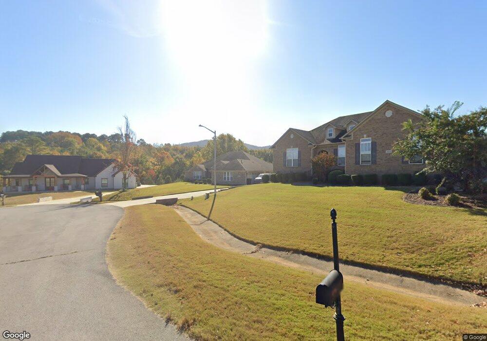
106 Brookshire Cir Huntsville, AL 35811
Ryland NeighborhoodEstimated Value: $468,000 - $518,000
--
Bed
1
Bath
3,010
Sq Ft
$164/Sq Ft
Est. Value
About This Home
This home is located at 106 Brookshire Cir, Huntsville, AL 35811 and is currently estimated at $492,876, approximately $163 per square foot. 106 Brookshire Cir is a home located in Madison County with nearby schools including Central School, Madison County High School, and Union Chapel Christian Academy.
Ownership History
Date
Name
Owned For
Owner Type
Purchase Details
Closed on
Apr 17, 2015
Sold by
Branhof Robert W and Branhof Amy S
Bought by
Cook Gregory A and Cook Kathryn W
Current Estimated Value
Home Financials for this Owner
Home Financials are based on the most recent Mortgage that was taken out on this home.
Original Mortgage
$298,889
Outstanding Balance
$230,924
Interest Rate
3.84%
Mortgage Type
VA
Estimated Equity
$261,952
Purchase Details
Closed on
Nov 21, 2008
Sold by
Dennis Olive Homes Inc
Bought by
Cook Rickey L and Cook Sharon O
Home Financials for this Owner
Home Financials are based on the most recent Mortgage that was taken out on this home.
Original Mortgage
$300,000
Interest Rate
5.89%
Mortgage Type
VA
Create a Home Valuation Report for This Property
The Home Valuation Report is an in-depth analysis detailing your home's value as well as a comparison with similar homes in the area
Home Values in the Area
Average Home Value in this Area
Purchase History
| Date | Buyer | Sale Price | Title Company |
|---|---|---|---|
| Cook Gregory A | $100 | None Available | |
| Cook Rickey L | -- | -- |
Source: Public Records
Mortgage History
| Date | Status | Borrower | Loan Amount |
|---|---|---|---|
| Open | Cook Gregory A | $298,889 | |
| Previous Owner | Cook Rickey L | $300,000 |
Source: Public Records
Tax History Compared to Growth
Tax History
| Year | Tax Paid | Tax Assessment Tax Assessment Total Assessment is a certain percentage of the fair market value that is determined by local assessors to be the total taxable value of land and additions on the property. | Land | Improvement |
|---|---|---|---|---|
| 2024 | -- | $50,480 | $6,000 | $44,480 |
| 2023 | $1,777 | $50,480 | $6,000 | $44,480 |
| 2022 | $1,526 | $43,440 | $4,000 | $39,440 |
| 2021 | $1,357 | $38,820 | $4,000 | $34,820 |
| 2020 | $1,254 | $35,310 | $4,000 | $31,310 |
| 2019 | $978 | $28,430 | $4,000 | $24,430 |
| 2018 | $933 | $27,200 | $0 | $0 |
| 2017 | $907 | $26,500 | $0 | $0 |
| 2016 | $907 | $26,500 | $0 | $0 |
| 2015 | $907 | $26,500 | $0 | $0 |
| 2014 | $933 | $27,200 | $0 | $0 |
Source: Public Records
Map
Nearby Homes
- 208 Townsend Dr SE
- 0 Old Gurley Rd NE Unit 24957018
- 109 Bridgestone Dr NE
- 3.8 Acres Townsend Dr SE
- .73 Acres Highway 72 E
- 1612 Calistoga Cir NE
- 1610 Calistoga Cir NE
- 1608 Calistoga Cir NE
- 1617 Calistoga Cir NE
- 1613 Calistoga Cir NE
- 1604 Calistoga Cir NE
- 1602 Calistoga Cir NE
- 137 Bridgestone Dr NE
- 510 Old Gurley Rd NE
- 143 Bridgestone Dr NE
- The Rainier Plan at Trailhead - Park Series
- The Acadia Plan at Trailhead - Park Series
- Yosemite Plan at Trailhead - Park Series
- The Tacoma at The Cove Plan at Trailhead - Cove Series
- The Yellowstone Plan at Trailhead - Park Series
- 104 Brookshire Cir
- 108 Brookshire Cir
- 100 Brookshire Cir
- 111 Sanders Dr
- 113 Sanders Dr
- 108 Hill Grass Cir
- 105 Brookshire Cir
- 101 Hill Grass Cir
- 0 Brookshire Cir Unit 1826437
- 0 Brookshire Cir Unit 1804341
- 133 Sanders Dr
- 103 Brookshire Cir
- 129 Sanders Dr
- 109 Brookshire Cir
- 107 Brookshire Cir
- 105 Sanders Dr
- 119 Sanders Dr
- 100 Hill Grass Cir
- 110 Sanders Dr
- 108 Sanders Dr