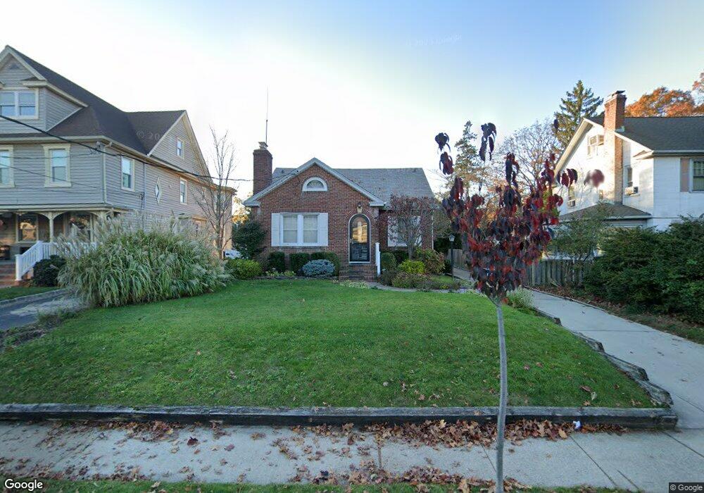
106 Brower Ave Rockville Centre, NY 11570
Estimated Value: $733,469 - $775,000
--
Bed
2
Baths
1,532
Sq Ft
$492/Sq Ft
Est. Value
About This Home
This home is located at 106 Brower Ave, Rockville Centre, NY 11570 and is currently estimated at $754,235, approximately $492 per square foot. 106 Brower Ave is a home located in Nassau County with nearby schools including South Side Middle School, South Side High School, and St Agnes Cathedral School.
Ownership History
Date
Name
Owned For
Owner Type
Purchase Details
Closed on
Jun 10, 2024
Sold by
Miller Patricia
Bought by
Miller Patricia and Irrevocable Trust Of Patricia Miller
Current Estimated Value
Purchase Details
Closed on
Oct 28, 1999
Sold by
Power John M and Power Kathleen A
Bought by
Miller Patricia
Purchase Details
Closed on
Jan 15, 1997
Sold by
Harris Eugene J and Harris Caterine
Bought by
Power John M and Power Kathleen A
Create a Home Valuation Report for This Property
The Home Valuation Report is an in-depth analysis detailing your home's value as well as a comparison with similar homes in the area
Home Values in the Area
Average Home Value in this Area
Purchase History
| Date | Buyer | Sale Price | Title Company |
|---|---|---|---|
| Miller Patricia | -- | None Available | |
| Miller Patricia | -- | None Available | |
| Miller Patricia | -- | None Available | |
| Miller Patricia | $315,000 | Commonwealth Land Title Ins | |
| Miller Patricia | $315,000 | Commonwealth Land Title Ins | |
| Power John M | $220,000 | -- | |
| Power John M | $220,000 | -- |
Source: Public Records
Tax History Compared to Growth
Tax History
| Year | Tax Paid | Tax Assessment Tax Assessment Total Assessment is a certain percentage of the fair market value that is determined by local assessors to be the total taxable value of land and additions on the property. | Land | Improvement |
|---|---|---|---|---|
| 2025 | $4,298 | $577 | $279 | $298 |
| 2024 | $799 | $587 | $284 | $303 |
| 2023 | $10,321 | $619 | $300 | $319 |
| 2022 | $10,321 | $638 | $309 | $329 |
| 2021 | $15,099 | $628 | $304 | $324 |
| 2020 | $13,637 | $742 | $610 | $132 |
| 2019 | $8,221 | $795 | $653 | $142 |
| 2018 | $9,802 | $857 | $0 | $0 |
| 2017 | $8,106 | $857 | $704 | $153 |
| 2016 | $9,392 | $857 | $704 | $153 |
| 2015 | $1,238 | $857 | $704 | $153 |
| 2014 | $1,238 | $857 | $704 | $153 |
| 2013 | $1,170 | $857 | $704 | $153 |
Source: Public Records
Map
Nearby Homes
- 473 Lakeview Ave
- 265 Raymond St
- 206 Brower Ave
- 1 Jefferson Ave Unit D2
- 1 Jefferson Ave Unit J10
- 25 Greystone Rd
- 327 N Forest Ave
- 104 Cedar Ave
- 46 Ongley St
- 33 Purdy Ct
- 43 N Forest Ave Unit C-23
- 43 N Forest Ave Unit E21
- 12 Shepherd St
- 10 Purdy Ct
- 15 Shepherd St
- 39 Gateway
- 217 Hamilton Rd
- 120 Morris Ave Unit A19
- 120 Morris Ave Unit B5
- 120 Morris Ave Unit B17
- 102 Brower Ave
- 102 Brower Ave Unit Upper
- 102 Brower Ave Unit Lower
- 110 Brower Ave
- 116 Brower Ave
- 98 Brower Ave
- 109 Powell Ave
- 118 Brower Ave
- 96 Brower Ave
- 105 Powell Ave
- 115 Powell Ave
- 101 Powell Ave
- 107 Brower Ave
- 90 Brower Ave
- 122 Brower Ave
- 109 Brower Ave
- 103 Brower Ave
- 121 Powell Ave
- 97 Powell Ave
- 99 Brower Ave