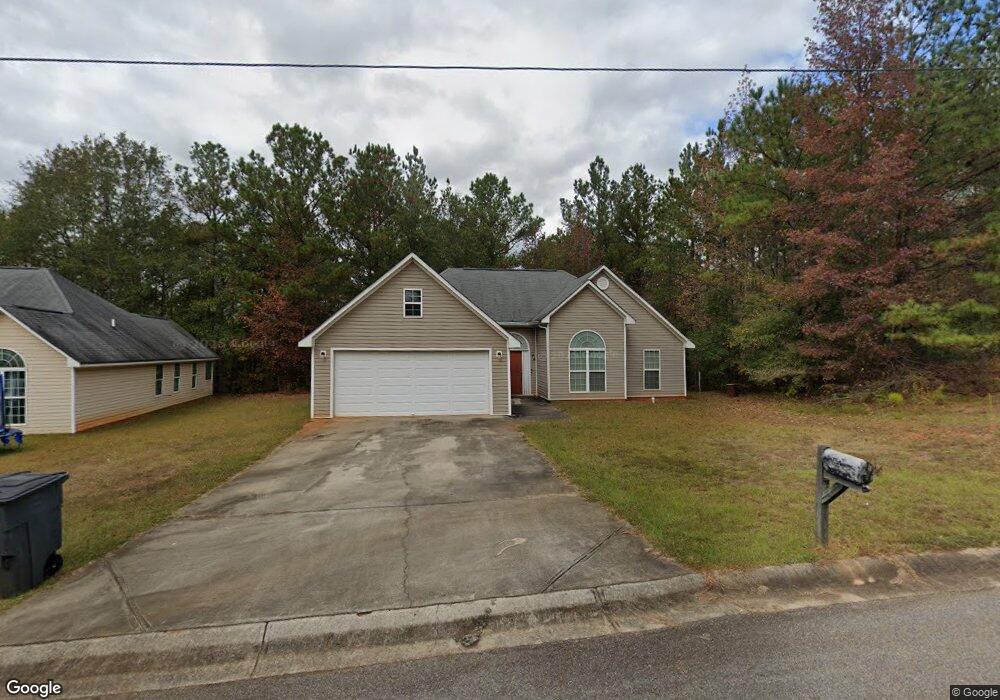
106 Chestnut St Manchester, GA 31816
Estimated Value: $122,000 - $160,000
3
Beds
2
Baths
1,402
Sq Ft
$100/Sq Ft
Est. Value
About This Home
This home is located at 106 Chestnut St, Manchester, GA 31816 and is currently estimated at $140,846, approximately $100 per square foot. 106 Chestnut St is a home with nearby schools including Mountain View Elementary School, Manchester Middle School, and Manchester High School.
Ownership History
Date
Name
Owned For
Owner Type
Purchase Details
Closed on
Nov 10, 2009
Sold by
Anderson Jonah
Bought by
Leonard Bernice Hart
Current Estimated Value
Purchase Details
Closed on
May 25, 2006
Sold by
Not Provided
Bought by
Leonard Bernice Hart
Purchase Details
Closed on
Dec 1, 2005
Sold by
Mcdowell Dennis H
Bought by
Mcdowell Construction Co Inc
Purchase Details
Closed on
Jan 14, 2004
Sold by
Cm Williams Inc
Bought by
Mcdowell Dennis
Create a Home Valuation Report for This Property
The Home Valuation Report is an in-depth analysis detailing your home's value as well as a comparison with similar homes in the area
Home Values in the Area
Average Home Value in this Area
Purchase History
| Date | Buyer | Sale Price | Title Company |
|---|---|---|---|
| Leonard Bernice Hart | $39,000 | -- | |
| Leonard Bernice Hart | $39,000 | -- | |
| Leonard Bernice Hart | $25,000 | -- | |
| Mcdowell Construction Co Inc | $900,000 | -- | |
| Mcdowell Dennis | $87,000 | -- |
Source: Public Records
Tax History Compared to Growth
Tax History
| Year | Tax Paid | Tax Assessment Tax Assessment Total Assessment is a certain percentage of the fair market value that is determined by local assessors to be the total taxable value of land and additions on the property. | Land | Improvement |
|---|---|---|---|---|
| 2024 | $2,164 | $61,320 | $3,600 | $57,720 |
| 2023 | $1,836 | $39,160 | $3,600 | $35,560 |
| 2022 | $1,836 | $39,160 | $3,600 | $35,560 |
| 2021 | $1,186 | $39,160 | $3,600 | $35,560 |
| 2020 | $1,195 | $39,160 | $3,600 | $35,560 |
| 2019 | $1,199 | $39,160 | $3,600 | $35,560 |
| 2018 | $1,276 | $44,600 | $3,600 | $41,000 |
| 2017 | $794 | $24,080 | $3,600 | $20,480 |
| 2016 | $793 | $24,080 | $3,600 | $20,480 |
| 2015 | $794 | $24,080 | $3,600 | $20,480 |
| 2014 | $794 | $24,080 | $3,600 | $20,480 |
| 2013 | -- | $24,080 | $3,600 | $20,480 |
Source: Public Records
Map
Nearby Homes
- 77 Cordwood St
- 16 North St
- 12 Truitt St
- 701 Jd Parham Dr
- 802 Jd Parham Dr
- 13.27 ACRES Roosevelt Hwy
- 434 Phil Howe Rd
- 305 Holy Hill Place
- 5 Jay St
- 36 E 2nd St
- 200 Hunt Cir
- 312 2nd Ave
- 522 4th St
- 408 Broad St
- 380 Elm St
- 3.26 ACRES Mountain Ridge Dr
- 514 Farris Blvd
- 604 Farris Blvd
- 403 W Broxton Ln
- 621 Mayes Way
- 104 Chestnut St
- 70 Chestnut St
- 69 Chestnut St
- 68 Chestnut St
- 71 Chestnut St
- 105 Cordwood St
- 106 Pigeon Creek Rd
- 26 Pigeon Creek Rd
- 0 White Oak Dr Unit LOT 19 3106005
- 0 White Oak Dr Unit LOT 18 3105722
- 55 White Oak Dr
- 0 White Oak Dr Unit LOT 18 7481007
- 56 White Oak Dr
- 54 White Oak Dr
- 53 White Oak Dr
- 0 White Oak Dr Unit LOT 19 7480871
- 0 White Oak Dr Unit 109 LOTS 10101800
- 0 White Oak Dr Unit 109 LOTS 9066825
- 0 White Oak Dr Unit 109 Lots 8978662
- 0 White Oak Dr Unit 109 Lots 8694458