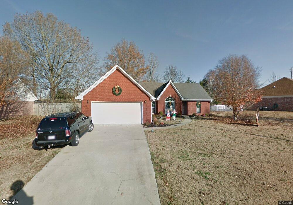
106 Colt Ln Guntown, MI 38849
Estimated Value: $219,000 - $245,000
3
Beds
2
Baths
1,720
Sq Ft
$132/Sq Ft
Est. Value
About This Home
This home is located at 106 Colt Ln, Guntown, MI 38849 and is currently estimated at $227,869, approximately $132 per square foot. 106 Colt Ln is a home located in Lee County with nearby schools including Saltillo Primary School, Saltillo Elementary School, and Guntown Middle School.
Ownership History
Date
Name
Owned For
Owner Type
Purchase Details
Closed on
Aug 8, 2012
Sold by
Mize Timothy R and Mize Andrea A
Bought by
Seeley Jason A
Current Estimated Value
Home Financials for this Owner
Home Financials are based on the most recent Mortgage that was taken out on this home.
Original Mortgage
$128,061
Outstanding Balance
$88,213
Interest Rate
3.55%
Estimated Equity
$139,656
Purchase Details
Closed on
Apr 5, 2007
Sold by
Watts Christopher Austin and Watts Nichole Danielle
Bought by
Mize Timothy R and Mize Andrea A
Home Financials for this Owner
Home Financials are based on the most recent Mortgage that was taken out on this home.
Original Mortgage
$129,900
Interest Rate
6.1%
Create a Home Valuation Report for This Property
The Home Valuation Report is an in-depth analysis detailing your home's value as well as a comparison with similar homes in the area
Home Values in the Area
Average Home Value in this Area
Purchase History
| Date | Buyer | Sale Price | Title Company |
|---|---|---|---|
| Seeley Jason A | -- | -- | |
| Mize Timothy R | -- | -- |
Source: Public Records
Mortgage History
| Date | Status | Borrower | Loan Amount |
|---|---|---|---|
| Open | Seeley Jason A | $128,061 | |
| Previous Owner | Mize Timothy R | $129,900 |
Source: Public Records
Tax History Compared to Growth
Tax History
| Year | Tax Paid | Tax Assessment Tax Assessment Total Assessment is a certain percentage of the fair market value that is determined by local assessors to be the total taxable value of land and additions on the property. | Land | Improvement |
|---|---|---|---|---|
| 2024 | $2,773 | $20,573 | $0 | $0 |
| 2023 | $2,546 | $19,179 | $0 | $0 |
| 2022 | $2,546 | $19,179 | $0 | $0 |
| 2021 | $2,546 | $19,179 | $0 | $0 |
| 2020 | $2,541 | $19,179 | $0 | $0 |
| 2019 | $2,422 | $18,227 | $0 | $0 |
| 2018 | $2,436 | $18,227 | $0 | $0 |
| 2017 | $2,361 | $18,227 | $0 | $0 |
| 2016 | $2,287 | $18,227 | $0 | $0 |
| 2015 | $2,111 | $16,890 | $0 | $0 |
| 2014 | $2,111 | $16,890 | $0 | $0 |
Source: Public Records
Map
Nearby Homes