Estimated Value: $243,000 - $266,035
3
Beds
3
Baths
1,893
Sq Ft
$136/Sq Ft
Est. Value
About This Home
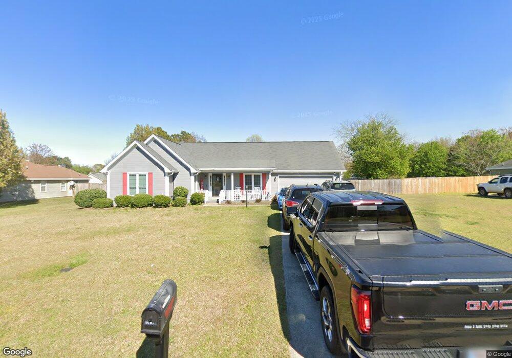
This home is located at 106 Darin Dr, Byron, GA 31008 and is currently estimated at $257,259, approximately $135 per square foot. 106 Darin Dr is a home located in Houston County with nearby schools including Eagle Springs Elementary School, Thomson Middle School, and Northside High School.
Ownership History
Date
Name
Owned For
Owner Type
Purchase Details
Closed on
Mar 30, 2007
Sold by
Gross Simone R
Bought by
Hinton James E
Current Estimated Value
Home Financials for this Owner
Home Financials are based on the most recent Mortgage that was taken out on this home.
Original Mortgage
$127,585
Outstanding Balance
$80,723
Interest Rate
7.01%
Mortgage Type
VA
Estimated Equity
$176,536
Purchase Details
Closed on
Oct 31, 2000
Sold by
Bucker Brian R and Bucker Christina M
Bought by
Gross Simone R
Purchase Details
Closed on
Dec 19, 1997
Sold by
Elmore Anthony W
Bought by
Bucker Brian R and Bucker Christina M
Purchase Details
Closed on
Oct 30, 1995
Sold by
Lada Inc
Bought by
Elmore Anthony W
Purchase Details
Closed on
Oct 13, 1995
Bought by
Lada Inc
Create a Home Valuation Report for This Property
The Home Valuation Report is an in-depth analysis detailing your home's value as well as a comparison with similar homes in the area
Home Values in the Area
Average Home Value in this Area
Purchase History
| Date | Buyer | Sale Price | Title Company |
|---|---|---|---|
| Hinton James E | $124,900 | None Available | |
| Gross Simone R | $101,300 | -- | |
| Bucker Brian R | $99,000 | -- | |
| Elmore Anthony W | -- | -- | |
| Lada Inc | -- | -- |
Source: Public Records
Mortgage History
| Date | Status | Borrower | Loan Amount |
|---|---|---|---|
| Open | Hinton James E | $127,585 |
Source: Public Records
Tax History
| Year | Tax Paid | Tax Assessment Tax Assessment Total Assessment is a certain percentage of the fair market value that is determined by local assessors to be the total taxable value of land and additions on the property. | Land | Improvement |
|---|---|---|---|---|
| 2024 | -- | $92,760 | $12,000 | $80,760 |
| 2023 | $0 | $72,880 | $10,000 | $62,880 |
| 2022 | $1,343 | $55,560 | $8,000 | $47,560 |
| 2021 | $1,217 | $52,080 | $8,000 | $44,080 |
| 2020 | $1,211 | $51,600 | $8,000 | $43,600 |
| 2019 | $1,211 | $51,600 | $8,000 | $43,600 |
| 2018 | $1,211 | $51,600 | $8,000 | $43,600 |
| 2017 | $1,212 | $51,600 | $8,000 | $43,600 |
| 2016 | $1,214 | $51,600 | $8,000 | $43,600 |
| 2015 | $1,216 | $51,600 | $8,000 | $43,600 |
| 2014 | -- | $51,600 | $8,000 | $43,600 |
| 2013 | -- | $51,360 | $8,000 | $43,360 |
Source: Public Records
Map
Nearby Homes
- 108 Manchester Ln
- 706 Georgian Walk
- 118 Manchester Ln
- 205 White Rd
- 107 Monroe Ct
- 721 Georgian Walk
- 732 Georgian Walk
- 260 Caleb Way
- 118 Bulloch Ct
- 110 Bulloch Ct
- 104 Monroe Ct
- 119 Bulloch Ct
- 217 Caleb Way
- 102 Monroe Ct
- 503 Georgian Walk
- 100 Monroe Ct
- 207 Gleneagle Dr
- 508 Georgian Walk
- 504 Georgian Walk
- 502 Georgian Walk
Your Personal Tour Guide
Ask me questions while you tour the home.