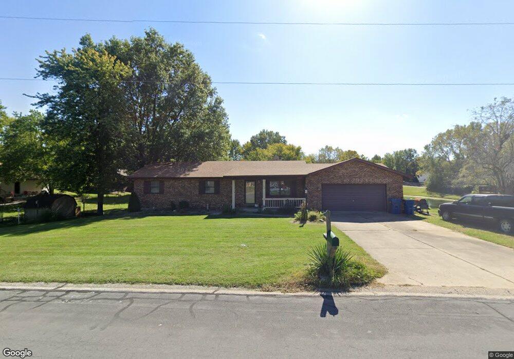
106 David Dr Collinsville, IL 62234
Estimated Value: $257,654 - $386,000
5
Beds
3
Baths
1,550
Sq Ft
$202/Sq Ft
Est. Value
About This Home
This home is located at 106 David Dr, Collinsville, IL 62234 and is currently estimated at $312,664, approximately $201 per square foot. 106 David Dr is a home located in Madison County with nearby schools including Silver Creek Elementary School, Triad Middle School, and Triad High School.
Ownership History
Date
Name
Owned For
Owner Type
Purchase Details
Closed on
Aug 1, 2007
Sold by
Mcclain Scott W and Mcclain Gaynetta
Bought by
Hicks Jimmy C and Hicks Sharon A
Current Estimated Value
Home Financials for this Owner
Home Financials are based on the most recent Mortgage that was taken out on this home.
Original Mortgage
$127,000
Interest Rate
6.7%
Mortgage Type
Purchase Money Mortgage
Purchase Details
Closed on
Jun 11, 2004
Sold by
Nussbaum Gene M and Nussbaum Linda J
Bought by
Mcclain Scott W and Mcclain Gaynetta
Home Financials for this Owner
Home Financials are based on the most recent Mortgage that was taken out on this home.
Original Mortgage
$148,720
Interest Rate
6.17%
Mortgage Type
Purchase Money Mortgage
Create a Home Valuation Report for This Property
The Home Valuation Report is an in-depth analysis detailing your home's value as well as a comparison with similar homes in the area
Home Values in the Area
Average Home Value in this Area
Purchase History
| Date | Buyer | Sale Price | Title Company |
|---|---|---|---|
| Hicks Jimmy C | $187,000 | Abstracts & Titles Inc | |
| Mcclain Scott W | $186,000 | Abstracts & Titles Inc |
Source: Public Records
Mortgage History
| Date | Status | Borrower | Loan Amount |
|---|---|---|---|
| Closed | Hicks Jimmy C | $127,000 | |
| Previous Owner | Mcclain Scott W | $148,720 | |
| Closed | Mcclain Scott W | $37,180 |
Source: Public Records
Tax History Compared to Growth
Tax History
| Year | Tax Paid | Tax Assessment Tax Assessment Total Assessment is a certain percentage of the fair market value that is determined by local assessors to be the total taxable value of land and additions on the property. | Land | Improvement |
|---|---|---|---|---|
| 2024 | $3,728 | $68,020 | $12,800 | $55,220 |
| 2023 | $3,728 | $61,900 | $11,650 | $50,250 |
| 2022 | $3,434 | $57,240 | $10,770 | $46,470 |
| 2021 | $3,125 | $53,780 | $10,120 | $43,660 |
| 2020 | $2,892 | $51,320 | $9,660 | $41,660 |
| 2019 | $3,403 | $57,640 | $9,580 | $48,060 |
| 2018 | $3,330 | $54,610 | $9,080 | $45,530 |
| 2017 | $3,412 | $53,520 | $8,900 | $44,620 |
| 2016 | $3,084 | $53,520 | $8,900 | $44,620 |
| 2015 | $2,717 | $52,130 | $8,670 | $43,460 |
| 2014 | $2,717 | $48,270 | $8,670 | $39,600 |
| 2013 | $2,717 | $52,130 | $8,670 | $43,460 |
Source: Public Records
Map
Nearby Homes
- 7 Keiths Ct
- 189 Meyer Dr
- 226 Woodridge Ct
- 130 Hilltop Place
- 1815 Robins Mill Ct
- 1819 Robin Mills Ct
- 1826 Robin Mills Ct
- 1830 Robin Mills Ct
- 1831 Crimson Oak Dr
- 1844 Crimson Oak Dr
- 7302 W Kirsch Rd
- 963 Long Branch Rd
- 961 Weathervane Ln
- 908 Long Branch Rd
- 2009 Buttonwood Ct
- 2033 Mapleleaf Dr
- 201 S Lange Ave
- 919 Carla Dr
- 131 E Country Ln
- 1205 Antler Dr
- 101 S Wilson Heights Rd
- 100 S Wilson Heights Rd
- 233 S Wilson Heights Rd
- 250 S Wilson Heights Rd
- 103 S Wilson Heights Rd
- 102 S Wilson Heights Rd
- 107 David Dr
- 251 S Wilson Heights Rd
- 105 S Wilson Heights Rd
- 110 David Dr
- 111 David Dr
- 101 Rebecca Ct
- 245 S Wilson Heights Rd
- 107 S Wilson Heights Rd
- 114 David Dr
- 103 Rebecca Ct
- 105 David Dr
- 109 S Wilson Heights Rd
- 242 S Wilson Heights Rd
- 132 David Dr