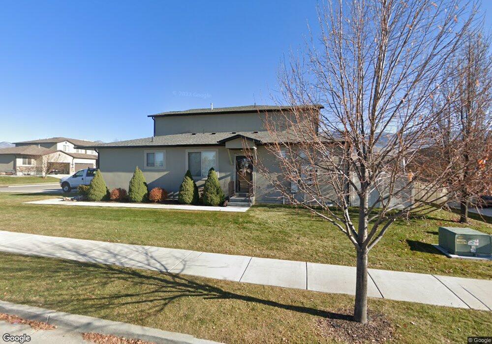
106 E 620 S Smithfield, UT 84335
Estimated Value: $348,000 - $400,000
3
Beds
3
Baths
1,853
Sq Ft
$200/Sq Ft
Est. Value
About This Home
This home is located at 106 E 620 S, Smithfield, UT 84335 and is currently estimated at $370,718, approximately $200 per square foot. 106 E 620 S is a home located in Cache County with nearby schools including Summit School, Cedar Ridge School, and North Cache Middle School.
Ownership History
Date
Name
Owned For
Owner Type
Purchase Details
Closed on
Sep 24, 2014
Sold by
Hanke Nova L
Bought by
Hanke Steven Michael and Hanke Nova L
Current Estimated Value
Home Financials for this Owner
Home Financials are based on the most recent Mortgage that was taken out on this home.
Original Mortgage
$152,000
Outstanding Balance
$115,813
Interest Rate
4.09%
Mortgage Type
New Conventional
Estimated Equity
$254,905
Purchase Details
Closed on
Sep 12, 2014
Sold by
Shepherd Dale G and Shepherd Geraldine B
Bought by
Hanke Nova L
Home Financials for this Owner
Home Financials are based on the most recent Mortgage that was taken out on this home.
Original Mortgage
$152,000
Outstanding Balance
$115,813
Interest Rate
4.09%
Mortgage Type
New Conventional
Estimated Equity
$254,905
Purchase Details
Closed on
Dec 6, 2011
Sold by
North Ridge Development Llc
Bought by
Shepherd Dale G and Shepherd Geraldine B
Home Financials for this Owner
Home Financials are based on the most recent Mortgage that was taken out on this home.
Original Mortgage
$143,144
Interest Rate
4.06%
Mortgage Type
New Conventional
Create a Home Valuation Report for This Property
The Home Valuation Report is an in-depth analysis detailing your home's value as well as a comparison with similar homes in the area
Home Values in the Area
Average Home Value in this Area
Purchase History
| Date | Buyer | Sale Price | Title Company |
|---|---|---|---|
| Hanke Steven Michael | -- | Heritage Title | |
| Hanke Nova L | -- | Heritage Title | |
| Shepherd Dale G | -- | Hickman Land Title Company |
Source: Public Records
Mortgage History
| Date | Status | Borrower | Loan Amount |
|---|---|---|---|
| Open | Hanke Nova L | $152,000 | |
| Previous Owner | Shepherd Dale G | $143,144 |
Source: Public Records
Tax History
| Year | Tax Paid | Tax Assessment Tax Assessment Total Assessment is a certain percentage of the fair market value that is determined by local assessors to be the total taxable value of land and additions on the property. | Land | Improvement |
|---|---|---|---|---|
| 2025 | $1,468 | $196,475 | $0 | $0 |
| 2024 | $1,763 | $221,460 | $0 | $0 |
| 2023 | $1,663 | $197,450 | $0 | $0 |
| 2022 | $1,690 | $197,450 | $0 | $0 |
| 2021 | $153 | $273,679 | $60,000 | $213,679 |
| 2020 | $1,476 | $245,808 | $60,000 | $185,808 |
| 2019 | $1,328 | $210,808 | $25,000 | $185,808 |
| 2018 | $1,243 | $190,900 | $25,000 | $165,900 |
| 2017 | $1,200 | $100,650 | $0 | $0 |
| 2016 | $1,221 | $84,185 | $0 | $0 |
| 2015 | $1,026 | $84,185 | $0 | $0 |
| 2014 | $1,006 | $84,185 | $0 | $0 |
| 2013 | -- | $84,185 | $0 | $0 |
Source: Public Records
Map
Nearby Homes
Your Personal Tour Guide
Ask me questions while you tour the home.