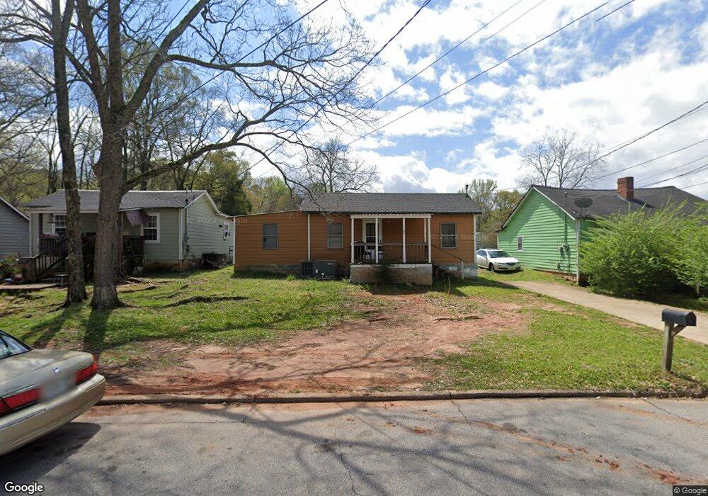
106 Fendig St Lagrange, GA 30241
Estimated Value: $62,300 - $107,000
2
Beds
1
Bath
852
Sq Ft
$88/Sq Ft
Est. Value
About This Home
This home is located at 106 Fendig St, Lagrange, GA 30241 and is currently estimated at $75,325, approximately $88 per square foot. 106 Fendig St is a home located in Troup County with nearby schools including Callaway Elementary School, Hogansville Elementary School, and Callaway Middle School.
Ownership History
Date
Name
Owned For
Owner Type
Purchase Details
Closed on
Nov 30, 2021
Sold by
T Squared 1 Llc
Bought by
Brbrshy Investments Inc
Current Estimated Value
Purchase Details
Closed on
Jun 1, 2021
Sold by
Stribling Ty
Bought by
T Squared 2 Llc
Purchase Details
Closed on
Nov 25, 2002
Sold by
Joann Ronald and Joann Massey
Bought by
Stribling Ty
Purchase Details
Closed on
Apr 26, 1990
Sold by
Murphy Charlie Will
Bought by
Joann Ronald and Joann Massey
Purchase Details
Closed on
Aug 29, 1956
Sold by
Moskowitz Jack
Bought by
Murphy Charlie Will
Create a Home Valuation Report for This Property
The Home Valuation Report is an in-depth analysis detailing your home's value as well as a comparison with similar homes in the area
Home Values in the Area
Average Home Value in this Area
Purchase History
| Date | Buyer | Sale Price | Title Company |
|---|---|---|---|
| Brbrshy Investments Inc | $12,484,500 | -- | |
| T Squared 2 Llc | -- | -- | |
| Stribling Ty | $209,000 | -- | |
| Joann Ronald | -- | -- | |
| Murphy Charlie Will | -- | -- |
Source: Public Records
Tax History Compared to Growth
Tax History
| Year | Tax Paid | Tax Assessment Tax Assessment Total Assessment is a certain percentage of the fair market value that is determined by local assessors to be the total taxable value of land and additions on the property. | Land | Improvement |
|---|---|---|---|---|
| 2024 | $559 | $20,480 | $3,000 | $17,480 |
| 2023 | $347 | $12,720 | $3,000 | $9,720 |
| 2022 | $294 | $10,520 | $3,000 | $7,520 |
| 2021 | $132 | $4,360 | $1,000 | $3,360 |
| 2020 | $132 | $4,360 | $1,000 | $3,360 |
| 2019 | $122 | $4,040 | $800 | $3,240 |
| 2018 | $122 | $4,040 | $800 | $3,240 |
| 2017 | $122 | $4,040 | $800 | $3,240 |
| 2016 | $114 | $3,792 | $750 | $3,042 |
| 2015 | $115 | $3,792 | $750 | $3,042 |
| 2014 | $115 | $3,792 | $750 | $3,042 |
| 2013 | -- | $6,556 | $1,000 | $5,556 |
Source: Public Records
Map
Nearby Homes
- 101 Cedar St
- 109 Bell St
- 0 Bagley St
- 0 Boggs St Unit 10550243
- 0 Boggs St Unit 10550231
- 0 Boggs St Unit 10550239
- 0 Boggs St Unit 10550250
- 304 Butler St
- 501 Milam St
- W W Crovat St
- 1191 Whitesville St
- 901 Whiteline St
- 303 E Mulberry St
- 0 E Fendig St
- 113 E Fendig St
- 1201 Whitesville St
- 1186 Lindsey St
- 311 Colquitt St
- 205 Fannin St
- 203 Fannin St