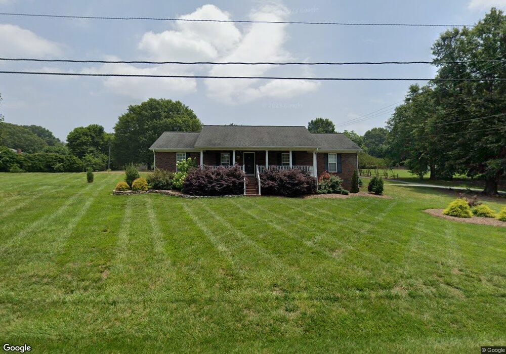
106 Garrison Dr Kings Mountain, NC 28086
Estimated Value: $388,393 - $450,000
Studio
--
Bath
2,065
Sq Ft
$200/Sq Ft
Est. Value
About This Home
This home is located at 106 Garrison Dr, Kings Mountain, NC 28086 and is currently estimated at $412,598, approximately $199 per square foot. 106 Garrison Dr is a home located in Cleveland County with nearby schools including North Elementary School, Kings Mountain Intermediate School, and Kings Mountain Middle.
Ownership History
Date
Name
Owned For
Owner Type
Purchase Details
Closed on
Nov 28, 2017
Sold by
Denton Sally N and Davis Sally D
Bought by
Denton Sally N
Current Estimated Value
Purchase Details
Closed on
Apr 20, 2011
Sold by
Goforth Rachael M and Goforth Virginia Susan
Bought by
Davis Sally D
Home Financials for this Owner
Home Financials are based on the most recent Mortgage that was taken out on this home.
Original Mortgage
$58,200
Outstanding Balance
$40,040
Interest Rate
4.74%
Mortgage Type
New Conventional
Estimated Equity
$372,558
Create a Home Valuation Report for This Property
The Home Valuation Report is an in-depth analysis detailing your home's value as well as a comparison with similar homes in the area
Home Values in the Area
Average Home Value in this Area
Purchase History
| Date | Buyer | Sale Price | Title Company |
|---|---|---|---|
| Denton Sally N | -- | None Available | |
| Davis Sally D | $125,000 | None Available |
Source: Public Records
Mortgage History
| Date | Status | Borrower | Loan Amount |
|---|---|---|---|
| Open | Davis Sally D | $58,200 |
Source: Public Records
Tax History
| Year | Tax Paid | Tax Assessment Tax Assessment Total Assessment is a certain percentage of the fair market value that is determined by local assessors to be the total taxable value of land and additions on the property. | Land | Improvement |
|---|---|---|---|---|
| 2025 | $3,478 | $339,327 | $52,659 | $286,668 |
| 2024 | $2,715 | $230,411 | $62,472 | $167,939 |
| 2023 | $2,600 | $230,411 | $62,472 | $167,939 |
| 2022 | $2,587 | $230,411 | $62,472 | $167,939 |
| 2021 | $2,600 | $230,411 | $62,472 | $167,939 |
| 2020 | $2,113 | $181,786 | $41,230 | $140,556 |
| 2019 | $2,113 | $181,786 | $41,230 | $140,556 |
| 2018 | $2,111 | $181,786 | $41,230 | $140,556 |
| 2017 | $2,101 | $181,786 | $41,230 | $140,556 |
| 2016 | $2,109 | $181,786 | $41,230 | $140,556 |
| 2015 | $2,243 | $198,592 | $39,981 | $158,611 |
| 2014 | $2,243 | $198,592 | $39,981 | $158,611 |
Source: Public Records
Map
Nearby Homes
- 231 Colton Ct
- 230 Colton Ct
- 236 Colton Ct
- 266 Colton Ct
- 111 Parker Claire Ln
- 1301 Shelby Rd
- 1305 Merrimont Ave
- 1203 W Gold Street Extension
- 306 Garrison Dr
- 308 Tommy James Ct
- 208 Victoria Cir
- 1409 Merrimont Ave
- 442 Phifer Rd
- 304 Ware St
- 1500 Shelby Rd
- 1417 Merrimont Ave
- 1610 Shelby Rd
- 430 Fulton Dr
- 1612 Shelby Rd Unit 14-17
- 813 W Mountain St
- 106 Garrison Dr
- 102 Garrison Dr
- 108 Independence Ct
- 1209 Suzanne St
- 110 Independence Ct
- 105 Independence Ct
- 107 Independence Ct
- 112 Independence Ct
- 109 Independence Ct
- 100 Garrison Dr
- 1207 Suzanne St
- 111 Independence Ct
- 111 N Roxford Rd
- 113 Independence Ct
- 1300 Shelby Rd
- 1205 Suzanne St
- 110 Liberty Ct
- 1204 Shelby Rd
- 201 N Roxford Rd
- 109 N Roxford Rd
Your Personal Tour Guide
Ask me questions while you tour the home.