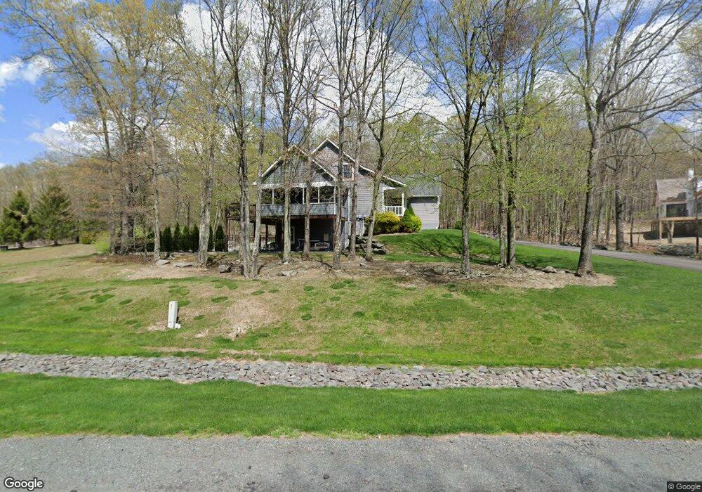
106 Glennwood Dr Hawley, PA 18428
Estimated Value: $553,438 - $668,000
4
Beds
4
Baths
1,512
Sq Ft
$404/Sq Ft
Est. Value
About This Home
This home is located at 106 Glennwood Dr, Hawley, PA 18428 and is currently estimated at $610,719, approximately $403 per square foot. 106 Glennwood Dr is a home located in Pike County with nearby schools including Wallenpaupack Area High School.
Ownership History
Date
Name
Owned For
Owner Type
Purchase Details
Closed on
Oct 21, 2019
Sold by
Desau Michael and Desau Kimberly A
Bought by
Roven Janice
Current Estimated Value
Home Financials for this Owner
Home Financials are based on the most recent Mortgage that was taken out on this home.
Original Mortgage
$292,000
Outstanding Balance
$253,779
Interest Rate
3.12%
Mortgage Type
New Conventional
Estimated Equity
$356,940
Create a Home Valuation Report for This Property
The Home Valuation Report is an in-depth analysis detailing your home's value as well as a comparison with similar homes in the area
Home Values in the Area
Average Home Value in this Area
Purchase History
| Date | Buyer | Sale Price | Title Company |
|---|---|---|---|
| Roven Janice | $365,000 | None Available |
Source: Public Records
Mortgage History
| Date | Status | Borrower | Loan Amount |
|---|---|---|---|
| Open | Roven Janice | $292,000 |
Source: Public Records
Tax History Compared to Growth
Tax History
| Year | Tax Paid | Tax Assessment Tax Assessment Total Assessment is a certain percentage of the fair market value that is determined by local assessors to be the total taxable value of land and additions on the property. | Land | Improvement |
|---|---|---|---|---|
| 2025 | $6,638 | $55,770 | $17,500 | $38,270 |
| 2024 | $6,638 | $55,770 | $17,500 | $38,270 |
| 2023 | $6,402 | $55,770 | $17,500 | $38,270 |
| 2022 | $6,262 | $55,770 | $17,500 | $38,270 |
| 2021 | $6,151 | $55,770 | $17,500 | $38,270 |
| 2020 | $5,903 | $53,520 | $17,500 | $36,020 |
| 2019 | $5,726 | $53,520 | $17,500 | $36,020 |
| 2018 | $5,638 | $53,520 | $17,500 | $36,020 |
| 2017 | $5,473 | $53,520 | $17,500 | $36,020 |
| 2016 | $0 | $53,520 | $17,500 | $36,020 |
| 2014 | -- | $49,750 | $17,500 | $32,250 |
Source: Public Records
Map
Nearby Homes
- 106 Lilypad Ln
- 0 Waterview Dr
- 173 Water View Dr
- 0 Blue Eddy Rd
- 46 Hawks Nest Dr
- 066 Hawks Nest Dr
- 141 Hawks Nest Dr
- 2.84 Acres Butchs Rd
- 0 Hidden Hollow Rd
- 23 Ledgecrest Rd
- 0 Tinkwig Dr
- 797 Tink Wig Dr
- Lot 155 Tink Wig Dr
- Lot 201 Tink Wig Dr
- 843+844 Tink Wig Dr
- 319 Tink Wig Dr
- 314 Ridgewood Ln
- 432 Eastwood Cir
- Lot 557 Eastwood Cir
- 274 Tink Wig Dr
- 105 Glennwood Dr
- 107 Glennwood Dr
- 111 Glennwood Dr
- 101 Upland Ct
- 104 Upland Ct
- 112 Glennwood Dr
- 114 Glennwood Dr
- 117 Glennwood Dr
- 12 Pin Oak Cir
- 121 Pin Oak Cir
- 123 Pin Oak Cir
- 1650 Route 590
- 14 Pin Oak Cir
- 117 Pin Oak Cir
- 115 Pin Oak Cir
- 121 Glennwood Dr
- 1644 Route 590
- 125 Glennwood Dr
- 122 Pin Oak Cir
- 113 Pin Oak Cir