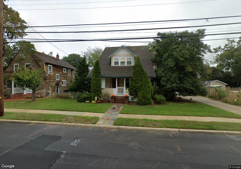
106 Hand Ave Cape May Court House, NJ 08210
Estimated Value: $392,842 - $596,000
--
Bed
--
Bath
2,492
Sq Ft
$194/Sq Ft
Est. Value
About This Home
This home is located at 106 Hand Ave, Cape May Court House, NJ 08210 and is currently estimated at $483,961, approximately $194 per square foot. 106 Hand Ave is a home located in Cape May County with nearby schools including Middle Township Elementary No. 1, Middle Township Elementary No. 2, and Middle Township Middle School.
Ownership History
Date
Name
Owned For
Owner Type
Purchase Details
Closed on
Jun 25, 2002
Sold by
Shoffler Tod Donald
Bought by
Hart Joseph and Hart Nancy
Current Estimated Value
Home Financials for this Owner
Home Financials are based on the most recent Mortgage that was taken out on this home.
Original Mortgage
$128,000
Outstanding Balance
$54,542
Interest Rate
6.92%
Mortgage Type
Purchase Money Mortgage
Estimated Equity
$429,419
Purchase Details
Closed on
Oct 29, 1997
Sold by
Montesano Patricia D
Bought by
Shoffler Tod D and Shoffler Patricia A
Home Financials for this Owner
Home Financials are based on the most recent Mortgage that was taken out on this home.
Original Mortgage
$70,000
Interest Rate
7.31%
Mortgage Type
Purchase Money Mortgage
Purchase Details
Closed on
Jun 11, 1992
Sold by
Brewer Jr James E and Brewer Dawn T
Bought by
Sammons Ellen D
Create a Home Valuation Report for This Property
The Home Valuation Report is an in-depth analysis detailing your home's value as well as a comparison with similar homes in the area
Home Values in the Area
Average Home Value in this Area
Purchase History
| Date | Buyer | Sale Price | Title Company |
|---|---|---|---|
| Hart Joseph | $160,000 | -- | |
| Shoffler Tod D | $87,500 | -- | |
| Sammons Ellen D | $78,800 | -- |
Source: Public Records
Mortgage History
| Date | Status | Borrower | Loan Amount |
|---|---|---|---|
| Open | Hart Joseph | $128,000 | |
| Previous Owner | Shoffler Tod D | $70,000 |
Source: Public Records
Tax History Compared to Growth
Tax History
| Year | Tax Paid | Tax Assessment Tax Assessment Total Assessment is a certain percentage of the fair market value that is determined by local assessors to be the total taxable value of land and additions on the property. | Land | Improvement |
|---|---|---|---|---|
| 2025 | $5,329 | $252,700 | $126,400 | $126,300 |
| 2024 | $5,329 | $252,700 | $126,400 | $126,300 |
| 2023 | $5,196 | $252,700 | $126,400 | $126,300 |
| 2022 | $5,046 | $252,700 | $126,400 | $126,300 |
| 2021 | $4,648 | $252,700 | $126,400 | $126,300 |
| 2020 | $4,824 | $252,700 | $126,400 | $126,300 |
| 2019 | $4,700 | $252,700 | $126,400 | $126,300 |
| 2018 | $4,627 | $252,700 | $126,400 | $126,300 |
| 2017 | $4,533 | $252,700 | $126,400 | $126,300 |
| 2016 | $4,420 | $252,700 | $126,400 | $126,300 |
| 2015 | $4,387 | $252,700 | $126,400 | $126,300 |
| 2014 | $4,359 | $252,700 | $126,400 | $126,300 |
Source: Public Records
Map
Nearby Homes
- 215 S Boyd St
- 220 Hand Ave
- 212 Shunpike Rd
- 310 Front St
- 13 Poplar St
- 24 Church St
- 33 E Mechanic St
- 26 Crest Rd
- 105 E Atlantic Ave
- 306 3rd St
- 90 Wynndemere Ct
- 4 Railroad Ave
- 211 Colonial Ave
- 416 Hand Ave
- 5 Locust Ln
- 144 Lee Ln Unit Front
- 100 Osprey Dr Unit 100
- 706 Bennett Rd
- 147 Lee Ln Unit 147
- 104 Bay Breeze Blvd Unit 104