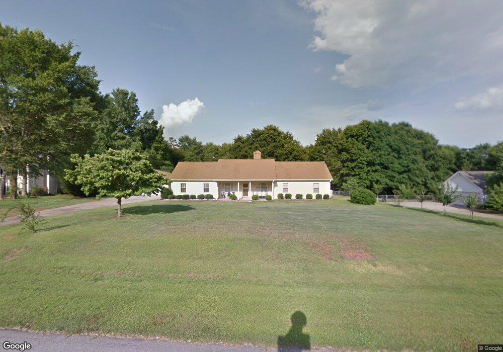
106 Hawthorne Cir Lagrange, GA 30240
Estimated Value: $235,978 - $259,000
2
Beds
2
Baths
1,432
Sq Ft
$174/Sq Ft
Est. Value
About This Home
This home is located at 106 Hawthorne Cir, Lagrange, GA 30240 and is currently estimated at $248,745, approximately $173 per square foot. 106 Hawthorne Cir is a home located in Troup County with nearby schools including Long Cane Elementary School, Berta Weathersbee Elementary School, and Whitesville Road Elementary School.
Ownership History
Date
Name
Owned For
Owner Type
Purchase Details
Closed on
Sep 14, 2015
Sold by
Parker Lewis Hamilton
Bought by
Crawford Wanda G and Philip Crawford J
Current Estimated Value
Purchase Details
Closed on
Jul 30, 1994
Sold by
Northern Virginia Service Cor-
Bought by
Parker Lewis Hamilton and Parker Lois
Purchase Details
Closed on
Apr 18, 1994
Sold by
Robinson William A and Robinson Margaret
Bought by
Northern Virginia Service Cor-
Purchase Details
Closed on
Apr 14, 1994
Sold by
Robinson Moye A
Bought by
Robinson William A and Robinson Margaret
Purchase Details
Closed on
Sep 25, 1992
Sold by
Robinson Moye A Int
Bought by
Robinson Moye A
Purchase Details
Closed on
Jan 15, 1990
Sold by
Marshall Stu and Smith Wendy Nbm
Bought by
Robinson Moye A Int
Purchase Details
Closed on
Apr 29, 1988
Sold by
Dan-Ric Inc
Bought by
Marshall Stu and Smith Wendy Nbm
Purchase Details
Closed on
Sep 1, 1986
Sold by
Dan-Ric Inc
Bought by
Dan-Ric Inc
Create a Home Valuation Report for This Property
The Home Valuation Report is an in-depth analysis detailing your home's value as well as a comparison with similar homes in the area
Home Values in the Area
Average Home Value in this Area
Purchase History
| Date | Buyer | Sale Price | Title Company |
|---|---|---|---|
| Crawford Wanda G | -- | -- | |
| Parker Lewis Hamilton | $78,000 | -- | |
| Northern Virginia Service Cor- | $77,000 | -- | |
| Robinson William A | -- | -- | |
| Robinson Moye A | -- | -- | |
| Robinson Moye A Int | $79,800 | -- | |
| Marshall Stu | $75,800 | -- | |
| Dan-Ric Inc | $87,400 | -- |
Source: Public Records
Tax History Compared to Growth
Tax History
| Year | Tax Paid | Tax Assessment Tax Assessment Total Assessment is a certain percentage of the fair market value that is determined by local assessors to be the total taxable value of land and additions on the property. | Land | Improvement |
|---|---|---|---|---|
| 2024 | $1,980 | $74,580 | $14,000 | $60,580 |
| 2023 | $1,410 | $71,600 | $10,000 | $61,600 |
| 2022 | $1,791 | $66,160 | $8,000 | $58,160 |
| 2021 | $1,462 | $48,480 | $6,000 | $42,480 |
| 2020 | $1,462 | $48,480 | $6,000 | $42,480 |
| 2019 | $1,445 | $47,920 | $6,000 | $41,920 |
| 2018 | $1,445 | $47,920 | $6,000 | $41,920 |
| 2017 | $1,445 | $47,920 | $6,000 | $41,920 |
| 2016 | $1,316 | $43,640 | $7,200 | $36,440 |
| 2015 | $1,082 | $43,640 | $7,200 | $36,440 |
| 2014 | $1,025 | $41,722 | $7,200 | $34,522 |
| 2013 | -- | $43,206 | $7,200 | $36,006 |
Source: Public Records
Map
Nearby Homes
- 110 Hawthorne Cir
- 105 Hawthorne Cir
- 103 Hawthorne Cir
- 100 Huntcliff Ct
- 124 Foxdale Dr
- 190 Hill Rd
- 141 Plymouth Dr
- 808 S Fling Rd
- 509 Connie Dr
- 102 Franklin Place
- 135 Planters Ridge Dr
- 119 Plymouth Dr
- 37 Overbrook Dr
- 0 Bradfield Dr Unit 10568803
- 101 Ivy Springs Dr
- 22 Freeman Rd
- 0 Deming St Unit 10550189
- 61 Freeman Rd
- 474 Newton Rd
- 40 River Point Dr
- 108 Hawthorne Cir
- 104 Hawthorne Cir
- 128 Hawthorne Cir
- 130 Hawthorne Cir
- 112 Hawthorne Cir
- 115 Hawthorne Cir
- 113 Hawthorne Cir
- 117 Hawthorne Cir
- 126 Hawthorne Cir
- 111 Hawthorne Cir
- 114 Hawthorne Cir
- 0 Hawthorne Cir Unit 7282470
- 0 Hawthorne Cir Unit 8727012
- 0 Hawthorne Cir Unit 8660766
- 0 Hawthorne Cir Unit 8587897
- 0 Hawthorne Cir Unit 8453268
- 0 Hawthorne Cir Unit 8170922
- 0 Hawthorne Cir Unit 8170789
- 0 Hawthorne Cir Unit 8098892
- 0 Hawthorne Cir Unit 7636596