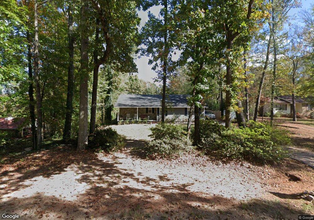
106 Heatherbrook Dr Lagrange, GA 30240
Estimated Value: $241,000 - $255,000
3
Beds
2
Baths
1,765
Sq Ft
$141/Sq Ft
Est. Value
About This Home
This home is located at 106 Heatherbrook Dr, Lagrange, GA 30240 and is currently estimated at $248,050, approximately $140 per square foot. 106 Heatherbrook Dr is a home located in Troup County with nearby schools including Long Cane Elementary School, Berta Weathersbee Elementary School, and Whitesville Road Elementary School.
Ownership History
Date
Name
Owned For
Owner Type
Purchase Details
Closed on
Sep 15, 1995
Sold by
Robin R Hammett
Bought by
Hammett Mark H and Hammett Robin R
Current Estimated Value
Purchase Details
Closed on
Sep 11, 1995
Sold by
Wm Wayne Mccarley
Bought by
Robin R Hammett
Purchase Details
Closed on
Dec 16, 1983
Sold by
Carol Calvin and Carol Johnson
Bought by
Wm Wayne Mccarley
Purchase Details
Closed on
Dec 1, 1981
Sold by
Whitaker Acres Inc
Bought by
Carol Calvin and Carol Johnson
Purchase Details
Closed on
Jul 3, 1979
Sold by
Charlie R Whitaker
Bought by
Whitaker Acres Inc
Purchase Details
Closed on
Apr 29, 1976
Bought by
Charlie R Whitaker
Create a Home Valuation Report for This Property
The Home Valuation Report is an in-depth analysis detailing your home's value as well as a comparison with similar homes in the area
Purchase History
| Date | Buyer | Sale Price | Title Company |
|---|---|---|---|
| Hammett Mark H | -- | -- | |
| Robin R Hammett | -- | -- | |
| Wm Wayne Mccarley | $44,000 | -- | |
| Carol Calvin | $40,000 | -- | |
| Whitaker Acres Inc | $4,500 | -- | |
| Charlie R Whitaker | -- | -- |
Source: Public Records
Tax History
| Year | Tax Paid | Tax Assessment Tax Assessment Total Assessment is a certain percentage of the fair market value that is determined by local assessors to be the total taxable value of land and additions on the property. | Land | Improvement |
|---|---|---|---|---|
| 2025 | $1,283 | $75,344 | $10,000 | $65,344 |
| 2024 | $1,892 | $71,360 | $10,000 | $61,360 |
| 2023 | $1,802 | $68,048 | $10,000 | $58,048 |
| 2022 | $1,654 | $61,260 | $10,000 | $51,260 |
| 2021 | $1,152 | $40,200 | $8,000 | $32,200 |
| 2020 | $1,152 | $40,200 | $8,000 | $32,200 |
| 2019 | $1,167 | $40,680 | $8,000 | $32,680 |
| 2018 | $1,078 | $37,720 | $8,000 | $29,720 |
| 2017 | $1,078 | $37,720 | $8,000 | $29,720 |
| 2016 | $1,060 | $37,129 | $8,000 | $29,129 |
| 2015 | $1,062 | $37,129 | $8,000 | $29,129 |
| 2014 | $1,017 | $35,596 | $8,000 | $27,596 |
| 2013 | -- | $36,491 | $8,000 | $28,491 |
Source: Public Records
Map
Nearby Homes
- 113 Colonial Ct Unit 100
- 101 Ivy Springs Dr
- 311 Cumberland Dr
- 474 Newton Rd
- 119 Plymouth Dr
- 135 Planters Ridge Dr
- 104 Bridlewood Dr
- 124 Foxdale Dr
- 440 & 448 Kimbrough Rd
- 4.5 ACRES Whatley Rd N
- 0 Deming St Unit 10550189
- 0 Salem Rd Tract 2 Unit 10675187
- 213 Linda Ln
- 266 Glass Bridge Rd
- 640 Hudson Rd
- 104 Hidden Springs Dr
- 226 Linda Ln
- 3835 W Point Rd
- 104 Dogwood Point
- 114 Riverbluff Dr
- 104 Heatherbrook Dr
- 108 Heatherbrook Dr
- 105 Heatherbrook Dr
- 110 Heatherbrook Dr
- 103 Heatherbrook Dr
- 166 Newton Rd
- 109 Heatherbrook Dr
- 111 Heatherbrook Dr
- 101 Heatherbrook Dr
- 146 Newton Rd
- 208 Newton Rd
- 132 Newton Rd
- 122 Newton Rd
- 171 Newton Rd
- 102 Newton Rd
- 131 Newton Rd
- 112 Newton Rd
- 201 Newton Rd
- 117 Newton Rd
- 151 Newton Rd
Your Personal Tour Guide
Ask me questions while you tour the home.