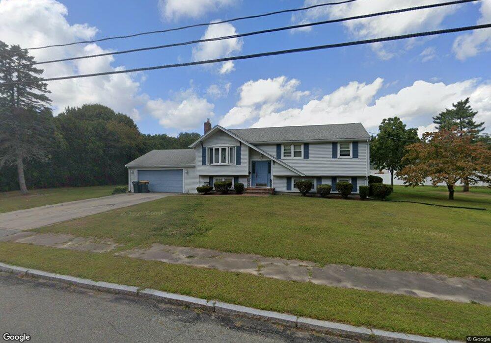
106 Hersey Ln Abington, MA 02351
Estimated Value: $648,401 - $664,000
3
Beds
2
Baths
1,554
Sq Ft
$422/Sq Ft
Est. Value
About This Home
This home is located at 106 Hersey Ln, Abington, MA 02351 and is currently estimated at $656,350, approximately $422 per square foot. 106 Hersey Ln is a home located in Plymouth County with nearby schools including Beaver Brook Elementary School, Abington Middle School, and Woodsdale School.
Ownership History
Date
Name
Owned For
Owner Type
Purchase Details
Closed on
Oct 15, 2015
Sold by
Teehan Theresa E
Bought by
Kearney Christine
Current Estimated Value
Purchase Details
Closed on
Apr 1, 2013
Sold by
Kearney Christine
Bought by
Teehan Theresa E
Purchase Details
Closed on
Oct 14, 2008
Sold by
106 Hersey Lane Rt
Bought by
Teehan Ft
Purchase Details
Closed on
Jul 2, 2007
Sold by
Teehan Theresa E
Bought by
106 Hersey Lane Rt
Home Financials for this Owner
Home Financials are based on the most recent Mortgage that was taken out on this home.
Original Mortgage
$14,200
Interest Rate
6.48%
Purchase Details
Closed on
Apr 29, 2002
Sold by
Mchugh Margaret M and Mchugh Ronald J
Bought by
Teehan Theresa E
Home Financials for this Owner
Home Financials are based on the most recent Mortgage that was taken out on this home.
Original Mortgage
$125,000
Interest Rate
7.05%
Mortgage Type
Purchase Money Mortgage
Create a Home Valuation Report for This Property
The Home Valuation Report is an in-depth analysis detailing your home's value as well as a comparison with similar homes in the area
Home Values in the Area
Average Home Value in this Area
Purchase History
| Date | Buyer | Sale Price | Title Company |
|---|---|---|---|
| Kearney Christine | -- | -- | |
| Teehan Theresa E | -- | -- | |
| Kearney Christine | -- | -- | |
| Teehan Ft | -- | -- | |
| 106 Hersey Lane Rt | -- | -- | |
| Teehan Theresa E | $315,000 | -- |
Source: Public Records
Mortgage History
| Date | Status | Borrower | Loan Amount |
|---|---|---|---|
| Previous Owner | Teehan Theresa E | $14,200 | |
| Previous Owner | Teehan Theresa E | $155,000 | |
| Previous Owner | Teehan Theresa E | $125,000 |
Source: Public Records
Tax History Compared to Growth
Tax History
| Year | Tax Paid | Tax Assessment Tax Assessment Total Assessment is a certain percentage of the fair market value that is determined by local assessors to be the total taxable value of land and additions on the property. | Land | Improvement |
|---|---|---|---|---|
| 2025 | $7,383 | $565,300 | $268,000 | $297,300 |
| 2024 | $7,037 | $525,900 | $244,100 | $281,800 |
| 2023 | $6,700 | $471,500 | $222,400 | $249,100 |
| 2022 | $6,292 | $413,400 | $186,100 | $227,300 |
| 2021 | $5,982 | $363,000 | $170,000 | $193,000 |
| 2020 | $6,156 | $362,100 | $171,200 | $190,900 |
| 2019 | $6,005 | $345,300 | $164,300 | $181,000 |
| 2018 | $5,765 | $323,500 | $164,300 | $159,200 |
| 2017 | $5,786 | $315,300 | $164,300 | $151,000 |
| 2016 | $5,094 | $284,100 | $150,100 | $134,000 |
| 2015 | $4,724 | $277,900 | $150,100 | $127,800 |
Source: Public Records
Map
Nearby Homes
- 137 Peregrine Rd
- 800 Plymouth St
- 679 Plymouth St
- 158 Central St
- 608 Plymouth St
- 14 Daniel Teague Dr
- 133 Spring St
- 60 Fairview St
- 64 Centre Ave Unit 1
- 17 Pat Rose Way
- 20 Pat Rose Way
- 8 Pat Rose Way
- 6 Pat Rose Way
- 19 Pat Rose Way
- 170 Pleasant St
- 810 Brookline Way
- 87 Summer St
- 149 Concord St
- 40 Lazel St
- 10 Bank St
- 53 Captain Standish Dr
- 120 Hersey Ln
- 65 Captain Standish Dr
- 88 Hersey Ln
- 95 Hersey Ln
- 105 Hersey Ln
- 41 Captain Standish Dr
- 77 Captain Standish Dr
- 117 Hersey Ln
- 85 Hersey Ln
- 134 Hersey Ln
- 129 Hersey Ln
- 89 Captain Standish Dr
- 11 Captain Standish Dr
- 27 Captain Standish Dr
- 68 Captain Standish Dr
- 78 Captain Standish Dr
- 58 Captain Standish Dr
- 139 Hersey Ln
- 148 Hersey Ln