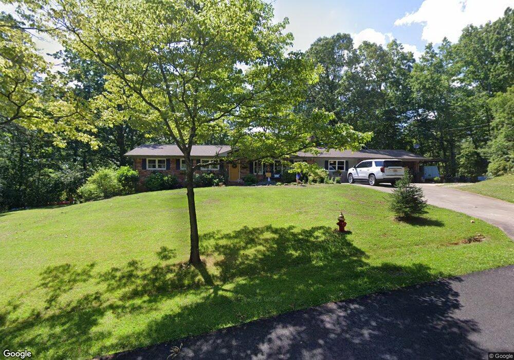
106 Hillcrest Dr Dahlonega, GA 30533
Estimated Value: $263,000 - $568,000
5
Beds
3
Baths
3,004
Sq Ft
$141/Sq Ft
Est. Value
About This Home
This home is located at 106 Hillcrest Dr, Dahlonega, GA 30533 and is currently estimated at $422,470, approximately $140 per square foot. 106 Hillcrest Dr is a home located in Lumpkin County with nearby schools including Clay County Middle School and Lumpkin County High School.
Ownership History
Date
Name
Owned For
Owner Type
Purchase Details
Closed on
May 7, 2010
Sold by
Ratzel Leah
Bought by
Owens John A
Current Estimated Value
Home Financials for this Owner
Home Financials are based on the most recent Mortgage that was taken out on this home.
Original Mortgage
$177,328
Outstanding Balance
$121,444
Interest Rate
5.5%
Mortgage Type
FHA
Estimated Equity
$301,026
Purchase Details
Closed on
Apr 1, 1981
Sold by
Mrs
Bought by
Hudson Thomas C
Create a Home Valuation Report for This Property
The Home Valuation Report is an in-depth analysis detailing your home's value as well as a comparison with similar homes in the area
Home Values in the Area
Average Home Value in this Area
Purchase History
| Date | Buyer | Sale Price | Title Company |
|---|---|---|---|
| Owens John A | $180,600 | -- | |
| Hudson Thomas C | -- | -- |
Source: Public Records
Mortgage History
| Date | Status | Borrower | Loan Amount |
|---|---|---|---|
| Open | Owens John A | $177,328 |
Source: Public Records
Tax History Compared to Growth
Tax History
| Year | Tax Paid | Tax Assessment Tax Assessment Total Assessment is a certain percentage of the fair market value that is determined by local assessors to be the total taxable value of land and additions on the property. | Land | Improvement |
|---|---|---|---|---|
| 2024 | $2,635 | $93,630 | $22,718 | $70,912 |
| 2023 | $2,586 | $89,730 | $22,718 | $67,012 |
| 2022 | $2,727 | $89,260 | $22,718 | $66,542 |
| 2021 | $2,627 | $80,533 | $22,718 | $57,815 |
| 2020 | $2,445 | $72,149 | $22,718 | $49,431 |
| 2019 | $2,458 | $72,149 | $22,718 | $49,431 |
| 2018 | $2,398 | $65,896 | $22,718 | $43,178 |
| 2017 | $2,468 | $66,681 | $22,718 | $43,963 |
| 2016 | $2,398 | $63,385 | $22,718 | $40,667 |
| 2015 | $2,099 | $63,385 | $22,718 | $40,667 |
| 2014 | $2,099 | $64,855 | $22,718 | $42,137 |
| 2013 | -- | $66,323 | $22,718 | $43,605 |
Source: Public Records
Map
Nearby Homes
- 490 N Hall Rd
- 0 Dawsonville Hwy Unit 10631159
- 00 Dawsonville Hwy
- 253 Blair Ridge Rd
- 120 Blair Ridge Rd
- 121 Blair Ridge Rd
- 549 Ivy Terrace
- 114 Funaro Ln
- 399 N Chestatee St
- 132 J Mountain Dr
- 315 Church St
- 168 W Main St
- 95 Jones St
- 94 Mountain View Dr
- 0 S Chestatee St Unit 10619536
- 22 Honeysuckle Ln
- 0 Highway 19 N Unit 10594984
- 1202 Oak Grove Rd
- 1392 S Chestatee St
- 1047 Nugget Ct
- 80 Hillcrest Dr
- 51 Hillcrest Dr
- 397 Housley Dr
- 24 Hillcrest Dr
- 33 Hillcrest Dr
- 775 N Hall Rd
- 795 N Hall Rd
- 393 Housley Dr
- 93 Woodland Hills Dr
- 368 Hamp Mill Rd
- 38 Woodland Hills Dr
- 391 Housley Dr
- 311 Torrington Rd Unit 102A
- 311 Torrington Rd
- 689 N Hall Rd
- 662 N Hall Rd
- 152 Woodland Hills Dr
- 273 Housley Dr
- 106 Cane Creek Commons
- 663 N Hall Rd