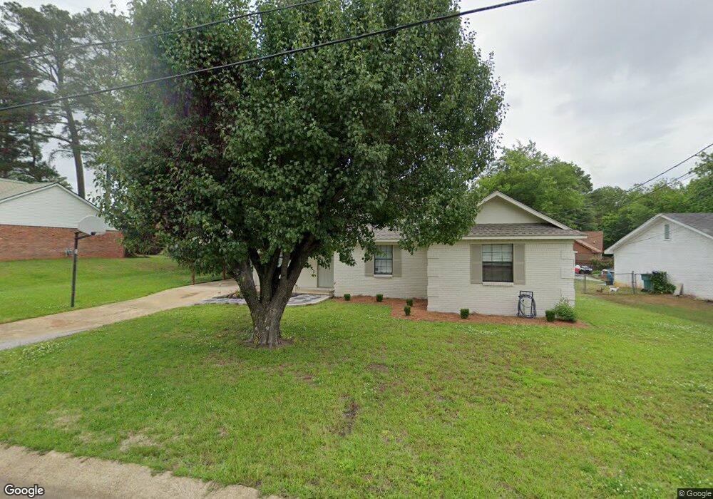
106 Honey Locust Dr Tupelo, MI 38801
Wilemon Acres NeighborhoodEstimated Value: $149,000 - $211,752
3
Beds
2
Baths
1,248
Sq Ft
$141/Sq Ft
Est. Value
About This Home
This home is located at 106 Honey Locust Dr, Tupelo, MI 38801 and is currently estimated at $175,688, approximately $140 per square foot. 106 Honey Locust Dr is a home located in Lee County with nearby schools including Thomas Street Elementary School, Pierce Street Elementary School, and Tupelo Middle School.
Ownership History
Date
Name
Owned For
Owner Type
Purchase Details
Closed on
Dec 3, 2012
Sold by
Hud
Bought by
Dbe Properties Llc
Current Estimated Value
Purchase Details
Closed on
Jun 5, 2012
Sold by
Courteau Emily Kaye
Bought by
Wells Fargo Bank
Purchase Details
Closed on
Jan 25, 2008
Sold by
Wyatt Kimberly Kimes
Bought by
Morris Farris L and Miller Kimberly M
Home Financials for this Owner
Home Financials are based on the most recent Mortgage that was taken out on this home.
Original Mortgage
$95,205
Interest Rate
6.17%
Create a Home Valuation Report for This Property
The Home Valuation Report is an in-depth analysis detailing your home's value as well as a comparison with similar homes in the area
Home Values in the Area
Average Home Value in this Area
Purchase History
| Date | Buyer | Sale Price | Title Company |
|---|---|---|---|
| Dbe Properties Llc | -- | -- | |
| Wells Fargo Bank | -- | -- | |
| Morris Farris L | -- | -- |
Source: Public Records
Mortgage History
| Date | Status | Borrower | Loan Amount |
|---|---|---|---|
| Previous Owner | Morris Farris L | $95,205 |
Source: Public Records
Tax History Compared to Growth
Tax History
| Year | Tax Paid | Tax Assessment Tax Assessment Total Assessment is a certain percentage of the fair market value that is determined by local assessors to be the total taxable value of land and additions on the property. | Land | Improvement |
|---|---|---|---|---|
| 2024 | $1,793 | $13,189 | $0 | $0 |
| 2023 | $1,117 | $8,348 | $0 | $0 |
| 2022 | $1,767 | $12,522 | $0 | $0 |
| 2021 | $1,714 | $12,522 | $0 | $0 |
| 2020 | $1,676 | $12,522 | $0 | $0 |
| 2019 | $1,725 | $12,270 | $0 | $0 |
| 2018 | $1,725 | $12,270 | $0 | $0 |
| 2017 | $1,719 | $12,270 | $0 | $0 |
| 2016 | $1,719 | $12,270 | $0 | $0 |
| 2015 | $1,566 | $11,378 | $0 | $0 |
| 2014 | $1,566 | $11,378 | $0 | $0 |
Source: Public Records
Map
Nearby Homes
- 0 W Jackson St
- 141 1802 West Jackson St
- 2306 Woods St
- 1338 W Jackson St
- 214 Nanney Dr
- 2700 W Main St
- 712 George Ave
- 402 Maynard Dr
- 909 Desoto Dr
- 405 S Foster Dr
- 1523 Central Ave
- 706 Robindale Dr
- 708 Robindale Dr
- 1101 Bienville St
- 1204 Beauregard St
- 2509 Confederate Ave
- 802 Poplarville St
- 210 S Highland Dr
- 355 Rankin Blvd
- 1407 Mitts Dr
- 106 Honey Locust Dr
- 105 Honey Locust Dr
- 107 Honey Locust Dr
- 107 Honey Locust Dr
- 105 Honey Locust Dr
- 104 Pinehill Dr
- 104 Pine Hill Dr
- 102 Honey Locust Dr
- 103 Honey Locust Dr
- 102 Honey Locust Dr
- 103 Pinehill Dr
- 105 Pinehill Dr
- 103 Pine Hill Dr
- 105 Pine Hill Dr
- 101 Honey Locust Dr
- 104 Honey Locust Dr
- 108 Honey Locust Dr
- 101 Honey Locust Dr
- 102 Pine Hill Dr
- 102 Pinehill Dr