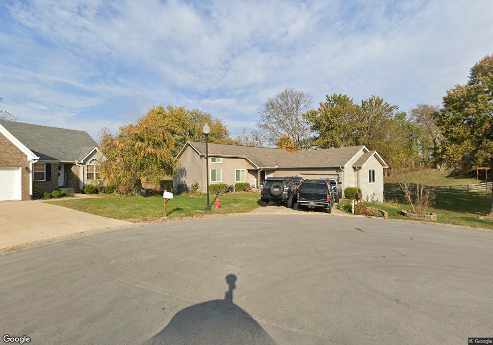
106 Joshua Ct Georgetown, KY 40324
Estimated Value: $247,000 - $260,000
3
Beds
3
Baths
1,753
Sq Ft
$145/Sq Ft
Est. Value
About This Home
This home is located at 106 Joshua Ct, Georgetown, KY 40324 and is currently estimated at $253,726, approximately $144 per square foot. 106 Joshua Ct is a home located in Scott County with nearby schools including Stamping Ground Elementary School, Creekside Elementary School, and Royal Spring Middle School.
Ownership History
Date
Name
Owned For
Owner Type
Purchase Details
Closed on
Dec 20, 2024
Sold by
Cooper Todd A and Cooper Angel
Bought by
Doyle Dalton and Robinson Holly
Current Estimated Value
Home Financials for this Owner
Home Financials are based on the most recent Mortgage that was taken out on this home.
Original Mortgage
$242,526
Outstanding Balance
$240,615
Interest Rate
6.78%
Mortgage Type
FHA
Estimated Equity
$13,111
Create a Home Valuation Report for This Property
The Home Valuation Report is an in-depth analysis detailing your home's value as well as a comparison with similar homes in the area
Home Values in the Area
Average Home Value in this Area
Purchase History
| Date | Buyer | Sale Price | Title Company |
|---|---|---|---|
| Doyle Dalton | $247,000 | For True Title | |
| Doyle Dalton | $247,000 | For True Title |
Source: Public Records
Mortgage History
| Date | Status | Borrower | Loan Amount |
|---|---|---|---|
| Open | Doyle Dalton | $242,526 | |
| Closed | Doyle Dalton | $242,526 |
Source: Public Records
Tax History Compared to Growth
Tax History
| Year | Tax Paid | Tax Assessment Tax Assessment Total Assessment is a certain percentage of the fair market value that is determined by local assessors to be the total taxable value of land and additions on the property. | Land | Improvement |
|---|---|---|---|---|
| 2024 | $1,733 | $192,700 | $0 | $0 |
| 2023 | $1,622 | $178,900 | $25,000 | $153,900 |
| 2022 | $1,393 | $163,800 | $25,000 | $138,800 |
| 2021 | $1,331 | $151,800 | $25,000 | $126,800 |
| 2020 | $1,212 | $141,100 | $25,000 | $116,100 |
| 2019 | $1,188 | $136,100 | $0 | $0 |
| 2018 | $1,096 | $126,300 | $0 | $0 |
| 2017 | $1,030 | $118,084 | $0 | $0 |
| 2016 | $951 | $118,084 | $0 | $0 |
| 2015 | $903 | $112,900 | $0 | $0 |
| 2014 | $862 | $112,860 | $0 | $0 |
| 2011 | $841 | $115,676 | $0 | $0 |
Source: Public Records
Map
Nearby Homes
- 109 Thomas Ln
- 128 Thomas Ln
- 104 Haney Ct
- 106 Casey Ct
- 1016 Fairway Dr
- 112 Lost Tree Dr
- 117 Windsong Way
- 1 Frankfort Pike
- 496 Soards Rd
- 111 Bold Bidder Dr
- 169 Muir Ln
- 2788 Frankfort Rd
- 136 King Fisher Way
- 120 Creekside Dr
- 208 Craig Ln
- 140 Seahawk Trail
- 106 Sand Piper Ct
- 3200 Fishers Mill Rd
- 133 Treetop Ct
- 3612 Ironworks Rd