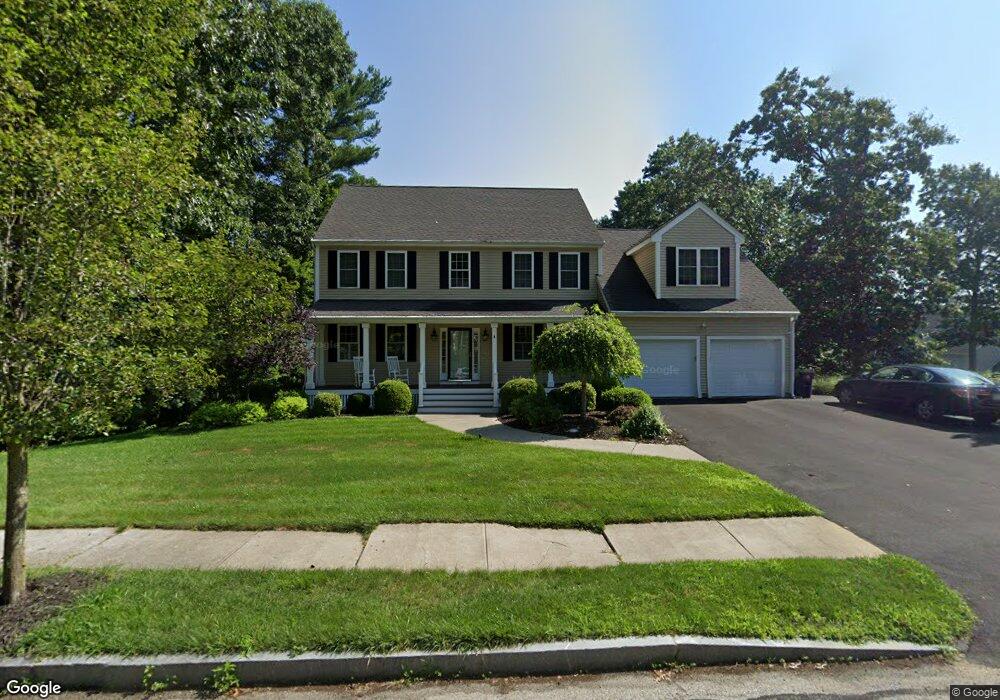
106 Lincoln Cir Northbridge, MA 01534
Estimated Value: $764,081 - $866,000
4
Beds
3
Baths
3,061
Sq Ft
$268/Sq Ft
Est. Value
About This Home
This home is located at 106 Lincoln Cir, Northbridge, MA 01534 and is currently estimated at $819,770, approximately $267 per square foot. 106 Lincoln Cir is a home located in Worcester County with nearby schools including Northbridge Elementary School, Northbridge Middle School, and Northbridge High School.
Ownership History
Date
Name
Owned For
Owner Type
Purchase Details
Closed on
Jun 29, 2007
Sold by
Prudential Relocation
Bought by
Deciero Jessica and Deciero Scott
Current Estimated Value
Home Financials for this Owner
Home Financials are based on the most recent Mortgage that was taken out on this home.
Original Mortgage
$32,000
Interest Rate
6.24%
Mortgage Type
Purchase Money Mortgage
Purchase Details
Closed on
May 15, 2007
Sold by
Brower Catherine C and Brower William A
Bought by
Prudential Relocation
Home Financials for this Owner
Home Financials are based on the most recent Mortgage that was taken out on this home.
Original Mortgage
$32,000
Interest Rate
6.24%
Mortgage Type
Purchase Money Mortgage
Create a Home Valuation Report for This Property
The Home Valuation Report is an in-depth analysis detailing your home's value as well as a comparison with similar homes in the area
Home Values in the Area
Average Home Value in this Area
Purchase History
| Date | Buyer | Sale Price | Title Company |
|---|---|---|---|
| Deciero Jessica | $430,000 | -- | |
| Deciero Jessica | $430,000 | -- | |
| Prudential Relocation | $497,500 | -- | |
| Prudential Relocation | $497,500 | -- |
Source: Public Records
Mortgage History
| Date | Status | Borrower | Loan Amount |
|---|---|---|---|
| Open | Prudential Relocation | $382,500 | |
| Closed | Deciero Jessica | $32,000 |
Source: Public Records
Tax History
| Year | Tax Paid | Tax Assessment Tax Assessment Total Assessment is a certain percentage of the fair market value that is determined by local assessors to be the total taxable value of land and additions on the property. | Land | Improvement |
|---|---|---|---|---|
| 2025 | $7,879 | $668,300 | $195,000 | $473,300 |
| 2024 | $7,630 | $631,100 | $195,000 | $436,100 |
| 2023 | $7,312 | $564,200 | $172,500 | $391,700 |
| 2022 | $6,952 | $504,900 | $132,800 | $372,100 |
| 2021 | $7,031 | $485,200 | $126,300 | $358,900 |
| 2020 | $6,492 | $469,100 | $126,300 | $342,800 |
| 2019 | $5,824 | $449,000 | $126,300 | $322,700 |
| 2018 | $5,576 | $430,900 | $120,200 | $310,700 |
| 2017 | $5,503 | $406,700 | $120,200 | $286,500 |
| 2016 | $5,578 | $405,700 | $114,000 | $291,700 |
| 2015 | $5,428 | $405,700 | $114,000 | $291,700 |
| 2014 | $5,380 | $405,700 | $114,000 | $291,700 |
Source: Public Records
Map
Nearby Homes
- 240 Roosevelt Dr
- 220 Alana Dr
- 86 Mikes Way Unit 86
- 24 Mcquades Ln
- 191 Hartness Rd
- 7 Central Turnpike
- 2294 Providence Rd
- 35 School St Unit 35
- 0 Emond St Unit 1
- 0 Emond St Unit 73480228
- 2248 Providence Rd
- 69-71 Providence Rd
- 557 Fowler Rd
- 79 Fisherville Terrace
- 53 Fisherville Terrace
- 55 Fisherville Terrace
- 44 Fisherville Terrace
- 58 Fisherville Terrace
- 64 Fisherville Terrace
- 62 Fisherville Terrace
- 74 Roosevelt Dr
- 68 Roosevelt Dr
- 28 Wilson St
- 145 Roosevelt Dr
- 48 Roosevelt Dr
- 46 Roosevelt Dr
- 16 Wilson St
- 42 Roosevelt Dr
- 40 Roosevelt Dr
- 38 Roosevelt Dr
- 75 Roosevelt Dr
- 36 Roosevelt Dr
- 73 Roosevelt Dr
- 167 Roosevelt Dr
- 71 Roosevelt Dr
- 34 Roosevelt Dr
- 67 Roosevelt Dr
- 30 Roosevelt Dr
- 183 Roosevelt Dr
- 26 Roosevelt Dr
Your Personal Tour Guide
Ask me questions while you tour the home.