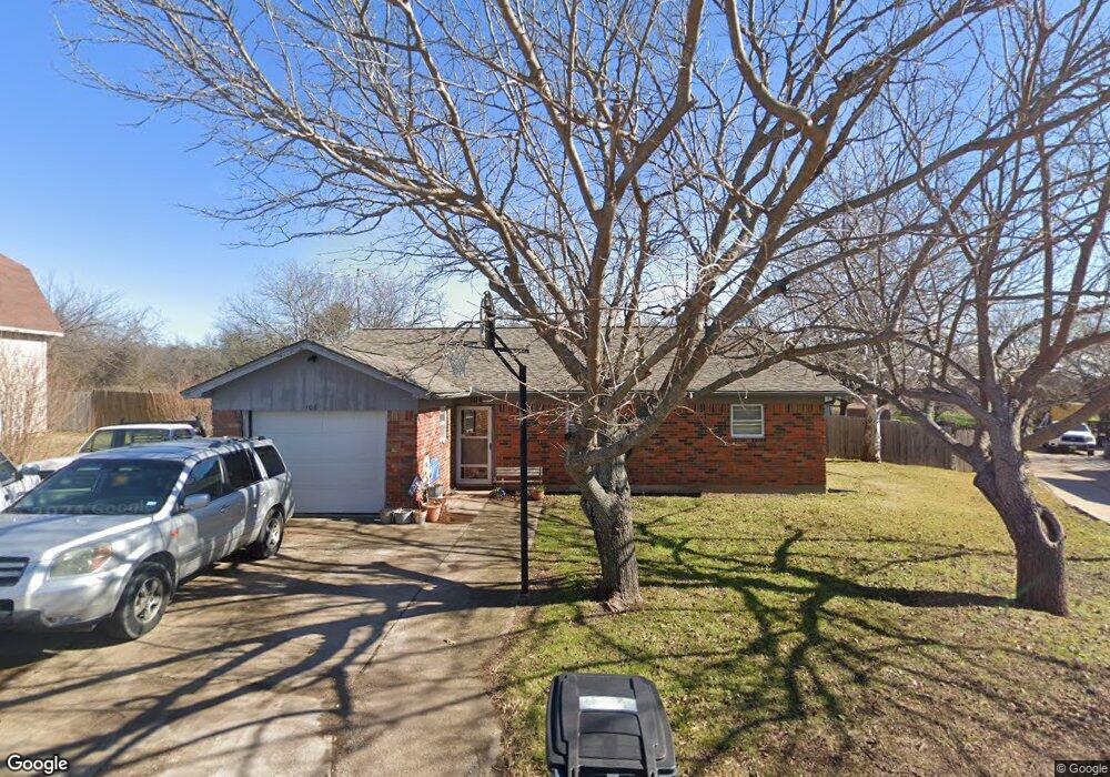
106 Lora Ln Weatherford, TX 76088
Estimated Value: $295,000 - $306,000
3
Beds
2
Baths
1,365
Sq Ft
$220/Sq Ft
Est. Value
About This Home
This home is located at 106 Lora Ln, Weatherford, TX 76088 and is currently estimated at $300,500, approximately $220 per square foot. 106 Lora Ln is a home located in Parker County with nearby schools including Peaster Elementary School, Peaster Middle School, and Peaster High School.
Ownership History
Date
Name
Owned For
Owner Type
Purchase Details
Closed on
Jul 22, 2009
Sold by
Reynolds Gary L and Reynolds Tammy
Bought by
Spikes Brennon and Spikes Melinda
Current Estimated Value
Home Financials for this Owner
Home Financials are based on the most recent Mortgage that was taken out on this home.
Original Mortgage
$91,575
Outstanding Balance
$60,729
Interest Rate
5.71%
Mortgage Type
Purchase Money Mortgage
Estimated Equity
$239,771
Purchase Details
Closed on
May 30, 2007
Sold by
Boggus Leatha May
Bought by
Spikes Brennon and Spikes Melinda
Home Financials for this Owner
Home Financials are based on the most recent Mortgage that was taken out on this home.
Original Mortgage
$84,050
Interest Rate
6.17%
Mortgage Type
New Conventional
Purchase Details
Closed on
Sep 28, 1984
Bought by
Spikes Brennon and Spikes Melinda
Create a Home Valuation Report for This Property
The Home Valuation Report is an in-depth analysis detailing your home's value as well as a comparison with similar homes in the area
Home Values in the Area
Average Home Value in this Area
Purchase History
| Date | Buyer | Sale Price | Title Company |
|---|---|---|---|
| Spikes Brennon | -- | Stnt-Gf | |
| Spikes Brennon | -- | -- | |
| Reynolds Gary L | -- | Alamo Title | |
| Spikes Brennon | -- | -- |
Source: Public Records
Mortgage History
| Date | Status | Borrower | Loan Amount |
|---|---|---|---|
| Open | Spikes Brennon | $91,575 | |
| Previous Owner | Reynolds Gary L | $84,050 |
Source: Public Records
Tax History Compared to Growth
Tax History
| Year | Tax Paid | Tax Assessment Tax Assessment Total Assessment is a certain percentage of the fair market value that is determined by local assessors to be the total taxable value of land and additions on the property. | Land | Improvement |
|---|---|---|---|---|
| 2025 | $2,425 | $193,080 | -- | -- |
| 2024 | $2,425 | $175,527 | -- | -- |
| 2023 | $2,425 | $159,570 | $0 | $0 |
| 2022 | $3,410 | $200,560 | $25,000 | $175,560 |
| 2021 | $3,156 | $200,560 | $25,000 | $175,560 |
| 2020 | $2,924 | $152,810 | $20,000 | $132,810 |
| 2019 | $2,773 | $152,810 | $20,000 | $132,810 |
| 2018 | $2,528 | $99,080 | $15,000 | $84,080 |
| 2017 | $2,483 | $99,080 | $15,000 | $84,080 |
| 2016 | $2,257 | $88,090 | $12,900 | $75,190 |
| 2015 | $1,857 | $88,090 | $12,900 | $75,190 |
| 2014 | $1,913 | $83,970 | $11,180 | $72,790 |
Source: Public Records
Map
Nearby Homes
- 107 Hall St
- 905 Zion Hill Rd
- 105 Oxford Ct
- 104 Lagrange Ct
- 2016 Vanderbilt Dr
- 2020 Vanderbilt Dr
- 2117 Pepperdine Dr
- Lot 11 Pepperdine Dr
- Lot 12 Pepperdine Dr
- Lot 10 Pepperdine Dr
- 2124 Pepperdine Dr
- 2000 Vanderbilt Dr
- 1425 N Bowie Dr
- 522 W 7th St
- TBD Hwy 920 Hwy
- 125 Odel Dr
- 3004 Greg Allen Dr
- 1813 Roadrunner Dr
- 109 Odel Dr
- 1616 Oliver St