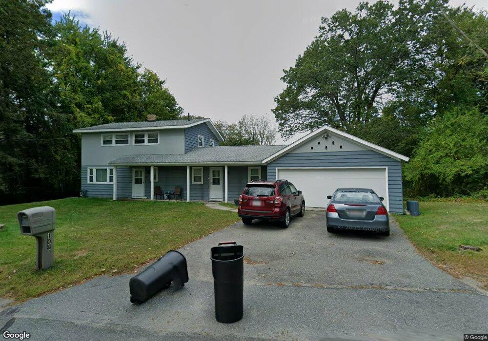
106 Lowell Rd Westford, MA 01886
Estimated Value: $690,000 - $711,000
3
Beds
2
Baths
1,770
Sq Ft
$396/Sq Ft
Est. Value
About This Home
This home is located at 106 Lowell Rd, Westford, MA 01886 and is currently estimated at $700,078, approximately $395 per square foot. 106 Lowell Rd is a home located in Middlesex County with nearby schools including Nabnasset Elementary, Abbot Elementary School, and Stony Brook School.
Ownership History
Date
Name
Owned For
Owner Type
Purchase Details
Closed on
Dec 21, 2016
Sold by
Parker Judith and Grochmal Diane M
Bought by
Grochmal Diane
Current Estimated Value
Home Financials for this Owner
Home Financials are based on the most recent Mortgage that was taken out on this home.
Original Mortgage
$230,000
Outstanding Balance
$186,007
Interest Rate
3.57%
Mortgage Type
New Conventional
Estimated Equity
$514,071
Create a Home Valuation Report for This Property
The Home Valuation Report is an in-depth analysis detailing your home's value as well as a comparison with similar homes in the area
Home Values in the Area
Average Home Value in this Area
Purchase History
| Date | Buyer | Sale Price | Title Company |
|---|---|---|---|
| Grochmal Diane | $230,000 | -- |
Source: Public Records
Mortgage History
| Date | Status | Borrower | Loan Amount |
|---|---|---|---|
| Open | Grochmal Diane | $230,000 |
Source: Public Records
Tax History Compared to Growth
Tax History
| Year | Tax Paid | Tax Assessment Tax Assessment Total Assessment is a certain percentage of the fair market value that is determined by local assessors to be the total taxable value of land and additions on the property. | Land | Improvement |
|---|---|---|---|---|
| 2025 | $7,593 | $551,400 | $303,600 | $247,800 |
| 2024 | $7,593 | $551,400 | $303,600 | $247,800 |
| 2023 | $7,545 | $511,200 | $289,200 | $222,000 |
| 2022 | $7,588 | $470,700 | $255,000 | $215,700 |
| 2021 | $7,325 | $440,200 | $255,000 | $185,200 |
| 2020 | $7,188 | $440,200 | $255,000 | $185,200 |
| 2019 | $7,012 | $423,400 | $255,000 | $168,400 |
| 2018 | $6,671 | $412,300 | $243,900 | $168,400 |
| 2017 | $6,569 | $400,300 | $243,900 | $156,400 |
| 2016 | $6,298 | $386,400 | $230,000 | $156,400 |
| 2015 | $6,062 | $373,300 | $240,000 | $133,300 |
| 2014 | $6,046 | $364,200 | $230,900 | $133,300 |
Source: Public Records
Map
Nearby Homes
- 104 Lowell Rd
- 108 Lowell Rd
- 102 Lowell Rd
- 107 Lowell Rd
- 105 Lowell Rd
- 1 Commodore Way Unit 1
- 8 Commodore Way Unit 11
- 10 Commodore Way
- 8 Brookside Rd Unit 35
- 8 Brookside Rd Unit 23
- 8 Brookside Rd Unit 7
- 8 Brookside Rd Unit 24
- 8 Brookside Rd Unit 19
- 8 Brookside Rd Unit 30
- 8 Brookside Rd Unit 5
- 8 Brookside Rd Unit 31
- 8 Brookside Rd Unit 4
- 8 Brookside Rd Unit 15
- 8 Brookside Rd Unit 22,8-12
- 2 Commodore Way Unit 2