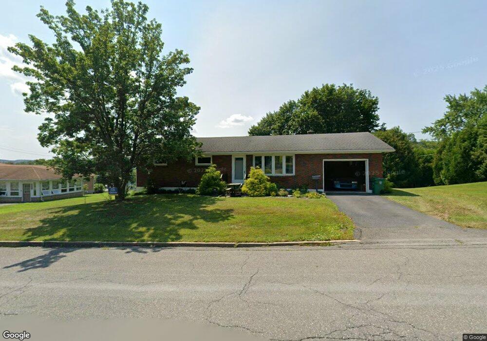
106 N 12th St Lehighton, PA 18235
Estimated Value: $233,000 - $345,000
3
Beds
1
Bath
1,320
Sq Ft
$219/Sq Ft
Est. Value
About This Home
This home is located at 106 N 12th St, Lehighton, PA 18235 and is currently estimated at $289,014, approximately $218 per square foot. 106 N 12th St is a home located in Carbon County with nearby schools including Lehighton Area High School, Sts. Peter & Paul School, and Valley Ridge Academy.
Ownership History
Date
Name
Owned For
Owner Type
Purchase Details
Closed on
Feb 27, 2018
Sold by
Ahner Roni Sue and Hiester Tammy S
Bought by
Potts Guy A
Current Estimated Value
Home Financials for this Owner
Home Financials are based on the most recent Mortgage that was taken out on this home.
Original Mortgage
$146,363
Outstanding Balance
$124,395
Interest Rate
4.04%
Mortgage Type
New Conventional
Estimated Equity
$164,619
Purchase Details
Closed on
Jun 18, 2004
Bought by
Ahner Roni Sue and Ahner Ahner
Create a Home Valuation Report for This Property
The Home Valuation Report is an in-depth analysis detailing your home's value as well as a comparison with similar homes in the area
Home Values in the Area
Average Home Value in this Area
Purchase History
| Date | Buyer | Sale Price | Title Company |
|---|---|---|---|
| Potts Guy A | $145,200 | None Available | |
| Ahner Roni Sue | -- | -- |
Source: Public Records
Mortgage History
| Date | Status | Borrower | Loan Amount |
|---|---|---|---|
| Open | Potts Guy A | $146,363 |
Source: Public Records
Tax History Compared to Growth
Tax History
| Year | Tax Paid | Tax Assessment Tax Assessment Total Assessment is a certain percentage of the fair market value that is determined by local assessors to be the total taxable value of land and additions on the property. | Land | Improvement |
|---|---|---|---|---|
| 2025 | $4,287 | $53,750 | $5,550 | $48,200 |
| 2024 | $4,072 | $53,750 | $5,550 | $48,200 |
| 2023 | $4,032 | $53,750 | $5,550 | $48,200 |
| 2022 | $4,032 | $53,750 | $5,550 | $48,200 |
| 2021 | $3,891 | $53,750 | $5,550 | $48,200 |
| 2020 | $3,796 | $53,750 | $5,550 | $48,200 |
| 2019 | $3,635 | $53,750 | $5,550 | $48,200 |
| 2018 | $3,554 | $53,750 | $5,550 | $48,200 |
| 2017 | $3,528 | $53,750 | $5,550 | $48,200 |
| 2016 | -- | $53,750 | $5,550 | $48,200 |
| 2015 | -- | $53,750 | $5,550 | $48,200 |
| 2014 | -- | $53,750 | $5,550 | $48,200 |
Source: Public Records
Map
Nearby Homes
- 0 Emily Plan at Summit Point Unit PACC2005480
- 0 Copper Beech Plan at Summit Ridge Unit PACC2005478
- 0 Black Cherry Plan at Summit Ridge Unit PACC2005474
- 0 Ridge
- 17 Mahoning Dr E
- 410 S 8th St
- 639 Iron St
- 70 W Highland Ln
- 522 Iron St
- 470 N 8th St
- 193 S 4th St
- 193 S 4th St Unit 191-193
- 0 Pine Hollow Dr Unit PACC2006714
- 0 Pine Hollow Dr Unit PM-135085
- 0 Pine Hollow Dr Unit 763487
- 117 N 4th St
- 196 S 3rd St
- 215 N 4th St
- 230 S 2nd St
- 236 S 2nd St
- 108 N 12th St
- 1200 Mahoning St
- 104 Peach Alley
- 107 N 12th St
- 101 N 12th St
- 111 N 12th St
- 1240 Mahoning St
- 1260 Mahoning St
- 115 N 12th St
- 110 Peach Alley
- 1120 Mahoning St
- 1110 Mahoning St
- 1300 Mahoning St
- 160 N Twelth St
- 134 N 11th St
- 115 Eastside Ave
- 105 Eastside Ave
- 160 N 12th St
- 125 Eastside Ave
- 130 N 11th St