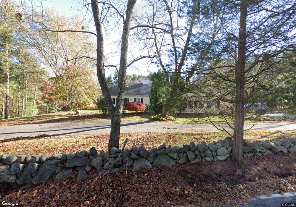
106 Peakham Rd Sudbury, MA 01776
Estimated Value: $1,872,000 - $2,563,000
4
Beds
6
Baths
6,457
Sq Ft
$324/Sq Ft
Est. Value
About This Home
This home is located at 106 Peakham Rd, Sudbury, MA 01776 and is currently estimated at $2,090,399, approximately $323 per square foot. 106 Peakham Rd is a home located in Middlesex County with nearby schools including Israel Loring Elementary School, Ephraim Curtis Middle School, and Lincoln-Sudbury Regional High School.
Ownership History
Date
Name
Owned For
Owner Type
Purchase Details
Closed on
Sep 2, 2008
Sold by
Coutu Donna King and Coutu Michael J
Bought by
Tortoise Partners Llc
Current Estimated Value
Purchase Details
Closed on
Jul 31, 2000
Sold by
Mulherin John J and Mulherin Lynn M
Bought by
Coutu Michael J and Coutu Donna K
Home Financials for this Owner
Home Financials are based on the most recent Mortgage that was taken out on this home.
Original Mortgage
$892,000
Interest Rate
8.18%
Mortgage Type
Purchase Money Mortgage
Purchase Details
Closed on
Aug 31, 1995
Sold by
Trout Jeffrey P and Trout Catherine B
Bought by
Mulherin John J and Mulherin Lynn M
Purchase Details
Closed on
May 25, 1990
Sold by
Gumlak Joseph S
Bought by
Trout Jeffrey P
Create a Home Valuation Report for This Property
The Home Valuation Report is an in-depth analysis detailing your home's value as well as a comparison with similar homes in the area
Home Values in the Area
Average Home Value in this Area
Purchase History
| Date | Buyer | Sale Price | Title Company |
|---|---|---|---|
| Tortoise Partners Llc | $1,375,000 | -- | |
| Coutu Michael J | $1,275,000 | -- | |
| Mulherin John J | $430,000 | -- | |
| Trout Jeffrey P | $400,000 | -- |
Source: Public Records
Mortgage History
| Date | Status | Borrower | Loan Amount |
|---|---|---|---|
| Previous Owner | Trout Jeffrey P | $965,000 | |
| Previous Owner | Trout Jeffrey P | $892,000 |
Source: Public Records
Tax History Compared to Growth
Tax History
| Year | Tax Paid | Tax Assessment Tax Assessment Total Assessment is a certain percentage of the fair market value that is determined by local assessors to be the total taxable value of land and additions on the property. | Land | Improvement |
|---|---|---|---|---|
| 2025 | $27,604 | $1,885,500 | $767,300 | $1,118,200 |
| 2024 | $26,646 | $1,823,800 | $746,900 | $1,076,900 |
| 2023 | $27,896 | $1,768,900 | $720,500 | $1,048,400 |
| 2022 | $25,665 | $1,421,900 | $620,500 | $801,400 |
| 2021 | $24,620 | $1,307,500 | $620,500 | $687,000 |
| 2020 | $25,149 | $1,363,100 | $676,100 | $687,000 |
| 2019 | $24,413 | $1,363,100 | $676,100 | $687,000 |
| 2018 | $24,616 | $1,372,900 | $730,500 | $642,400 |
| 2017 | $23,129 | $1,303,800 | $699,700 | $604,100 |
| 2016 | $22,319 | $1,253,900 | $675,300 | $578,600 |
| 2015 | $21,850 | $1,241,500 | $669,300 | $572,200 |
| 2014 | $21,838 | $1,211,200 | $651,700 | $559,500 |
Source: Public Records
Map
Nearby Homes
- 143 Peakham Rd
- 0 Boston Post Rd
- 54 Stone Rd
- 12 Hickory Rd
- 30 Rolling Ln
- 0 Robbins Rd
- 123 Dutton Rd
- 7 Saddle Ridge Rd
- 7 Adams Rd
- 21 Summer St
- 89 Bridle Path
- 24 Woodland Rd
- 6 Mountain View Dr
- 30 Nobscot Rd Unit 14
- 1011 Boston Post Rd
- 28 Stetson Dr
- 270 Old Lancaster Rd
- 32 Eaton Rd W
- 3 Stonehill Rd
- 50 Juniper Ln