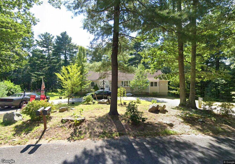
106 Ramshorn Rd Charlton, MA 01507
Estimated Value: $424,000 - $488,002
4
Beds
3
Baths
2,592
Sq Ft
$177/Sq Ft
Est. Value
About This Home
This home is located at 106 Ramshorn Rd, Charlton, MA 01507 and is currently estimated at $459,501, approximately $177 per square foot. 106 Ramshorn Rd is a home located in Worcester County with nearby schools including Shepherd Hill Regional High School.
Ownership History
Date
Name
Owned For
Owner Type
Purchase Details
Closed on
Sep 27, 2004
Sold by
Simmons Beverly and Faucher Diane
Bought by
Rydlak Jacek and Tanona Patricia A
Current Estimated Value
Home Financials for this Owner
Home Financials are based on the most recent Mortgage that was taken out on this home.
Original Mortgage
$177,200
Outstanding Balance
$87,229
Interest Rate
5.89%
Mortgage Type
Purchase Money Mortgage
Estimated Equity
$372,272
Purchase Details
Closed on
Aug 23, 1991
Sold by
Sutherland Gary B
Bought by
Fdic
Create a Home Valuation Report for This Property
The Home Valuation Report is an in-depth analysis detailing your home's value as well as a comparison with similar homes in the area
Home Values in the Area
Average Home Value in this Area
Purchase History
| Date | Buyer | Sale Price | Title Company |
|---|---|---|---|
| Rydlak Jacek | $221,500 | -- | |
| Rydlak Jacek | $221,500 | -- | |
| Fdic | $420,000 | -- | |
| Fdic | $420,000 | -- |
Source: Public Records
Mortgage History
| Date | Status | Borrower | Loan Amount |
|---|---|---|---|
| Open | Rydlak Jacek | $177,200 | |
| Closed | Fdic | $177,200 |
Source: Public Records
Tax History Compared to Growth
Tax History
| Year | Tax Paid | Tax Assessment Tax Assessment Total Assessment is a certain percentage of the fair market value that is determined by local assessors to be the total taxable value of land and additions on the property. | Land | Improvement |
|---|---|---|---|---|
| 2025 | $4,098 | $368,200 | $113,200 | $255,000 |
| 2024 | $3,916 | $345,300 | $108,400 | $236,900 |
| 2023 | $3,784 | $310,900 | $87,300 | $223,600 |
| 2022 | $3,859 | $290,400 | $79,400 | $211,000 |
| 2021 | $3,593 | $239,400 | $75,200 | $164,200 |
| 2020 | $3,532 | $236,400 | $72,200 | $164,200 |
| 2019 | $3,492 | $236,400 | $72,200 | $164,200 |
| 2018 | $3,191 | $236,400 | $72,200 | $164,200 |
| 2017 | $2,955 | $209,600 | $66,200 | $143,400 |
| 2016 | $2,888 | $209,600 | $66,200 | $143,400 |
| 2015 | $2,813 | $209,600 | $66,200 | $143,400 |
| 2014 | $2,711 | $214,100 | $68,700 | $145,400 |
Source: Public Records
Map
Nearby Homes
- 65 Haggerty Rd
- 2 Potter Village Rd
- 2 Lelandville Rd
- 3 Lelandville Rd
- 76 Number 6 Schoolhouse Rd
- 58 Colburn Rd
- 0 Partridge Hill Rd
- 16 Sandersdale Rd
- 0 Freeman Rd Unit 73369281
- 60 Saundersdale Rd
- Lot 1A Sandersdale Rd
- Lot 3A Sandersdale Rd
- Lot 2A Sandersdale Rd
- 6 Blackwell Dr
- Lot 1 Mason Road Extension
- 18 Mckinstry Dr
- 0 Sandersdale Rd
- 337 Mason Road Extension
- Lots 1+16 Pierpont Rd
- 0 Blood Rd
- 108 Ramshorn Rd
- 105 Ramshorn Rd
- 109 Ramshorn Rd
- 110 Ramshorn Rd
- 98 Ramshorn Rd
- 97 Ramshorn Rd
- lot 0 Ramshorn Rd
- 114 Ramshorn Rd
- 118 Ramshorn Rd
- 93 Ramshorn Rd
- 7 Ramshorn Rd
- 111 Ramshorn Rd
- 23 Lincoln Point Rd
- 0 Lincoln Point Rd
- 88 Ramshorn Rd
- 119 Ramshorn Rd
- 14 Lincoln Point Rd
- 10 Lincoln Point Rd
- 120 Ramshorn Rd
- 25 Lincoln Point Rd