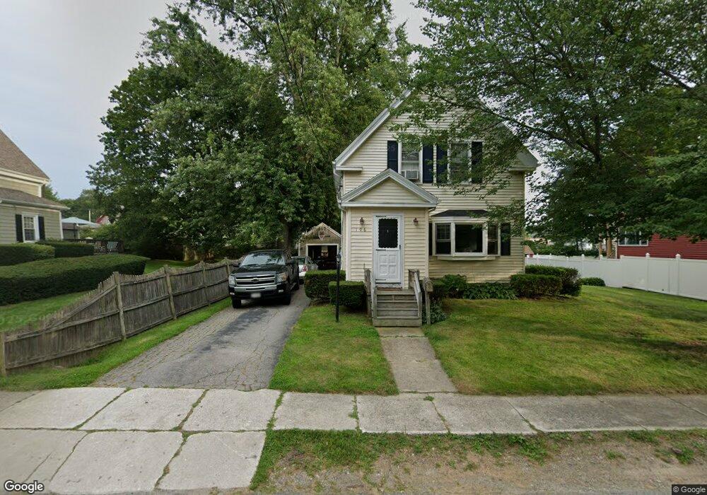
106 Rock St Whitman, MA 02382
Estimated Value: $454,000 - $545,000
3
Beds
1
Bath
1,444
Sq Ft
$345/Sq Ft
Est. Value
About This Home
This home is located at 106 Rock St, Whitman, MA 02382 and is currently estimated at $498,462, approximately $345 per square foot. 106 Rock St is a home located in Plymouth County with nearby schools including St Bridget School.
Ownership History
Date
Name
Owned For
Owner Type
Purchase Details
Closed on
Jul 31, 2003
Sold by
Derosier Kimberly M and Derosier Brian T
Bought by
Tamulevich Paul R and Tamulevich Renee M
Current Estimated Value
Purchase Details
Closed on
Aug 31, 1998
Sold by
Baker Carol A
Bought by
Derosier Kimberly M
Create a Home Valuation Report for This Property
The Home Valuation Report is an in-depth analysis detailing your home's value as well as a comparison with similar homes in the area
Home Values in the Area
Average Home Value in this Area
Purchase History
| Date | Buyer | Sale Price | Title Company |
|---|---|---|---|
| Tamulevich Paul R | $293,000 | -- | |
| Derosier Kimberly M | $132,500 | -- |
Source: Public Records
Mortgage History
| Date | Status | Borrower | Loan Amount |
|---|---|---|---|
| Open | Derosier Kimberly M | $50,000 | |
| Open | Derosier Kimberly M | $305,000 | |
| Closed | Derosier Kimberly M | $288,600 |
Source: Public Records
Tax History Compared to Growth
Tax History
| Year | Tax Paid | Tax Assessment Tax Assessment Total Assessment is a certain percentage of the fair market value that is determined by local assessors to be the total taxable value of land and additions on the property. | Land | Improvement |
|---|---|---|---|---|
| 2025 | $5,728 | $436,600 | $206,200 | $230,400 |
| 2024 | $5,394 | $423,400 | $202,300 | $221,100 |
| 2023 | $5,154 | $379,800 | $175,400 | $204,400 |
| 2022 | $5,089 | $349,500 | $159,400 | $190,100 |
| 2021 | $4,909 | $316,700 | $146,500 | $170,200 |
| 2020 | $4,707 | $297,000 | $132,500 | $164,500 |
| 2019 | $4,436 | $288,400 | $132,500 | $155,900 |
| 2018 | $4,139 | $258,500 | $125,500 | $133,000 |
| 2017 | $3,898 | $258,500 | $125,500 | $133,000 |
| 2016 | $3,784 | $242,700 | $119,600 | $123,100 |
| 2015 | $3,789 | $242,700 | $119,600 | $123,100 |
Source: Public Records
Map
Nearby Homes
- 164 Warren Ave
- 135-137 Temple St
- 66 Belmont St
- 604 Bedford St Unit 5
- 53 Temple St
- 1098 Bedford St
- 63 Dewey Ave
- 300 High St
- 532 Washington St
- 277 School St
- 110 South Ave Unit 14
- 110 South Ave
- 90 Loring Ave
- 48 Day St
- 20 Elm Place
- 360 High St
- 150 Harvard St
- 262 Homeland Dr
- 501 Auburn St Unit 404
- 501 Auburn St Unit 201
- 112 Rock St
- 100 Rock St
- 101 Star St
- 92 Rock St
- 122 Rock St
- 103 Rock St
- 95 Star St
- 815 Bedford St
- 815 Bedford St Unit 2
- 815 Bedford St Unit 10
- 815 Bedford St Unit 9
- 815 Bedford St Unit 7
- 815 Bedford St Unit 5
- 815 Bedford St Unit 12
- 815 Bedford St Unit 8
- 815 Bedford St Unit 11
- 815 Bedford St Unit 1
- 815 Bedford St Unit 4
- 815 Bedford St Unit 3
- 815 Bedford St Unit 6