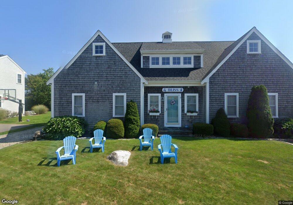
106 Rope Walk Rd Unit 106 Buzzards Bay, MA 02532
Estimated Value: $827,000 - $1,848,000
3
Beds
2
Baths
2,442
Sq Ft
$558/Sq Ft
Est. Value
About This Home
This home is located at 106 Rope Walk Rd Unit 106, Buzzards Bay, MA 02532 and is currently estimated at $1,361,555, approximately $557 per square foot. 106 Rope Walk Rd Unit 106 is a home with nearby schools including Bourne High School.
Ownership History
Date
Name
Owned For
Owner Type
Purchase Details
Closed on
Oct 18, 2013
Sold by
Mcvay Joseph V and Mcvay Lynn M
Bought by
Krupski Martha W and Krupski Joseph P
Current Estimated Value
Home Financials for this Owner
Home Financials are based on the most recent Mortgage that was taken out on this home.
Original Mortgage
$415,000
Outstanding Balance
$99,055
Interest Rate
3.59%
Mortgage Type
New Conventional
Estimated Equity
$1,262,500
Purchase Details
Closed on
Jun 21, 1991
Sold by
Deveau Stephen J and Deveau Donna M
Bought by
Mcvay Joseph and Mcvay Lynn M
Purchase Details
Closed on
Oct 6, 1988
Sold by
Magliano John J
Bought by
Deveau Stephen J
Create a Home Valuation Report for This Property
The Home Valuation Report is an in-depth analysis detailing your home's value as well as a comparison with similar homes in the area
Purchase History
| Date | Buyer | Sale Price | Title Company |
|---|---|---|---|
| Krupski Martha W | $682,500 | -- | |
| Krupski Martha W | $682,500 | -- | |
| Mcvay Joseph | $145,000 | -- | |
| Mcvay Joseph V | $145,000 | -- | |
| Deveau Stephen J | $75,000 | -- |
Source: Public Records
Mortgage History
| Date | Status | Borrower | Loan Amount |
|---|---|---|---|
| Open | Krupski Martha W | $415,000 | |
| Closed | Deveau Stephen J | $415,000 | |
| Previous Owner | Deveau Stephen J | $408,000 | |
| Previous Owner | Deveau Stephen J | $410,000 |
Source: Public Records
Tax History
| Year | Tax Paid | Tax Assessment Tax Assessment Total Assessment is a certain percentage of the fair market value that is determined by local assessors to be the total taxable value of land and additions on the property. | Land | Improvement |
|---|---|---|---|---|
| 2025 | $9,350 | $1,197,200 | $523,500 | $673,700 |
| 2024 | $8,769 | $1,093,400 | $498,500 | $594,900 |
| 2023 | $8,578 | $973,700 | $441,200 | $532,500 |
| 2022 | $7,550 | $748,300 | $325,400 | $422,900 |
| 2021 | $7,384 | $685,600 | $296,100 | $389,500 |
| 2020 | $7,215 | $671,800 | $293,300 | $378,500 |
| 2019 | $6,880 | $654,600 | $293,300 | $361,300 |
| 2018 | $6,366 | $604,000 | $279,400 | $324,600 |
| 2017 | $6,650 | $645,600 | $309,900 | $335,700 |
| 2016 | $6,331 | $623,100 | $309,900 | $313,200 |
| 2015 | $6,631 | $658,500 | $359,800 | $298,700 |
Source: Public Records
Map
Nearby Homes
- 248 Great Neck Rd
- 566 Shore Rd
- 35 Benedict Rd
- 14 Navajo Rd
- 200 Great Neck Rd
- 60 Bourne Neck Dr
- 203 County Rd
- 36B Starboard Dr Unit 36E
- 36B Starboard Dr Unit 36G
- 36B Starboard Dr Unit 36C
- 36B Starboard Dr Unit 36A
- 36B Starboard Dr Unit 36D
- 36B Starboard Dr Unit 36B
- 36B Starboard Dr Unit 36F
- 36B Starboard Dr Unit 36H
- 3 Carleton St Unit 3
- 23 Starboard Dr Unit Lot 50
- 32 Carleton St Unit 32
- 254 Barlows Landing Rd
- 10 East Blvd
- 106 Rope Walk Rd
- 106 Rope Walk Rd
- 106 Rope Walk Rd
- 104 Rope Walk Rd
- 104 Rope Walk
- 104 Rope Walk Rd
- 108 Rope Walk Rd
- 107 Mashnee Rd
- 107 Mashnee Rd
- 72 Rope Walk Rd
- 109 Mashnee Rd
- 105 Mashnee Rd
- 70 Rope Walk Rd
- 70 Rope Walk Rd
- 102 Rope Walk Rd
- 74 Rope Walk Rd
- 110 Rope Walk Rd
- 103 Mashnee Rd
- 111 Mashnee Rd
- 68 Rope Walk Rd
Your Personal Tour Guide
Ask me questions while you tour the home.